I had not been really updated on what is happening in Jämtland and the Storsjö area, where two companies have been exploring the Alum shale for uranium and vanadium. So now I took a closer look at what the two companies are currently up to.
The first one, EU Energy Corp seems to have disappeared, changed name or been bought up – I can’t find any information, except for at Bloomberg. The entry there sounds as if the company still exists. But when I checked the website, I got the following message:
Last year, Aura Energy also lodged compensation from the Swedish government, because “Uranium in Sweden was banned effective August 1, 2018 and Aura Energy is seeking compensation for the financial loss resulting from this decision“. According to some media, the company has asked for a compensation amounting to 17 billion Swedish kronor. In the file below, you can read more about Aura Energy‘s compensation claim.
What is pretty interesting in this respect, is that Aura Energy was absolutely aware of the fact that a ban on uranium was in the making. In a referral dated to 22nd December 2017, the company commented on the consequences a ban on uranium will have when it comes to mining in general and for their Häggån project specifically. Many of their comments were in the end also incorporated in the final legal text. So seeking compensation for loosing money because Sweden banned uranium mining is probably a shot in the dark. Below is the referral document in Swedish.
Today I read in the news that discussions had been going on between Aura Energy and the Swedish government. The amount of money claimed by Aura Energy is now not cited as 17 billion SEK, but as 1,8 billion SEK.
The lawyers, who advise the Swedish government, concluded that Sweden had not violated any treaties or laws by banning uranium exploration and mining. Accordingly, there are no conditions for any kind of settlement. Moreover, Aura Energy has no legal right to claim compensation because the treaty to which the company had referred to had been signed but not ratified by Australia.
So far so good.
Another interesting issue is currently whether mining of Alum shale should be banned completely because the shale contains many toxic elements, including high amounts of uranium. This issue had been included in the government’s January agreement. Just a few weeks ago, the Swedish government has appointed a person, who shall analyze unconditionally how the regulatory framework for the extraction of metals and minerals from the Alum shale can be sharpened. It will be very interesting to follow this investigation!
Most people have some knowledge in biology, physics, chemistry and mathematics, but very few are actually familiar with geology. Of course everyone knows about dinosaurs, most people also know about volcanoes and earthquakes and how devastating a tsunami can be. But do they actually relate these phenomena to geology?
Upper gallery: (Glacier on Iceland covered with ash particles and meltwater discharging the glacier left). Large bolder close to Stockholm University’s research station Tarfala – left behind by a melting glacier (middle); sea cliff on Malta consisting of marine sediments (right). Lower gallery: Water fall and river valley on northern Iceland.
Geology has many names: geoscience, geological science, earth science, some even include the subject under geography. The different names and definitions of the subject have led to numerous and lengthy discussions over the years: What is the difference between geology and geosciences? What is the difference between earth sciences and geology? And what is the difference between geology and geography? Are they all the same or are these disciplines different in one way or another?
Wikipedia actually provides good definitions and includes geology as a subject within the much broader discipline of earth sciences and both are explained as follows:
Earth sciences, which is a much broader field encompasses ... the study of geology, the lithosphere, and the large-scale structure of the Earth’s interior, as well as the atmosphere, hydrosphere, and biosphere. Typically, Earth scientists use tools from geology, chronology, physics, chemistry, geography, biology, and mathematics to build a quantitative understanding of how the Earth works and evolves. Earth science affects our everyday lives. For example, meteorologists study the weather and watch for dangerous storms. Hydrologists study water and warn of floods. Seismologists study earthquakes and try to understand where they will strike. Geologists study rocks and help to locate useful minerals. Earth scientists often work in the field—perhaps climbing mountains, exploring the seabed, crawling through caves, or wading in swamps. They measure and collect samples (such as rocks or river water), then they record their findings on charts and maps.
Now – why am I at all writing about all of this? Because I think more people should be made aware of what geology and earth sciences actually are and how they influence so much of our daily life. Geology is not just dinosaurs and earthquakes – it is much more than this. Using geological knowledge about Earth’s history and Earth’s rocks, we are able to extract all the raw materials needed in our daily life. And we really extract and use a huge amount of minerals and metals for construction, cars, electronic devices, household items, weapons, …. the list could of course be made so much longer!
The table below illustrates how many tons of metals and minerals were globally produced in the year 2012, how much of it is recycled and when peak production may occur (according to a model).
Table 3 from Sverdrup et al. 2017: An assessment of metal supply sustainability as an input to policy: security of supply extraction rates, stocks-in-use, recycling, and risk of scarcity. Journal of Cleaner Production 140, 359-372.
Do we ever reflect upon where all the raw materials actually come from? From where in the world? From which type of rock? Do we ever reflect upon that extraction of these raw materials means mining, often large scale mining that has devastating effects on people’s health, on groundwater, biodiversity, food production, …, …. ?
Let’s have a look at what a smart phone – a device which very many people use daily – contains in terms of metals. All these elements have once been part of a rock and have been extracted in mines somewhere in the world.
Where does all the raw material actually come from? Where is it mined and under which circumstances and which consequences does mining have in these countries? The map below shows in which countries all these raw materials are mined. It is obvious that Europe does not have any significant mines that produce raw materials for smart phones.
Most of the mining is done in China, followed by Russia and Peru. But also Canada, USA, Mexico, Brazil, Chile and Argentina, Congo, Rwanda and South Africa, India, Burma, Indonesia, Australia and the Republic of Korea have important mines where smart phone minerals are extracted. Most of these mines (if not all) operate under non-sustainable conditions. Waste from these mines will form very severe environmental problems for water and soils for a long time.
What is also often forgotten is that mining creates dust particles, which contain toxic elements. The smallest dust particles can travel over long distances, far away from a mine. When very tiny particles are inhaled, then they get stuck in our lungs and accumulate there for ever, causing severe lung problems. Of course this problem does not only relate to mining, it is of concern when it comes to all types of tiny particles.
“Environmental” problems can sound pretty abstract. Indeed I have many times heard the following comments: “A bit of pollution does not harm the environment that much“, “nature can heal itself“, “we have always had some pollution“, “the whole talk about environmental pollution is exaggerated“, “there are safe ways of mining“, “storage of mining waste is safe”. What is forgotten, however, is that we all depend on clean water, clean air and a healthy soil for agriculture. Once these basic needs are no longer available, life will become pretty different.
With more smart phones in use and with a change of phone every two years, and no recycling, more minerals have to be extracted and more mines have to be opened. More mining waste is created, …. I guess you can imagine the consequences.
Maybe one could think twice before buying a new smart phone, a new car or a new and bigger TV? All of these need metals, metals, metals, and these need to be mined somewhere. It is easy to imagine that a larger phone, a larger TV, and a larger car means that more metals are needed as compared to a smaller phone, a smaller car, a smaller TV.
Maybe we do not need more than one smart phone or more than one car or more than one TV? However, if we think that we need all of this and much more, then we will also need more mines, we will also need to open mines in our backyard and we will need to make sacrifices.
I am not saying that we should stop using all these raw materials. But I think that we must become much more conscious about their origin and must better understand the enormous environmental impact mining has, worldwide and in Sweden.
Raw materials are not something one digs up, processes, uses and then throws away. Raw material is not a resource that can be extracted endlessly, as can be seen in the Table above. Yet we need it and we cannot live without it.
But in order to understand the complexity of it all, we also need to have a basic knowledge of geology and of the geological terminology. Raw materials are nothing else but geological material.
Who knows, where in Sweden the next exploration permits are granted? Without geological knowledge we are not able to correctly understand the documents issued by the exploration company or to present relevant arguments against or in favor. Without geological knowledge we are not able to access and understand the information provided by the Geological Survey of Sweden, nor are we able to interpret the various geological maps. Without geological knowledge we are also not able to assess the ecological consequences a future mine and its mining waste might have.
Because of the large impact geology and earth sciences have on our life, much more people should actually learn about geology and study geology. Take an evening course or a distance course at any of our universities to start with!
Clean and healthy water is probably one of the most important things for our survival. We are really fortunate here in Sweden that we can drink tap water, that we can cook with clean water, water our plants with clean water and shower in clean water. This is not the case in many other places. I remember a travel to Guanajuato in Mexico, which still is an important silver and gold mining area.
One of the old silver mines is actually a tourist attraction. What I remember most is that tap water could not be used to brush teeth, that the water coming out of the shower was extremely polluted and that the only water than could be used was bottled. At that time I had no idea how much pollution acid mine drainage can cause.
Later visits to Asia, where tap water also often is a no go, reinforced how precious clean drinking water is. We really should value what we have!
Therefore now a little note on the groundwater in the area, where ScandiVanadium wants to drill and eventually open a mine in the Alum shale to extract vanadium. The rationale for the company is that a greener future needs green technologies and one of these green technologies would be so-called Vanadium redox-flow batteries, which allow storing sun or wind energy for later use. Of course it is never mentioned in these future mining plans that mining consumes huge amounts of water, emits huge amounts of carbon dioxide and leaves huge amounts of toxic waste behind.
Where does the groundwater in the area around Onslunda, Spjutstorp and Fågeltofta, where the company plans for exploration drilling, come from?
Ground water aquifers can be found in the bedrock, but also fluvioglacial sediments (= isälvssediment) are good groundwater aquifers. Around Onslunda, Spjutstorp and Fågeltofta, the dominant glacial sediments are till (= morän; blue color) and fluvioglacial sediments (= isälvssediment; green color), as can be seen on the maps below. A marked esker (= ås) runs in an east-west direction south of Onslunda and Kullentorp and a smaller esker (= ås) can be spotted southwest of Fågeltofta (blue dotted line). Eskers (åsar) consist of coarse sediment, such as sand, gravel and rounded stones. Some eskers (åsar) can extend over long distances and were deposited by rivers draining the huge inland ice that melted 18 000-16 000 years ago. Other eskers (åsar) are much smaller, such as those close to Onslunda and Fågeltofta, which are probably related to melting of dead ice. Today these eskers (åsar) can function as an important groundwater aquifer. Would this be the case for the esker (åsar) deposits around Onslunda and Fågeltofta?
Maps showing the surface sediments for Fågeltofta (left) and Onslunda-Spjutstorp (right). The coring locations of ScandiVanadium are indicated by white and yellow rectangles, respectively. Downloaded from the Geological Survey of Sweden.
To check this up, I consulted the well archive (=Brunnsarkivet), which is available at the Geological Survey of Sweden, and several groundwater maps. I found information for more than 65 wells drilled around Onslunda and Spjutstorp and for 16 wells drilled in the area around Fågeltofta. The total depth for the different wells ranges between 11 and 150 m and it seems that most, if not all, of the wells reach the underlying bedrock.
Groundwater was however also found in much shallower depth, between 0 and 6 m, but this shallow aquifer does not seem to be used for wells. The reason is probably that groundwater availability is limited, or that the water does not qualify as drinking water. Indeed, by looking at the map below, it becomes obvious that the fluvioglacial sediments have a fairly low groundwater capacity. They deliver less than 1 l of groundwater per second and rarely exceed 5 l/second, except for in the very southern part of the map, where measurements indicate 5-25 l/second.
Looking at the Hydrogeological map for Skåne (Gustafsson, O. 1999; Sveriges geologiska undersökning, Ah 15. ISBN 91-7158-625-3) shown below, a similar picture appears. The brown colored areas on the map are a poor groundwater resource (<1l/s), whereas the light purple and blue areas are moderate (1-5 l/s) to good (5-25 l/s) groundwater resources, respectively. These areas correspond to where fluvioglacial sediments are found.
Map showing the groundwater aquifers in sediments and bedrock in the Onslunda area. Note that the brown colored area more or less corresponds to the green area (fluvioglacial sediments) in the uppermost figure. Downloaded from the Geological Survey of Sweden. Gustafsson, O. 1999. Hydrogeological map of Skåne County. Scale 1:250 000. Geological Survey of Sweden Ah 15.Legend to the map above. From Gustafsson, O. 1999. Hydrogeological map of Skåne County. Scale 1:250 000. Geological Survey of Sweden Ah 15.Legend to the map above. From Gustafsson, O. 1999. Hydrogeological map of Skåne County. Scale 1:250 000. Geological Survey of Sweden Ah 15.
In contrast, aquifers in fractured bedrock (crystalline bedrock, sandstone, Alum shale, and so on) have fairly good (light green color on the map) (600-2000 l/s) and good (darker green color on the map) (2000-6000 l/s) exploitation potentials.
Wells drilled in bedrock thus seem to be the only alternative to obtain sufficient drinking water. However, there is a lot of Alum shale in the bedrock. Indeed, during drilling of deep wells in the Onslunda-Spjutstorp and Fågeltofta area, the well driller reported badly smelling water, which hints at sulfur-rich Alum shale. I cannot imagine that any of the wells that are in use derive their water from the shale, since it is not a good aquifer given its high content of uranium and other toxic elements.
Where do all the deep wells then get their water from? The really deep wells probably reach as far as into the Cambrian sandstone. Other, less deep wells might – depending on the bedrock – tap into aquifers in the Ordovician-Silurian shale.
The maps definitely tell us that the areas around Onslunda, Spjutstorp and Fågeltofta are really sensitive when it comes to groundwater. First of all, wells have to be deep enough to reach good aquifers; secondly, drilling deep wells costs a lot of money; and thirdly should these deep wells be polluted by mining and/or acid mining waste, then farming will no longer be possible.
Any type of surface pollution will also easily spread to other areas via the fluvioglacial aquifers (brown color in the map below), which are connected and form a broad band stretching all the way to the Baltic Sea.
Copy of the groundwater map for Skåne from Gustafsson, O. (1999): Hydrogeological map for Skåne. Sveriges geologiska undersökning.
Let’s continue a bit more along the geology trail! After all geology is fun and interesting and many more should get insight into the subject – that’s at least what I think :-))
Linking geology to real life is a good way of showing how important geological knowledge actually is. Here comes a bit more of this – this time with a focus on another of ScandiVanadium‘s planned exploration targets. For those of you not familiar with ScandiVanadium: this is the company who has re-discovered that parts of the Alum shale in Skåne contain very high amounts of the element vanadium. Vanadium has recently gained more importance and interest because it can be used in so-called vanadium redox batteries (VRB) or vanadium redox flow batteries (VRFB), which allow storing sun and wind energy for later use.
Bergsstaten recently approved ScandiVanadium‘s latest work plan (May 8th, 2019) for coring close to Spjutstorp (license Killeröd 1) and Fågeltofta (license Fågeltofta 1) in Österlen. In an earlier text I wrote about the geology around Spjutstorp and Onslunda, so now it is time to look a bit closer into the situation around Fågeltofta.
Fågeltofta’s geology is very similar to that around Onslunda and Spjutstorp. The same rocks appear here and also the same type of glacial sediments, which means sediments deposited in connection with the melting of the last ice sheet. Let’s start again with the glacial sediments, which are at or close to the surface. The map below shows how these sediments are distributed on the surface in the area.
The blue colored area marks different types of glacial till (= morän in Swedish) and the green colored areas show fluvioglacial sand, gravel and stones. Till (= morän in Swedish) is the geological name for sediment material that had been released by the ice sheet when it started to melt some 18 000 to 16 000 years ago. There has been much confusing regarding the word morän, because it denotes both a land form (for example ändmorän, lateralmorän) and a sediment (morän) in Swedish. To avoid these confusions, which are important from a scientific perspective, scientists call a morän with the more appropriate terms glacial diamicton or a till. The green colored areas denote the occurrence of sediment deposited by rivers draining the ice sheet. In Swedish these sediments are – in general terms – called isälvssediment, and in English they are summarized under the term fluvio-glacial.
Map showing the surface sediments around Fågeltofta. Most of the sediments are different types of morän (clayey, sandy till) (blue color) and fluvioglacial sediments (= isälvssediment) (green color). Small eskers (= ås) – shown by dotted blue lines – can be seen. The location of Scandivanadium’s planned drill holes is shown by white rectangles. Map downloaded from the Geological Survey of Sweden.
Much of the area around Fågeltofta is covered by glacial till (= morän), but there is also a larger complex with fluvioglacial sediments (= isälvssediment) extending from north of Fågeltofta further south. I guess that these sediments originate from when the ice sheet had melted and only big chunks of dead ice remained. Water circulating between the blocks of dead ice then accumulated all the sand, gravel and rounded stones.
Now let’s take a step further and look at the bedrock map for Fågeltofta, which shows how rocks of different ages are distributed below the glacial sediments. The geological map for Fågeltofta is actually very similar to that for Spjutstorp and Onslunda, the same rocks and very similar features.
I really like geological maps, because so much information can be gained from these. Now I will try and explain as much of the information as I can.
Geological map for Fågeltofta including the location of ScandiVanadium‘s planned three drill cores (yellow markers). The map also shows the location of wells – marked by a B with a circle. Tectonic deformation zones are shown by thick black stippled lines and the location of dolerite/diabase dikes by purple lines. Note also the marked tectonic deformation zone between the blue and light olive colored areas (arrows and triangles). Copied from geological map AF 215 Berggrundskartan Tomelilla SO, Simrishamn SV, Ystad NO & Örnahusen NV issued by the Geological Survey of Sweden.
First of all, the different colors on the map above show the horizontal distribution of rocks of different ages. From left to right, we see the extension of quarzites and sandstones of lower Cambrian age (brown color with white spots); the next younger rocks are the Alum shales of middle Cambrian and lower Ordovician age (dark olive color); the lighter olive color marks the limestones, mudstones and shales of middle and upper Ordovician age and the blue color represents the youngest rocks here, the Silurian shales (blue color).
Secondly, the map also shows us that rocks younger than the Silurian shales are missing and must have been eroded. We can moreover see that where Ordovician and Cambrian rocks are close to the surface, all younger rock types must have been eroded. These had of course been present at some point, but erosion during hundreds of millions of years has led to their removal.
Thirdly, the map shows us that rocks older than the Silurian shales are very likely preserved below the blue colored area. This means that below the Silurian rocks we could find first limestones, mudstones and shales of upper and middle Ordovician age; below these latter we will find Alum shales of lower Ordovician and middle Cambrian age and below these quarzites and sandstones of lower Cambrian age. The reason why ScandiVanadium wants to core in the light olive colored area (upper and middle Ordovician) is that they suspect to find intact lower Ordovician age Alum shales below. Indeed the map tells us that lower Ordovician age Alum shales (Oal) can be found at a depth of about 18 m below glacial sediments.
This type of information has been obtained from well drillings (Brunnsarkivet) (marked as B in a circle on the map above). Well drillers provide important information for geological maps since they note the depth to bedrock and also the type of bedrock encountered at different depths. Thus when looking at the map above, we can for example see the signs B, Cha 4 and U 20 close to Fulltofta. This means that in the drilled well (B), quarzites and sandstones of lower Cambrian age (Cha) are at 4 m below the moraine and that the Precambrian bedrock (urberget) (U) is at 20 m depth. Similarly we can see that in a well (B) close to Bondrum, limestones, mudstones and shales of upper and middle Ordovician age (O) are at 3 m below the moraine, that the lower Ordovician age Alum shales (Oal) lies at 18 m depth and the quarzites and sandstones of lower Cambrian age (Cha) at 126 m depth.
What more does the geological map tell us? The dashed lines between rocks of different ages and the marked black line between the Silurian and Ordovician rocks show that significant tectonic movements have taken place. How these have influenced the rocks cannot be seen from the map, but I suspect that such tectonic movements could make the geological succession of the rocks a bit more complicated since larger rock packages could have been eroded. But let’s see what ScandiVanadium‘s drill cores will show.
I have not mentioned the purple colored lines on the geological map. These indicate the approximate location of dolerite/diabase dikes, which formed during Permian–Carboniferous time when magma from Earth’s interior intruded into older rocks. It is possible to get a more precise picture by looking at a geophysical map. This map, shown below, shows in red the extension of dolerite/diabase dikes.
Geophysical map for Fågeltofta. Downloaded from the Geological Survey of Sweden. The red areas show lines of high magnetic anomalies and thus mark the presence of dolerite/diabase dikes. The approximate position of ScandiVanadium‘s drill cores is indicated by white rectangles.
Given that ScandiVanadium‘s drill cores are located close to these dolerite/diabase dikes, I would suggest that the company performs detailed geophysical investigations prior to coring. Otherwise the coring campaign could turn out as difficult as it seems to have been in Lybymosse. After all they are out there to find Alum shale and not any dolerite/diabase.
Recently, Bergsstaten – the Mining Inspectorate of Sweden – approved ScandiVanadium‘s latest work plan (May 8th, 2019) for coring close to Spjutstorp (license Killeröd 1) and Fågeltofta (license Fågeltofta 1) in Österlen. In its decision, the Mining Inspectorate writes that the planned drilling needs to be performed between February 25 and October 25 this year. Obviously it is possible to appeal this decision. But I am not really sure about how Bergsstaten‘s decision should be interpreted: does it mean that ScandiVanadium can start their coring right now or only after Mark- och Miljödomstolen in Växjö has dealt with the appeals? I guess that those who are impacted by ScandiVanadium‘s work plan will actually also appeal the decision.
For Spjutstorp/Killeröd 1, Bergsstaten has approved seven drill holes, in contrast to the 8-10 drill holes that were mentioned in ScandiVanadium‘s work plan, but had not been shown on the maps accompanying the work plan. For Fågeltofta 1, three drill core locations have been approved. As in their earlier work plans for Lybymosse, ScandiVanadium states that about 2-3 days will be needed to drill each hole. That this is an oversimplification has been shown by their drilling campaign in Lybymosse, which started in August last year and ended sometime in October. Drilling each hole in Lybymosse took much longer than the 2-3 days anticipated by the company. Why was this the case? Probably because ScandiVanadium did not do their home work well and had not read the existing geological literature.
Bergsstaten writes that the exploration work must be performed in accordance with what ScandiVanadium Ltd has stated in its work plan dated May 8th, 2019. In the work plan, ScandiVanadium writes that 1-2 months are needed for exploration in each area and that 2-3 days are needed to core one drill hole. But what happens if the work takes more than 2 months and drilling more than 3 days, as has been the case in Lybymosse? Will this still be in accordance with the working plan?
Although the whole issue may thus be pending until a decision has been reached by Mark- och Miljödomstolen in Växjö, I thought it would be timely to revisit the geology of the planned exploration areas. I will start with the geology around Spjutstorp and Onslunda and will write about Fågeltofta’s geology in a follow up text.
Let’s start with the surface geology, i.e. with the sediments above the bedrock. Most of the sediments in the area are glacial sediments, which means that they were deposited in connection with the last ice sheet. These are different types of till (= morän in Swedish) and glacifluvial sediments (= isälvssediment in Swedish). These sediments were deposited some 18 000-16 000 years ago, when the last ice sheet started to melt in the area.
Map showing the surficial sediments in the Onslunda-Spjutstorp area. Most of the sediments are different types of morän (clayey, sandy till) and isälvssediment (fluvioglacial sediments). A marked esker (= ås) is shown by the dotted blue line south of Onslunda. The location of Scandivanadium’s planned drill holes is shown by orange colored rectangles. Map downloaded from the Geological Survey of Sweden.
Unfortunately, the map above does not show the thickness of these sediments, but we can use the extensive documentation provided by well drillers (Brunnsarkivet). Many wells have been drilled in the area and their location is actually shown on the bedrock map below (marked by a B with a circle). The documentation tells us that the glacial sediments have a thickness of between 4 and 21 m and that below 4 to 21 m, we will find bedrock.
Of course, for mapping the geology in the area, the well documentation is of great help, because the well drillers also indicate which type of bedrock they have found at which depth, how deep they have drilled and where they have found groundwater and how much.
Geological map for Onslunda – Spjutstorp including the location of ScandiVanadium‘s drill cores (indicated by orange rectangles). The map also shows the location of wells (marked by B in a circle) and the depth at which the lower Ordovician Alum shale (Oal 30, Oal 10, etc)) can likely befound. Copied from the geological map AF 215 Berggrundskartan Tomelilla SO, Simrishamn SV, Ystad NO & Örnahusen NV issued by the Geological Survey of Sweden.
The different colors on the geological map above show the different rock types and the ages of the respective rocks. Basically, from left to right, the rocks become successively older. The youngest rocks shown on the map are Silurian shales (blue color), the next older rocks are limestones, mudstones and shales of Ordovician age (light olive color) and next next older rocks are the Alum shales of lower Ordovician and middle Cambrian age (olive color). The oldest rocks are the quarzites and sandstones of lower Cambrian age (brown color with white spots).
The purple colored lines represent the approximate location of dolerite (diabase) dikes, which are much younger than the rocks. These dikes represent magma, which intruded into the older rocks some time during the Permian–Carboniferous, when Skåne experienced strong tectonic movements. The map also shows a marked deformation zone at the contact between the Silurian shales and the Ordovician rocks (black stippled line), which also originates from tectonic movements.
What one needs to imagine when looking at this map is, that older rocks are (almost always) found below younger rocks. Around Spjutstorp and below the blue colored Silurian shales, we will find limestones, mudstones and shales of Ordovician age and below these Alum shales of lower Ordovician and middle Cambrian age and below these quarzites and sandstones of lower Cambrian age. Further towards Onslunda limestones, mudstones and shales of Ordovician age are found, and below these are the Alum shales of lower Ordovician and middle Cambrian age and below these the quarzites and sandstones of lower Cambrian age, and so on. The map also shows us that much erosion has taken place. In an ideal case we would have the absolute youngest rocks all over the place and below these we would find a succession of continuously older rocks. But this is not the case. What we see on the map, is that only parts of the original succession of rocks are preserved. For example, everything that was deposited above the quarzites and sandstones of lower Cambrian age (brown with white dots) has been eroded. And everything that once had been deposited above the Alum shales of lower Ordovician and middle Cambrian age (olive color) has been eroded.
Focus of ScandiVanadium is on the lower Ordovician Alum shale (which the company stubbornly calls Dictyonema Formation) and which is known for its high content in vanadium. In order to obtain a full sequence of these shales and to understand the sequence of rocks, the company plans to drill through the limestones, mudstones and shales of Ordovician age, assuming that below these they will find the lower Ordovician Alum shale. Using the well drilling archive (Brunnsarkivet), we also know that these rocks (Oal) can be found at depths of between 12 and 30 m close to ScandiVanadium‘s anticipated coring points 4-8. But the company obviously also wants to core where the lower Ordovician and middle Cambrian Alum shale is closer to the surface (coring point 3).
A piece of Alum shale from Flagabro
All this seems pretty straight forward, but just looking at the bedrock types is not the whole story. It is also important to consider what happened to the rocks at a later stage.
What happened was that during Permian–Carboniferous time magma from Earth’s interior intruded through these older rocks. These dolerite/diabase dikes therefore cut through the sandstone, limestone and shales (purple lines on the geological map), preferably along weaker zones in the overlying rocks.
The boundaries between a dolerite/diabase dike and the surrounding bedrock are often fractured zones, where water can easily percolate and reach underlying rocks. The contact zones between dolerite/diabase dikes and other rock types are therefore often also important zones for groundwater transport. And as such can be easily contaminated.
The sketch below illustrates what a dike can look like. Younger magma from deep inside the earth intrudes into older rocks and seeps into the different layers. The resulting sills and dike are what can today be found at the surface and also in deeper layers.
There are actually several of these dolerite/diabase dikes close to Onslunda. They have been mapped using geophysical instruments. The map below shows that ScandiVanadium‘s coring locations 8, 3, 4, and 6 seem to be positioned in close proximity to these dikes. It is of course not possible to say exactly where the dikes occur and how wide and deep they are using this map only. Their exact position should be determined with geophysical instruments prior to drilling.
Airborne geophysics map showing the position of dolerite/diabase dikes (red color). The position of ScandiVanadium’s planned drill cores 3-8 and 20 (white rectangles) is approximate. However, several of the drill locations are obviously located very close to a dike. Map downloaded from the Geological Survey of Sweden.
Drilling through a dolerite/diabase dike is not so simple. Avoiding dikes is a good idea, but it cannot be done before the vertical and horizontal extent of the dike has been mapped. I wonder if ScandiVanadium has any plans to map the dikes more exactly with geophysical instruments prior to drilling?
The announcement by ScandiVanadium – the company which is exploring the Scanian Alum shale for vanadium – that it secured 500 000 SEK for a joint project from VINNOVA has made headlines in the media and has outraged people on Facebook.
First what is VINNOVA? VINNOVA is a Swedish funding agency which – according to the information on their website – supports the build up of Sweden’s innovation capacity by funding research and innovation projects, but also by coordinating strategic initiatives and collaborating with actors across all sectors. One line of funding is within the strategic innovation programme for mining and metal recovery – STRIM, which opened a call for applications last year and announced its decisions a few weeks ago..
ScandiVanadium, together with partners, had applied for a 6 months pre-study project and was granted 500 000 kr, as announced by ScandiVanadium to its investors. The requirements for a pre-study are detailed on STRIM’s website. For a pre-study, applicants must, among other requirements, be able to demonstrate industrial relevance in the form of a letter of intent from at least one company. Also only a maximum of 75 per cent of the project’s eligible costs are being funded.
ScandiVanadium made a big issue of the fact that they were granted the pre-study by VINNOVA, and as is typical for the company, made an elephant out of a mouse. It sounds in the announcement as if the Swedish Government had selected the one and only ScandiVanadium for finally solving the following long-standing issue:
“The project builds on work undertaken by ScandiVanadium to develop a process flow sheet capable of financially viable and environmentally acceptable recovery of vanadium from the Dictyonema Formation. Test work will focus on the application of Pressure Oxidation Leaching to recover vanadium in a closed loop system, expanding on previous studies to determine the appropriate conditions of pressure, temperature, oxygen and pH.”
What ScandiVanadium wants to do is test how vanadium can be best extracted from vanadium-rich Alum shale by processing a certain number of rock samples. From where these samples are is unclear, but since the ASX Announcement again refers to the Hörby / Lybymosse drill cores (“ScandiVanadium is pleased to have secured funding to maximise the benefit of drilling conducted at Hörby“), I assume that samples from these drill cores will be processed. Samples from Hörby contain a certain amount of vanadium, but not the high values, which the company had hoped for. My guess is therefore, that samples from Flagabro, where the desired shale occurs along a creek, are used for these test runs instead.
It is not easy to scrutinize the project application, since Vinnova blackened much of the application due to confidentiality/secrecy. This is actually possible according to Swedish law (30 kap. 23 § första stycket punkt 1 OSL) in the following case: Confidentiality applies to information that concerns individual business and operating conditions, inventions or research results if it can be assumed that the individual suffers damage if the information is revealed (my translation of the Swedish text). According to Vinnova, the blackened information, such as research methods, the exact budget, test methods, technical descriptions, research focus and CV, if revealed would lead to damage.
So how much can be gained from the application, despite all the blackened parts? First of all that the project will focus on the Pressure Oxydation Leaching technique; that it will explore the appropriate conditions of pressure, temperature, oxygen and pH to test how much vanadium can be recovered from the Alum shale, and that it will characterize the clay minerals, which host vanadium. All in all, the overarching goal is to find an economic and environmental sustainable recovery of vanadium from Alum shale. The long-term goal of the project is to assist in the development of a local Swedish supply of vanadium, which could strengthen the Swedish mining sector and expand it southern Sweden.
The total budget for the project – 500 000 kr from Vinnova and 125 000 kr in-cash and 125 000 kr in-kind from ScandiVanadium – is, if I understood it correctly, divided into 315 000 kr for RISE, 15 000 kr for ScandiVanadium, and the remaining cirka 300 000 kr go to Geologica Consult AB, Processum and Clay Technology AB.
The CV’s of the persons involved from ScandiVanadium, David Minchin and John Turney, and for two other persons are also blackened, while that for project partner Geologica Consult AB is visible. It is not clear to me why there is a need to blacken all these persons CV? What is so confidential about these?
So much secrecy when it comes to a Vinnova-financed project obviously leads to suspicion. Especially since Vinnova’s research budget is tax payers’ money. It is therefore no surprise that people get upset when they read that tax payers money goes into financing a project that aims at finding the best way to extract vanadium from Alum shale; that the project application is by a foreign company which has claimed 22 000 ha of land in southern Sweden for exploration and which has the clear aim to open up mines somewhere within the claimed land area.
In addition, and as stated in the proposal, the results of this pre-study could form the base for future full-scale innovation projects with the following potential impacts: Improved societal acceptance of mineral processing plant operation due to higher resource efficiency and less emissions and waste; increased awareness of civil society of how the mining industry can improve the quality of life in society; generation of new knowledge through research to be included in educational programs and trainings.
In the eyes of many – this pilot project, financed by tax payers’ money, is nothing else but paving the way for future mines in the Alum shale. It is still a very long way to go before an eventual mine in the Alum shale will open in Skåne and Österlen. But ScandiVanadium‘s Vinnova (tax payer)-financed pre-study and the confidentially-marked parts in the application, leave a bitter taste.
I doubt if ScandiVanadium‘s future project will increase the awareness of civil society of how the mining industry can improve the quality of life in society or will improve societal acceptance of mineral processing plant operation due to higher resource efficiency and less emissions and waste. On the contrary, the whole story shows ignorance towards those who work and live on the claimed land areas, leads to a deepening of the land – city contrast and to questions regarding democratic decision making.
ScandiVanadium concluded, based on their Lybymosse drill cores, that the “Dictyonema Formation” had been reached. First I thought that they are probably not correct. But when they reported their first results, I thought that they are indeed correct and that what they got actually does correspond to the lower Ordovician Alum shale (or what the company calls Dictyonema shale). I based this conclusion on the observation that in a normal stratigraphic succession older rocks are below younger rocks. But the thought that something is not as it should be, did not leave me. So I had another but different go at the available geological data sets.
We know from the geological literature and from previous drill cores that the lower Ordovician part of the Alum shale (which is called Tremadocian) is marked by especially high vanadium values of between 2500 and almost 5000 parts per million (ppm). It had been speculated in the older literature that these high vanadium values could be used to correlate the “Dictyonema shale” over larger distances. So I thought why not compare the vanadium values in the Lyby drill cores with those of the Gislövshammar-2 drill core, for which different data sets are available (Schovsbo 2001). Fossils that were analyzed in the Gislövshammar-2 drill core, alongside with geochemical variables, clearly show that the very high vanadium values relate to a specific zone in the upper part of the Alum shale. This zone is attributed to the lower Ordovician and corresponds to what is named Dictyonema shale by ScandiVanadium.
So I asked myself: are the reported vanadium values for Lybymosse actually in the same range as those that have been published for the Gislövshammar-2 drill core? If so, then it would be easy to correlate between the two sites and once for all conclude that ScandiVanadium‘s Dictyonema shale is present in the Lyby drill cores.
To solve the problem I looked again at ScandiVanadium‘s Lyby mosse data set, which is detailed in their latest ASX Announcement and made my own figures using the reported values. I also used the published Gislövshammar-2 drill core data set (Schovsbo 2001) for comparisons.
What did I find?
Let’s first look again at what ScandiVanadium reported and what is shown in the figure below: three drill cores (HDD002, HDD003B, HDD005) in which the rocks from top to bottom are shown as: grey color – Didymograptus (which refers to a middle Ordovician shale), blue color – middle OrdovicianKomstad limestone and purple color – Dictyonema Formation (= lower Ordovician Alum shale). Reported percentages for vanadium pentoxide are shown by the green, yellow and red bars.
To make the comparisons, I converted the reported vanadium values (ppm) from the Gislövshammar-2 data set to vanadium pentoxide percentages and copied ScandiVanadium‘s reported vanadium pentoxide values into a spreadsheet. Then I was ready to make a few figures for comparing the data sets.
The part of the Gislövshammar drill core shown in the figure below comprises from top to bottom the Ordovician Alum shale (= Dictyonema) and the Cambrian Alum shale. The boundary between the two is at around 39.5 m depth. The Ordovician Alum shale has increasing vanadium pentoxide values and shows highest values of between 0.5 and 0.9% in the uppermost part. It is this part with significantly high vanadium values that has drawn the attention of ScandiVanadium. Values remain continuously high in the upper part of the Gislövshammar drill core and only decrease again in the very top.
Vanadium pentoxide percentages in the Gislövshamammar-2 drill core (Schovsbo 2001) compared to vanadium pentoxide percentages in the Lyby drill cores. The green shaded area marks those parts of the cores where vanadium pentoxide values are above 0.5% and the yellow shaded area marks parts where vanadium pentoxide values are between 0.2 and 0.5%.
But what do the Lyby cores show? Only two samples in HDD002, only three samples in HDD003B and only three samples in HDD005 reach above 0.5% vanadium pentoxide. Although samples were taken continuously along the Lyby drill cores, meaning that intervals with especially high vanadium pentoxide levels should have been able to detect, none of the samples reaches the values that are typical for the Dictyonema shale/lower Ordovician Alum shale (which are 0.5-0.9% vanadium pentoxide). As can be seen in the figure above, vanadium pentoxide percentages in the Lyby cores mainly range between 0.2 and 0.5%. Such values are very similar to those in the upper part of the Cambrian Alum shale and in the lowermost part of the Ordovician Alum shale in the Gislövshammar drill core.
Which part of the Alum shale is then actually present in the Lyby cores? Is it the lowermost part of the Ordovician Alum shale or is it the upper Cambrian Alum shale? These questions are difficult to answer given the available data sets. To answer these questions, we would need a detailed description of the rocks and an analysis of the tiny fossils in the Lyby cores to being able to exactly correlate to the Gislövshammar core.
But what is sure is that the Lyby cores did not reach the target – the interval with vanadium pentoxide percentages of 0.5-0.9%.
Also, independent from the question which part of the Alum shale is actually present in the Lyby drill cores, it is obvious that the intervals with slightly elevated vanadium pentoxide levels are at depths of 50 to 95 m, which is pretty deep for an open mine. It is also obvious that mining of an Alum shale with such low vanadium pentoxide values would mean that enormous amounts of shale will need to be processed and the remains deposited somewhere. All in all a very doubtful project.
Reference:
Schovsbo, N.H. 2001: Why barren intervals? A taphonomic case study of the Scandinavian Alum Shale and its faunas. Lethaia, Vol. 34, pp. 271–285. Oslo. ISSN 0024-1164.
This morning I read an interesting article in the news. The article dealt with the environmental impact on ecosystems, animals and humans caused by the production of drugs in low-wage countries. Drugs, such as those commonly used against fungal infections or to regulate blood pressure are produced in for example India. No strict environmental regulations exist and chemical residues, antibiotics and harmful substances end up in the sewage and in water bodies.
Similar situations exist when it comes to the manufacturing of clothes or the production of many other items that are made in low-wage countries with no or little environmental regulations, but are consumed in richer countries. A study from 2018, which investigated the environmental impact of Swedish consumption, showed for example that the use and release of hazardous chemicals occur to around 80% abroad and that only around 20% of the emissions occur within Sweden.
Similarly, many metals used in electronics are mined in low-wage countries, where mining leads to large scale pollution, or in countries with an unstable political situation. The growing demand for, for example critical metals, will mean more mines, more environmental pollution and more unsafe working environments in these countries. The mining industry’s arguments are therefore that mining needs to be partly relocated to countries, which have strict environmental regulations and can guarantee a safe work environment. And the recently more often heard argument is that also Sweden has to take a share in this. We consume, but we don’t produce.
The exactly same argument – we consume, but don’t produce – can be employed for many other consumer goods. The reasons why all these items are manufactured in low-wage countries are that it is cheap to produce there, salaries are low, work environments lousy and environmental regulations are basically non-existent. Which in turn means that the products can be sold at a fairly cheap price, yet the industry still earns a lot of money. After all consumers want to buy cheap products.
Before all the outsourcing, many goods were produced in Sweden. But with higher wages and stricter environmental laws, companies moved elsewhere. The pollution and the environmental impacts of these former factories are however still a ticking bomb in many parts of the country.
So, how shall we do? Relocate all kinds of mining, production and manufacturing to Sweden? This would certainly give an enormous boost and would reduce unemployment to below zero! Given salaries, taxes, safety regulations and environmental regulations in Sweden, the produced goods will however become very expensive and only very few will be able to afford them.
Shall we have environmentally-friendly labels on all the goods? Certify all the metals that are used in consumer products so that we know where they come from and how they were mined? We will probably end up with everything being certified in one way or other, without being able to control how valid these certificates are.
January is also one of these months with short and dark days and there is no snow to light up. Therefore it is nice to have several interesting things going.
The first thing to happen in the new year was that our debate article was published in the newspaper Sydsvenskan, In this article we explained that what the media had published regarding Scandivanadium’s drilling results in Lybymosse, does not at all correspond to what Scandivanadium’s latest report said. The debate article was partly a Swedish version of an earlier text that I had published on my blog.
Other things to lighten up this dark January is a new research project and a one-day seminar, which I am co-organizing.
The new research project, which is in collaboration with researchers from Örebro University, Linné University and Stockholm University, is aimed at a better understanding of the mechanisms and processes that govern the distribution and mobility of uranium in soils, sediments and water. To do this we will sample rocks, sediments and water in areas affected by former mining (Kvarntorp, Andrarum, Stripa) and in areas with acid soils. We know that uranium in these sites constantly leaks into soils and water bodies, therefore they are ideal sampling localities.
Once the samples have been prepared in our laboratories, we will analyze them in detail at the MAX IV Laboratory in Lund in April. This is an exciting project and we hope that it will help to better understand how uranium is stored and transported in water and sediment systems. If successful, we will be able to make more robust predictions regarding the release and remobilization of uranium.
Fingers crossed that the mild weather prevails so that we can start sampling by the end of January!
Earlier in fall I walked around Andrarum to find the best spots for sampling. I guess we will foremost select some of the following places for sampling, where we can assume that the sediments are enriched in uranium. But we’ll see, there are maybe also other places that can be sampled.
The day will be divided into different themes, each filled with interesting lectures and debates: Where in Sweden can these critical raw materials be found? Which types of conflicts and interests exist? How suitable are the current laws? What kind of responsibility does Sweden have?
We will gather a good mix of people from research, the industry, the government, and NGOs and I am really happy that so many have agreed to participate. I am sure this will be a really exciting day.
Yesterday morning a debate article appeared in my Facebook feed, which had the headline “More mines need to be opened in Sweden for the sake of climate” (my translation from the Swedish text). In short, the writer means that Sweden has the geological potential for mining many of the metals and minerals needed for a fossil-free energy production and storage and that recycling of raw materials will not be able to meet the growing demand. Accordingly new mines will need to be opened and for doing this, the process chain from application to approval needs to be shortened. And consequently, we will have to accept environmental impacts.
Using the threat of climate change and the (obviously necessary) transition to a fossil-free technology as an argument for opening new mines and for extracting raw materials is in my view naive and presents only parts of a large conflict of interest. The issue is immensely complex and the way it is handled will have long-lasting societal, political, economic and environmental impacts.
Calling critical metals and minerals for ‘green metals’ is for example already a bad start. The term ‘green’ and the color green signals to me (and probably to most other people) something that is close to nature and environmentally friendly. Something that is positive. To me as a geologist, a green metal is a metal that is colored green because of the chemical substances it is composed of. Most metals are however not green. But, many green minerals exist, such as for example Malachite shown below.
Metals and minerals exist in nature and have been mined and used for hundreds of years. But only some of these are what is now called ‘green’ metals, metals that are employed in the many electronic gadgets or batteries, to name just a few applications. Lithium and vanadium are some of these, as are the rare earth elements. Mining for these elements occurs in different places and in different types of source rocks.
When I googled the term ‘green metals’, a flood of pictures turned up advertising for companies that either recycle metals or exploit metals in mines. Only a few of the sites mention metals that actually have a green color. It seems to me that what is now being sold under the term ‘green metals’ is just an effort by the mining industry to jump on the current bandwagon and to profit from climate change and the transition to new technologies.
What is completely forgotten in this recurrent discourse, and many lacking geological knowledge are making their voices heard in these public debates, is that metals have been formed through various geological processes and are nothing else but an assortment of different chemical substances.
Mining metals means the release of these various chemical elements into nature. Storage of mining waste and processing of mined rocks will therefore inevitably lead to large-scale environmental damage, not to mention the impact on ground water resources. This has been shown over and over again. It is today often forgotten that heaps and mining waste from old mines in many parts of Sweden constantly leak toxic elements into the ground water.
What is also hardly ever mentioned in the current debate of combating climate change, is that mining industries are among the largest emitters of carbon dioxide and contribute directly to climate change. More mines will mean more emissions. It is also rarely mentioned that extraction and processing of metals and minerals contributes to air pollution and health impacts. All this is detailed in the report Global Resources Outlook 2019.
What is also hardly ever mentioned when writers advocate opening new mines is that metals and minerals, which are geological resources, are abundant in parts of the Globe, but are nevertheless not endlessly available. Geological resources do not form within weeks or years, but on long geological time scales. And with geological time scales I mean hundred of thousands and millions of years.
What is also never really said is that the economy of mining depends on the price of the metals in question. If prices go up, then mining is economically viable and mining companies can earn a lot of money. When prices go down, a mining company may go bankrupt and may abandon the mine and leaves the country.
Really sustainable mining, which by the way does not exist anywhere, would mean redefining the whole mining process and adopting really strict environmental laws without any loopholes. This in turn will entail enormous costs for a mining company and accordingly very high raw material prices. And who is willing to pay such high prices?
So why not focus first of all on new technologies that will allow recycling existing mining and electronic waste and on laws that force companies to design manufacturing so that metals and electronic waste can easily be recycled?
The most recent ASX announcement of ScandiVanadium of December 18 has made headlines in several regional newspapers and in Swedish TV. What is the whole thing about and why does it create such an interest?
The only thing that ScandiVanadium now did was to provide an update of their results from the drill core investigation at Lybymosse. This update is basically the same as what has been stated in the ASX Announcement of November 29. The only difference is that the media has suddenly picked up the ‘new’ information, probably as a result of ScandiVanadium’s intensified charm offensive towards media and local population.
What ScandiVanadium writes in the most recent ASX Announcement is that the target area (Lyby close to Hörby) contains 116.9 million tonnes @ 0.39% V2O5 (vanadium pentoxide). At first sight the 116.9 million tonnes sound much, but on what are these estimates actually based upon?
First of all, the percentages of V2O5 (vanadium pentoxide) found in the Lybymosse Alum shale are far below those that had been earlier suggested by the company, which was on average 0.5-0.8% V2O5 (vanadium pentoxide). Moreover, only four out of six Lybymosse drill cores show that vandium-bearing layers have been reached. In these four drill cores (HDD001, HDD001B, HDD002, HDD003B, HDD005), the vanadium-rich layers are at depths of 36-52 m (HDD001, HDD1B), 50-66 m (HDD002), 80-94 m (HDD3b) and 74-90 m (HDD005). In HDD004, the vanadium-rich layers are probably in much further depth and in HDD003 the layers have been eroded and are no longer present.
Indicated and inferred vanadium resources according to ScandiVanadium’s latest ASX Announcement of December 18, 2019. Indicated resources are based on actual measurements on rock samples from the drill cores, while inferred resources are based on extrapolating the results using 3D modelling.
The indicated resources, which are shown in yellow color in the figure above, amount to 61.8 million tonnes @ 0.39% V2O5 (vanadium pentoxide), while the indicated (yellow) plus inferred (red) resources together make up the total of 116.9 million tonnes @ 0.39% V2O5 (vanadium pentoxide). Note – it is indicated and inferred resources that make up the number of 116.9 million tonnes and it was these values that have made headlines and not the actual numbers obtained from drill core analyses.
Estimations of an inferred resource relate however to basically nothing, and are only based on 3D modeling. There are no drill cores and analyses to support these values. And using the results of HDD004 as an indication, it is clear that the vanadium-bearing layers are at depths of below 100 m and were not even reached in the drill core. This can also be seen in another of ScandiVanadium‘s figures shown below.
ScandiVanadium further write that 75% of the indicated mineral resource occurs within 100 m of surface. We can translate this statement simply to that vanadium-rich layers were found in cores HDD001/HDD1B, HDD002, HDD003B and HDD005 within what the company terms ‘top seam’ and bottom seam’.
This transect shows that the so-called ‘top seam’ and ‘bottom seam’ was reached in the two drill cores HDD001B and HDD003B, but is probably far below 100 m depth in core HDD004.
But what exactly is meant with the terms ‘top seam’ and ‘bottom seam’? This means that vanadium-rich layers were found in two distinct horizons that are separated by rock layers with an average vanadium pentoxide grade of 0.24%. Looking in more detail at what is written in the ASX Announcement, it becomes clear that calculation of the average grades were made in different ways. One Table details the average grades for each seam and each drill core, another Table provides calculations for the average indicated and average inferred vanadium pentoxide grade in all top and bottom seams, respectively.
Averaged indicated V2O5 (vanadium pentoxide) grades as measured in the top seams of all cores range between 0.39% and 0.42% and in the bottom seams between 0.37% and 0.39% (Table 1). From these values ScandiVanadium calculated a total indicated value of 0.39% V2O5 for the top and bottom seams.
Now the same values were used to obtain inferred values, i.e. 0.39% V2O5 for the top and bottom seams. Indicated and inferred values together are thus the same: 0.39% V2O5 (Table 2). But what is different, is the amount in tonnes: indicated amounts are 61.8 million tonnes @ 0.39% V2O5 and inferred amounts are 116.9 million tonnes @ 0.39% V2O5.
In section 2 of the ASX Announcement, where more details are given, I found slightly different values however. Here it is stated that the top seam in all five drill holes has an average grade of 0.41% V2O5 (vanadium pentoxide) and the bottom seam of 0.38% V2O5 (vanadium pentoxide). Further reading shows that additional factors contribute to the various calculations.
What is not mentioned in the current media hype is that the vanadium-rich layers also contain a feature, which is typical for the Alum shale and called ‘nodules’ by ScandiVanadium. These nodules are nothing else but ‘Orsten‘ or in Swedish ‘stinkkalk’, which are fossil-rich concretions poor in vanadium. The values measured by ScandiVanadium for these Orsten concretions are below 0.1% V2O5 (vanadium pentoxide).
However, to estimate the overall V2O5 (vanadium pentoxide) resources in the top and bottom seams, the low values measured in the nodules were excluded. To account for the occurrences of Orsten, ScandiVanadium instead assumed a geological loss of 7% for the indicated mineral resource tonnage and a geological loss of 10% for the inferred mineral resource tonnage.
An inclusion of the Orsten’s low vanadium values in the calculations arrived at an average grade of 0.37% V2O5 (vanadium pentoxide) for the top seam. Excluding the Orsten’s low vanadium values, however, gave an average grade of 0.40% V2O5 (vanadium pentoxide). Despite these various and slightly diverging calculations and estimations it is evident that V2O5 (vanadium pentoxide) grades are much lower in Lybymosse than earlier anticipated by the company. Values of the anticipated 0.5-0.8% V2O5 (vanadium pentoxide) are nowhere seen in the Lybymosse drill cores.
I also found interesting what the company’s CEO told the media: parts of the vanadium resource is too close to buildings to being able to be mined (my free translation). But when I read the ASX Announcement of December 18, I find the following text: It is assumed that the vanadium resource at Hörby will be likely mined using conventional open cast extraction methods, but that underground methods may be applicable for the deeper part of the resource. The resources have been extended to a maximum of 1,500 m from the last known point of observation and the maximum depth at this point is 260 m which is considered appropriate for potential extraction. I leave it up to my readers to draw their own conclusions!
ScandiVanadium‘s recently issued ASX Announcements, one dating November 14, 2019 and another dating November 29, 2019, are interesting reading. These announcements detail some of the analytical results of drill holes HDD001, HDD001B, HDD002, HDD003B, and HDD005 from Lybymosse.
During the drilling campaign, ScandiVanadium used a hand-held X-ray fluorescence (XRF) instrument to directly measure the vanadium content of the drilled rocks. Such instruments are frequently used in the field to obtain a first idea of the type and amount of certain (measurable) elements present in a sediment or rock. As such these field analyses allow delimiting zones of interest, and as was the case in Lybymosse, helped identifying the intervals where samples for further analyses needed to be taken.
Once these zones had been determined by initial XRF analysis, ScandiVanadium took continuous rock samples from the drill cores along the designated intervals and sent the samples to the ALS Laboratory in Piteå for Inductively Coupled Plasma (ICP) analysis. These latter analyses, which are now ready and presented in the two ASX Announcements, allow a better characterization of the various elements in the rock samples, and provide more exact values for, for example, how much vanadium is present in the Lybymosse Alum shale.
To illustrate the different rock units encountered in Lyby, ScandiVanadium presents a very simplified stratigraphy (vertical columns in the figures above and below). The Stratigraphy shown by ScandiVanadium makes reference to an old and outdated geological terminology, such as “Didymograptus” and “Dictyonema Formation”. I have discussed earlier that the term ‘Dictyonema shale’ is no longer used in more recent work. The same holds true for Didymograptus, as stated by Eriksson (2012): “The formation name Almelund Shale was recently adopted by Bergström et al. (2002) instead of the outdated topostratigraphical designations Upper Didymograptus Shale and Lower Dicellograptus Shale” (Eriksson 2012, p. 18). Accordingly, in Eriksson’s (2012) Figure 5, which is shown below, these old names are abandoned and referred to as ‘traditional names’. Terms such as ‘Dictyonema Shale’, are thus pretty much off and do not exist anymore in the current literature. Moreover, using the term ‘Dictyonema Formation’ as is done by ScandiVanadium is not compatible with current geological terminology, as can be seen in Eriksson’s (2012) figure below.
I am aware that these differences may sound like hair-splitting to non-specialists. But they are nevertheless important in the current context. By calling the Alum shale for ‘Dictyonema shale’ or ‘Dictyonema Formation’, as done by ScandiVanadium, one can get the impression that we are dealing with a rock type that has nothing to do with an Alum shale; just using the term ‘Dictyonema shale’ implies that this rock type is completely different from the Alum shale, and as such does not have the same properties as an Alum shale. But this is not correct.
Stratigraphy of drill cores HDD002, HDD003B and HDD005 (purple, blue, grey) and Vanadium pentoxide (V2O5) contents (%) (red, yellow, green) along the three profiles. Downloaded from: https://www.asx.com.au/asxpdf/20191129/pdf/44c3bkrnsnm8g7.pdf
Following Eriksson’s (2012) work (see Figure below), ScandiVanadium‘s Lybymosse core stratigraphy could probably be translated into the following: Alum Shale Formation (purple color), Björkåsholmen Formation and Toyen Shale (likely missing in the Lyby cores), Komstad Limestone (blue color) and Almelund Shale (grey color). What we can conclude from looking at ScandiVanadium‘s simplified stratigraphies is that the Alum shale (purple color) is directly overlain by Komstad Limestone (blue color) and that rock layers belonging to the Björkåsholmen Formation and the Toyen Shale are missing.
Figure 5 from Eriksson (2012) showing parts of the Cambrian stratigraphy, the Ordovician stratigraphy and parts of the Silurian stratigraphy. Note that terms such as ‘Dictyonema Shale’ and ‘Didymograptus Shale’ are traditional names, which are no longer in use. Note also that the Alum Shale Formation belongs to the Cambrium and extends into the lower Ordovicium. This part of the Ordovicium is called Tremadocian.
But now back to what the new analyses show. Obviously, as can be seen in ScandiVanadium‘s figures below, the analyzed cores show a distinct interval with values of >40 % vanadium pentoxide (red colored horizontal bars) in the uppermost part of the Alum shale (purple color and termed Dictyonema Formation). Yellow and green horizontal bars indicate intervals, where vanadium pentoxide values are 0.30-0.40 % and <0.30%, respectively. The exact values for vanadium pentoxide for the different cores are detailed on pages 6-7 (November 14, 2019) and pages 6-8 (November 29, 2019) in ScandiVanadium‘s ASX Announcement.
A look at the analytical results for hole HDD001 shows that only one of the red bar values for vanadium pentoxide attains 0.62%. The remaining seven ‘red’ horizontal bars correspond to values of between 0.43 and 0.58% vanadium pentoxide. Values shown in yellow color range between 0.31 and 0.37% vanadium pentoxide. For hole HDD001B the situation is not much different. One single sample gave a vanadium pentoxide content of 0.60%, whereas all the other samples shown by red horizonal bars only gave between 0.40 and 0.56 % vanadium pentoxide.
What about hole HDD002 then? For this drill core, only two samples provided a vanadium pentoxide content of 0.70% and 0.65%, respectively, while the other values in the red interval are between 0.40 and 0.50%. In hole HDD003b the highest value is 0.57% vanadium pentoxide for one single sample and values range between 0.40 and 0.54% vanadium pentoxide for the remaining samples shown in red color. And finally, in hole HDD005 only one sample provided 0.59% vanadium pentoxide, all other ‘red bar’ samples have values of between 0.41 and 0.54% vanadium pentoxide.
Stratigraphy of drill cores HDD002, HDD003B and HDD005 (purple, blue, grey) and Vanadium pentoxide (V2O5) contents (%) (red, yellow, green) along the three profiles. Downloaded from: https://www.asx.com.au/asxpdf/20191129/pdf/44c3bkrnsnm8g7.pdf
How do these values compare to what ScandiVanadium states on their webpage? “The project shows potential to develop a large, long life vanadium operation; with an exploration target of 610Mt – 1,200Mt @ 0.5-0.8% V2O5 (Vanadium pentoxide) in a sediment hosted black-shale ore deposit which dips gently from surface“. The results obtained on the Lyby cores do not match this statement.
None of the analyzed samples provided values of 0.8% vanadium pentoxide. Only very few samples in the five analyzed cores gave values equal to or above 0.50% vanadium pentoxide. To be exact, values equal to or above 0.50% vanadium pentoxide have been measured on 4 samples in HDD001, on 4 samples in HDD001B, on 3 samples in HDD002, on 4 samples in HDD003B and on 4 samples in HDD005. In short, these values are far from what ScandiVanadium and probably also their shareholders had expected.
But maybe ScandiVanadium is nevertheless happy with the results and will further pursue the Lybymosse mine project?
I think it would be an interesting exercise to calculate how much Alum shale will have to be dug out and processed in order to obtain economically acceptable vanadium pentoxide quantities. My guess is that one will need huge amounts of Alum shale. And all of the processed shale containing other toxic elements will of course needed to be deposited and redeposited.
References cited:
Eriksson, M. (2012): Stratigraphy, facies and depositional history of the Colonus Shale Trough, Skåne, southern Sweden. Master’s thesis, no 310.
About two months ago, I commented on ScandiVanadium’s drilling in Lybymosse and suggested that the extended drilling program (including additional drill holes) might be due to the fact that the company had encountered difficulties and that they might not have hit their target, the uppermost part of the Alum shale, or what is generally referred to as ‘Dictyonema shale or Formation’.
I now need to revise my former assumption, since the analytical results of the drill cores show that the uppermost part of the Alum shale, the ‘Dictyonema shale’, is indeed present in some of ScandiVanadium’s new cores.
Recently the company published two ASX Announcements, one dating November 14, 2019 and another dating November 29, 2019. The first announcement details analytical results of drill holes HDD001 and HDD001B and the second announcement the analytical results of drill holes HDD002, HDD003B, and HDD005. The position of the different drill holes is quite a bit different from the picture I showed earlier and which was based on ScandiVanadium’s original working plan. Obviously, the company moved drill hole locations, also added an additional drill hole, HDD001B, and renamed the various drill cores differently than in the original working plan. This makes it a bit difficult to follow all the whereabouts of ScandiVanadium.
Map showing the position of ScandiVanadium’s drill cores in Lybymosse. HDD001B and HDD003B are cores that were added later during the drilling campaign. High Vanadium contents were only found in cores HDD001, HDD01B, HDD002, HDD003B and HDD005, but not in HDD003 and HDD004.
In any case and as shown on the figure above, seven drill cores now exist for Lybymosse, and analyses have been presented for five of these (more about these analyses in a follow up blog contribution). In the ASX Announcement of November 29, 2019, the company writes that five drill cores (HDD001, HDD001B, HDD002, HDD003B and HDD005) intersected (= reached) the ‘Dictyonema Formation’. This would mean that the ‘Dictyonema shale’ was not found in holes HDD003 and HDD004 further to the west and east. Reasons for this could be that this part of the Alum shale has been eroded and therefore is no longer present, or that it is found in considerable depth due to tectonic movements. But it also means that the target layer is not evenly distributed in the area and that more drill holes are needed to better confine the area where a mine could possibly be opened in the future.
Cores HDD001 and HDD001B are located close to core Lyby-1, which was reported by Erlström et al. (2001). I discussed this core already earlier since Erlström et al. (2001) write that the whole Alum Shale interval (35.5-55 m) present in their drill core can be correlated to the upper Cambrian. Note that what is generally considered the ‘Dictyonema shale’ (or Dictyonema Formation) belongs in time to the next younger geological time period, the Ordovicium, and more specifically to the lowermost part of the Ordovicium.
In their ASX Announcement, ScandiVanadium now write that the ‘Dictyonema Formation’ (or shale) starts at 35.5 m in the Lyby-1 core and at 35.7 m in cores HDD001 and HDD001B, thus at a similar depth. This made me pretty confused, especially since the article by Erlström et al. (2001) does not even mention the ‘Dictyonema shale’. And now ScandiVanadium write that everything recovered below 35.7 m relates to the ‘Dictyonema Formation’ (or shale).
So I asked one of my Alum shale colleagues for advise. The answer I got was that the ‘Dictyonema shale’ (uppermost part of the Alum shale formation) cannot be separated from the rest of the Alum shale using only lithological parameters. Without detailed analyses of the fossils (so-called graptolites) in the shale, the boundary between the ‘Dictyonema shale’ and the underlying shale cannot be determined. My colleague felt pretty confident that the ‘Dictyonema shale’ was reached in ScandiVanadium‘s Lyby cores, but that its thickness remains unclear in Lyby.
The ‘Dictyonema shale’ (purple color in the two figures below) generally reaches a thickness of around 10-15 m in Skåne. The purple columns in the two figures below however represent a core length of between 15 and 30 m. I therefore draw the conclusion that the purple columns in ScandiVanadium‘s Lyby cores not only represent the ‘Dictyonema shale’ (i.e. the lower Ordovicium) as stated in the figure legend, but also parts of the Cambrian Alum shale.
ScandiVanadium’s ASX Announcement dating November 14, 2019 showing analytical results for drill cores HDD001 and HDD001B. Note that the ‘Dictyonema Formation’ mentioned here corresponds to the upper part of the Alum shale. The ‘Dictyonema shale’ has a general thickness of about 10-15 m in Skåne. Core HDD001B thus reached below the ‘Dictyonema shale’.
So what actually is the ‘Dictyonema shale’ (or Dictyonema Formation as ScandiVanadium write)? Many talk about it now since ScandiVanadium appeared in Skåne and it has become a common term, especially in Österlen. Is the ‘Dictyonema shale’ a separate and special rock type? Is it an Alum shale or something completely different? Let’s look at the various definitions and terminologies.
According to my Alum shale colleague the ‘Dictyonema shale’ is an Alum shale and forms part of the Alum shale Formation. The only way to distinguish it from other Alum shale ‘sub-units’ is by analyzing its fossil content. But – are there other ways that distinguish this uppermost part of the Alum shale from its older part?
To check this up, I went back to the paper by Schovsbo (2001) and searched for the term Dictyonema in his article. I did not find a single mentioning of Dicyonema in the paper, except for in the reference list. The only thing that Schovsbo (2001) shows, using the Gislövshammar-2 drill core (see the black and white figure further below), is that the part of the Alum shale with high Vanadium content belongs to the lower Ordovicium. Nothing more. I then checked the detailed and very nice summary of eastern Skåne’s geology by Eriksson (2012). And there I found an answer! The term ‘Dictyonema shale’ (it certainly is not a Formation as ScandiVanadium always write) refers to what Eriksson (2012) calls ‘traditional names’, that is an old terminology that is no longer in use in the scientific literature.
ScandiVanadium also state that the rocks in the cores were classified in accordance with earlier geological work in the area and with advise from geologists Niels Schovsbo and Arne Nielsen from the University of Copenhagen. I just wonder why these two geologists, who obviously are Alum shale experts, did not explain to ScandiVanadium that it would be better to name things for what they are and to not use an old terminology.
ScandiVanadium’s ASX Announcement of November 29, 2019 showing analytical results for drill cores HD002, HDD003B and HDD005. Note that the Dictyonema Formation mentioned here corresponds to the upper part of the Alum shale. The ‘Dictyonema shale’ has a general thickness of about 10-15 m in Skåne. Core HDD002 thus reached below the ‘Dictyonema shale’.
Maybe it is time to label ScandiVanadium‘s ‘Dictyonema Formation’ for what it is: nothing else but Alum shale. By using the term ‘Dictyonema Formation’ ScandiVanadium gives the impression that this rock type or rock layer interval is different and separated from the Alum shale. But it is not.
As shown in Schovsbo’s (2001) figure below, the only differences that can be seen between the uppermost part of the Alum shale and the middle and lower parts are: a) that certain important fossils allow separating between the older, middle and upper part of the Alum shale (column A) and b) that organic carbon (TOC), Sulphur, Vanadium (V) and Nickel (Ni) (columns B-E) show distinct variations between lower and higher values, which partly overlap with the fossil zones, and partly do not overlap with these zones.
Profiles through the Alum Shale Formation in the Gislövshammar-2 drill core of Scania, southern Sweden. Figure 2 in Schovsbo (2001).
The high Vanadium values thus occur in a certain interval within the uppermost part of the Alum shale. This interval belongs to the geological time period called Ordovicium and more specifically, to parts of the Ordovician Stage termed ‘Tremadocian‘. Thus, it is better to name the ‘Dictyonema Shale’ or ‘Dictyonema Formation’ in a correct way: the Tremadocian Alum shale. Such a term can’t really be more difficult to use than ‘Dictyonema Shale’ or ‘Dictyonema Formation’?!
References cited
Eriksson, M. (2012): Stratigraphy, facies and depositional history of the Colonus Shale Trough, Skåne, southern Sweden. Dissertations in Geology at Lund University, Master’s thesis, no 310.
Uranium is now removed from the list of concession minerals in the Minerals Acts (1 kap. 1 § 1 minerallagen). This means that it is no longer possible to apply for exploration licenses or exploitation concessions when it comes to uranium.
And, according to the Swedish Environmental Code (9 kap. 6 i § and 17 kap. 1 §) it is no longer possible to obtain permission to extract, process and enrich uranium from mines if the aim is to use the fissile properties of uranium. The prohibition applies both to mining operations with the extraction of uranium as a by-product as well as recycling of mining waste.
When I looked at the legal documents for this specific issue, I noticed that things are not as clear-cut as one might assume when reading the above text. As outlined here, the prohibition is not valid for mines that extract and process iron ores, basic metals, rare earth elements or other minerals for other purposes than the use of uranium as fissile material.
Does this mean that uranium can still be mined as long as it is not used for fissile purposes? Or, does it mean that uranium as a specific element can no longer be extracted and processed, but that rocks containing uranium (and many rocks do contain uranium) can still be mined and processed to for example extract iron ores, basic metals and minerals? Probably one can answer ‘yes’ to both of these questions.
What would it mean if we apply the prohibition of uranium and its exceptions to my favorite topic, the Alum shale, which is known for its high uranium content?
It would mean that all kinds of minerals and metals can be extracted from the uranium-rich Alum shale, except for uranium if it will be used for its fissile properties. But the problem is that uranium is present in the Alum shale. And that it is present in the rock fragments and the mining waste, which will be deposited in the tailings.
Uranium is very susceptible to weathering at low and high pH, which means that it is easily transported into the groundwater and streams. Mining waste from an Alum shale mine is thus not so much different from processed and mined shale in an uranium mine. And the potential environmental effects of uranium mining are well known. Some of it you can find here and here. Mining Alum shale will just entail similar environmental problems.
The obvious problems connected with mining of Alum shale have of course been recognized and have been known for many years. Point #33 in the so-called January Agreement between four of Sweden’s political parties therefore also addresses mining and exploitation of Alum shale.
How this issue is being addressed and what its outcome will be, is however still very uncertain. My guess is that if point #33 in the so-called January Agreement is being addressed it will probably end up in a regulation similar to the one for uranium: a regulation with two sides. A regulation to which all parties can agree on, a regulation that does not fence off the industry and that keeps the environmentalists happy at the same time. A very Swedish way of solving a problem.
Let’s just face the facts: the Alum shale contains many of the critical minerals and metals that are interesting and in demand right now. Mining the Alum shale could generate a lot of money.
For an economy that builds on ‘sustainable’ economic growth and for a government and an industry, which continuously talk about sustainable mining and ‘we also have to contribute our share‘ (and other moralizing statements), there is far too much money to be made and prestige to be lost. Thus I have a hard time believing that the outcome of the discussions around point #33 in the so-called January Agreement will be a complete prohibition of mining Alum shale.
The picture of sustainable mining that the mining industry tries to paint is nothing else but jumping on the sustainability bandwagon. Using the transition to a green technology as an argument for new raw materials and for extracting more minerals and metals from new mines is nothing else than rebranding mining by adding the word sustainable.
Maybe we should start scrutinizing how the words ‘sustainable’ and ‘sustainability’ are used and in which circumstances. It seems to me that these words are being grossly diluted and used everywhere just to give the impression of “we are caring about the environment and our children’s future”. I have a hard time believing this without seeing clear and sustainable proofs.
The Canadian mining company EU Energy Corp. is planning to apply for opening several open-cast mines in Viken in Jämtland after years of exploration, drilling and analyzing the drill core samples. A good overview regarding EU Energy Corp.’s whereabouts and response to these can be found in the web-based newspaper Grus & Guld (published March 18, 2019).
An application to Bergsstaten to open a mine has to be accompanied by an Environmental Impact Assessment. According to Swedish law, the first step for a company is therefore to consult various stakeholders and ask them to provide input to what the Environmental Impact Assessment should encompass. For this, a company sends out a ‘samrådsunderlag‘ to all concerned parties. It is not easy to translate the term ‘samrådsunderlag’ into English. Maybe one could translate it as providing a basis for joint consultations.
EU Energy Corp. submitted such a joint consultation document last year in October. On the Internet I could only find responses to this document by Östersund municipality (dated February 5th, 2019) and the Jämtland-Härjedalen region (dated March 4th, 2019). There are probably more, but I could just not find them.
Let’s start with saying that EU Energy Corp.’s ‘samrådsunderlag’ is a meager document. It states that 152 drill holes have been made and analyzed to delineate the area where the highest vanadium content in the Alum shale can be found. See the figure below.
Figure 2 from EU Energy Corp.’s samrådsunderlag, 2018-10-12 delineating the area in question for opening open-cast mines in Alum shale to extract vanadium.
The company further writes that it plans to open four open-cast mines that will be about 30-35 m deep. From these mines around 3.7 million tonnes of Alum shale with a vanadium pentoxide content of about 0.24% can be extracted. Although the company’s focus is on vanadium, they note that other metals are present in the Alum shale, among others, molybdenum, copper, nickel, zinc and uranium. But there is no mentioning whether there are plans to also extract any of these other metals.
The glacial sediments and the limestone that overlie the alum shale will, according to EU Energy Corp.’s ‘samrådsunderlag’, be used to construct a dam for the planned tailings pond (called ‘sandmagasin’ in Swedish), where the rest material (i.e. what is left after extraction of the desired metals) will be stored. The company writes that the material that will be stored in the tailings dam (sandmagasin) will later be used to refill mine 1. The same procedure will be employed for the other mines.
The newspaper Grus & Guld (March 18, 2019) published this overview figure showing where the four mines, the tailings dam and the processing plant will be located and where the overburden, i.e. the limestone and the sediments above the Alum shale will be stored. Downloaded from: https://issuu.com/grusoguld/docs/g_g_webbtidning
To extract vanadium from the Alum shale, a processing plant will need to be built within the area (see figure above – Anrikningsverk). Processing the Alum shale will likely include crushing, grinding and closed leaching with various chemicals. The processes to be used are – according to EU Energy Corp., however still under development. But – it would actually be crucial to know which processes are going to be employed and which chemical leaching technique/s. Because it will be the crushed and processed Alum shale, i.e. the remains after extraction of vanadium that are being deposited in the tailings pond, together with the water used during processing. And these remains are not just simple crushed rock fragments, but rather a toxic cocktail. What will end up in the tailings and what will eventually be moved back into the hole created by a mine is thus not a trivial issue.
EU Energy Corp. also writes that overflow water from the tailings ponds will be discharged into local water bodies. It would be interesting to know what the composition of this overflow water is … how will it impact local water bodies, the aquatic flora and fauna and the groundwater? Maybe the statement by EU Energy Corp. that water from the tailings could change the water chemistry in nearby waters could give a hint of what the future might look like.
Under ‘future environmental impacts’, EU Energy Corp. mention that the landscape will be changed, but that the mines will be filled with the rest material from the tailings (sandmagasin) and covered by moraine. They also note, among others, that the groundwater level will be lowered, that vibration and noise will occur and that the air quality could be influenced by mining dust.
Groundwater is in the minds of many people, especially after the dry summer of 2018. But what is much less known is that vanadium, and especially vanadium pentoxide, is toxic. Se also here and here for more information regarding vanadium’s impact on health.
Berg municipality and the Jämtland-Härjedalen region responded to EU Energy Corp.’s joint consultation document (samrådsunderlag) and have listed a large number of points that need to be addressed in the Environmental Impact Assessment. Most of the points raised are kept fairly general, but this will none the less mean that a comprehensive and detailed Environmental Assessment Report needs to be presented by the company.
When I talked to a geology colleague with experience form the mining industry and asked why municipalities respond in such a general way and do not ask very specific questions when it comes to for example, the geology and geochemistry of the rocks, the composition and toxicity of the tailings, or the hydrological impact on groundwater, lakes and river systems, the answer was: municipalities often do not have the expertise, means and finances to check if what a company writes in respect to geology, geochemistry, hydrology, etc. is entirely correct. Municipalities often don’t have the money to employ another independent consultancy agency to perform the necessary analyses that would allow verifying and controlling a mining company. I have no idea if this is the case in general, but I would really be interested to know if this is a reality that many municipalities are confronted with.
In my world, i.e. in the research world, it is not possible to publish data that cannot be verified (although this happens now and then!). The usual way is that manuscripts are reviewed and scrutinized by colleagues before they can be published and data sets that accompany a manuscript are made available online. In this way other researchers can use the data sets and can also check on what the interpretations are based on.
In theory this scrutinizing should also work for a mining company, which submits an Environmental Assessment Report. It is just not clear for me which independent institution will scrutinize these documents. Bergsstaten and the Geological Survey of Sweden may be regarded by some as independent institutions. However their close link to the Ministry of Enterprise and Innovation does not make them independent institutions.
From my scientific perspective I would for example expect to find the following details in an Environmental Assessment report by EU Energy Corp. in respect to their planned mines in Viken:
How will the mine look like? How many tonnes of shale will actually need to be processed to obtain the desired quantity of vanadium? How wide and deep will each mine need to be to extract XX tonnes of shale? How stable will the mine be? Have the consequences of a lowered groundwater level on the local and regional water supply been demonstrated?
A detailed description of the processing plant and the complete leaching process: which chemicals will be used and in which quantities during the different leaching steps; which elements will be extracted other than vanadium; what is the exact chemical composition of the leaching residue to be deposited in the tailings? How will the residues react to weathering and which chemical elements will be released and in which quantity? Has each leaching step been tested scientifically in the laboratory and in the field?
Tailings dam: location, stability and size of the tailings dam; amount and chemical composition of the overflowing water; a hydrological model including all chemical elements showing how the overflowing water will change the chemistry of nearby lakes and rivers and which consequences this will have.
The Alum shale does not only contain vanadium, but a range of different elements, such as for example barium, cobalt, chromium, copper, lanthanum, molybdenum, niobium, nickel, scandium, tin, tungsten, zinc and uranium. If none of these is extracted by leaching, they will all end up in the tailings dam and eventually in the infill of the mine. This would mean that the infill will be composed of several of the so-called innovation-critical minerals and metals – what a waste of time and money!
The infill will also contain uranium. It is well known that the Alum shale in general is rich in uranium and that parts of the shale are very rich in uranium. Weathering releases uranium and broken Alum shale is even more susceptible to weathering than intact bedrock. Just covering the infill, i.e. the processed Alum shale, with moraine is not the best solution as has been demonstrated for Kvarntorp in Närke.
It surprises me over and over again that scientifically unsupported statements that will have enormous environmental impacts and other consequences can pass through without being thoroughly scrutinized. But let’s wait and see what EU Energy Corp.’s Environmental Assessment Report will contain. I am looking forward to reading it.
… if my writing is easy enough to understand. My intention is not to reach out to geologists or geology students, but to reach a wider audience with little or no geological knowledge. Although I try to keep my texts simple, I realize that I sometimes drift away and my writing becomes complicated for someone who is not a geological expert.
It is not easy to simplify things. Leaving out too much means that one cannot present the whole picture or important details and this in turn can lead to misunderstandings and misinterpretations, and also to speculations.
Geology is not a very complicated subject, but it has its own language and scales. What is special about geology however is that one needs to think in both time and space.
It really is a pity that geology is not taught in schools in Sweden. Everyone can get a basic understanding of mathematics, physics, chemistry and biology in school, but geology remains an almost completely unknown subject. Of course some teachers may mention rocks, sediments, soils, volcanoes, dinosaurs, continental drift, earthquakes and mountain building as part of a physics, biology or chemistry class, or as part of a natural science class. But by doing so, geology is not perceived as a subject on its own and the importance of geology for society is largely downplayed.
Yet, geology impacts us in so many ways and surrounds our daily life. Bedrock and sediment composition determine the type of vegetation; construction work (tunnels, buildings, roads) needs to know the properties of bedrock and sediments; we use rocks and sediments for building material; we use minerals and metals for almost everything, such as for example in cars, phones, computers, kitchen ware, energy (oil, coal, peat, nuclear energy, geothermal, and so on), weapons, chemical industry, jewelry, … this list could be made really long! Even salt, which you probably use daily is a geological resource!
A few years ago I gave a lecture about Earth’s resources and tried to make students understand how much geology really surrounds us. When I compiled the lecture, it struck me how many of the simple things we use every day are of geological origin. I thought I could share parts of this (by now old) lecture with you so that you can get an idea about geology’s impact on our daily lives.
Because geology is so important, and because geology has so many consequences when it comes to our daily life, it is really surprising that we know so little about it and that kids are not educated in geology in school. A consequence of this is that geology is not a familiar subject when students apply to university. And therefore not many students study geology, although the job market for geologists is really good.
Geological knowledge is not only needed in consulting companies and the industry, but is really much needed ‘on the other side’ to assist municipalities and other stake holders so that they are able to address and scrutinize geological issues.
With the awakened interest in mining and the call for new raw materials to satisfy the transition to a ‘green’ technology, geological knowledge and understanding is more important than ever – for everyone.
August 8th, 2019 ScandiVanadium sent out a press release where they informed that the drilling campaign in Lyby has started. The press release stated that a total of five drill holes with a maximum depth of between 60 and 125 m will be cored and that it will take 2-4 days per locality to core. Five times four days makes 20 days. According to my calendar, the whole drilling should have been completed by September 5th.
Coring locations 30, 31, 32, 33, 34 and 35 according to ScandiVanadium’s work plan of January 8th, 2019.
It is early October by now.
Why this delay? Obviously some of the originally planned localities did not turn out as expected by ScandiVanadium. So what are ScandiVanadium‘s new plans?
Part of the Geological Map A212 made by the Geological Survey of Sweden 1999 (Erlström et al. 1999). The light blue and light olive colors show where rocks younger than the Alum shale are close to the surface; the beige color marks where the Alum shale has been mapped close to the surface. Red squares indicate the approximate location of ScandiVanadium’s original and new drill holes. The target rock, the Dictyonema shale, was not reached in holes 31 and 34. Therefore coring locations are being moved. Hole 31 is moved to the new coring point 2 (HDD004) and hole 34 (or coring point 5/HDD005 is moved further to the northwest. A new hole 3b (HDD003b) is added. Note that the position of the drill holes is approximate.
The information I have from Hörby commune dated 16th September 2019 (Dnr: M-2019-32) and 23rd September 2019 (Dnr: M-2019-32) is the following (note my free English translation of the Swedish text): Coring point 31, which is now called coring point 2 (HDD004), will be moved 300 m further to the north and in the middle of the Lyby peatbog. The reason given for this is that the coring equipment does not allow reaching the bedrock in question. Coring point 34, which is now called coring point 5 (HDD005), is moved 1 100 m to the northwest out of the same reason, i.e. the coring equipment did not allow reaching the target bedrock. In addition, a new core locality is needed, according to ScandiVanadium, to make sure that the whole target bedrock can be drilled. This new hole, which is called 3b (HDD003b), is located ca. 700 m to the east of coring point 30 (or coring point 1).
The target bedrock is, as you all may know, the Dictyonema shale, which is the uppermost part of the Alum shale formation (see Figure below). I interpret the information I have from Hörby commune as such that the coring company did not have enough equipment to core deep enough to reach the shale in question, which means deeper than 125 m. From this I draw the further conclusion that ScandiVanadium drilled through Silurian and Ordovician rocks at points 31 and 34, and that these rock layers had much greater thicknesses than anticipated (more than the 125 m as indicated in the company’s work plan).
But all of this sounds really just too strange. A drilling company can easily add more rods to drill deeper. If they don’t have the equipment on site, they can ask for it to be sent. But then ScandiVanadium may be not interested in Dictyonema shale that lies very deep (>125 m deep)? The whole story did however bother me and therefore I dug deeper into the existing geological literature (or let’s say I read the existing papers more carefully than before).
On the geological map shown above it says that the Dictyonema shale can be found in about 35 m depth (Oal 35 within the olive colored part) below younger rock layers (see figure above). This assumption is based on mapping and coring data from SGU (Erlström et al. 1999, 2001). A deep drill core, 1 to 2 km south-southeast of Lyby, had suggested that Lower Ordovician Alum shale (which is the Dictyonema shale) is present. The SGU data sets also indicate that the rock layers in the area dip 10–15° to the SE and that several NW–SE oriented faults and dolerite dykes are present and divide the bedrock into minor blocks (Erlström et al. 2001). My thoughts were therefore that ScandiVanadium may have hit a dolerite dyke or that the Dictyonema shale really was located too deep to be mined because of the existing fault system.
But things still did not make sense. Therefore I read a later paper by Erlström et al. (2001) again. The article reports results from another deep drill core that was obtained in 1998 at the northern edge of the Lyby peatbog (900 m SSE of Lyby church) (Erlström et al. 2001). This drill core is thus a different one from that mentioned above. The succession of rock layers in the new (Lyby peatbog) drill core suggested that the Komstad limestone lies directly on top of the Alum shale. Now this is really interesting.
Simplified Precambrian to Ordovician stratigraphy for eastern Skåne. Modified from Eriksson (2012).
Finding the Komstad limestone on top of the Alum shale would mean that chunks of rocks are missing in Lyby – but which and how much of it? Erlström et al. (2001) further write that the whole Alum Shale interval (35.5-55 m) present in their drill core can be correlated to the upper Cambrian. Now this tells me that the Dictyonema shale, the Björkåsholmen formation and the Toyen shale (which are of lower Ordovician age) are not present at all.
To make a long story short: the drill core from 1998 from the Lyby peatbog and published by Erlström et al. (2001) suggests that finding the Dictyonema shale in the Lyby area could prove to be very difficult, because the chances are very high that there is no Dictyonema shale at all in Lyby.
ScandiVanadium did not chose the easiest place in terms of geology and despite reports by their ‘able’ or ‘competent’ geologist, things have turned out much more tricky. Maybe the homework was after all not fully done? And with this I mean that the company’s and the able geologist’s knowledge of the local geology is poor and that not enough information had been gathered prior to drilling.
What the whole story tells us is that with enough background knowledge in geology, one would not have chosen this site to search for the Dictyonema shale in the first place.
This story also shows that those who provide permits based on a company’s working plan, that is the Swedish Mining Inspectorate (Bergsstaten), lack the necessary geological knowledge and only handle applications following jurisdiction, i.e. the Mineral Acts.
This story further shows that local authorities do not have local and regional geological knowledge since they accept a working plan without questioning if it is at all appropriate from a geological perspective.
So let’s see if ScandiVanadium finds the Dictyonema shale after all in Lyby. If not, then this specific case will be a perfect example of geological incompetence on all levels.
Given the information gained from studying SGU’s 28 deep drill cores from around Myrviken in Jämtland, it is of no surprise, that Continental Precious laid their eyes on the Jämtland Alum shale and applied for exploration permits already in 2005 for the sites Hackåsen, Viken, Kämpdalen, Bölåsen and Åbbåsen. From then on, things moved fast. Already 2007, a new player showed up, Vanadis Battery Metals AB, who gained licenses for Häggån 1; and in 2008 Continental Precious obtained licenses for Hackåsen 2 and Vattjom and in the year 2016 Canada-based EU Energy Corp. took over the licenses that had been granted to Continental Precious. Confusing? Yes!
Between 2015 and 2018 several more new exploration licenses were granted: Kinderåsen 1, Bölåsen 1, Skallböle 1 and Möckelåsen 1 to Vanadis Battery Metals AB. And EU Energy Corp.‘s exploration licenses for Hackåsen 2 and Vattjom were extended. Here you can find a map showing all the exploration permits granted for Sweden and once you zoom in on Östersund, you will find those that have been granted for the Storsjö area.
I looked a bit into the applications for obtaining exploration licenses and into the decisions issued by Bergsstaten to understand more about how the whole exploration business in the Storsjö area has evolved.
Continental Precious/EU Energy Corp. gained licenses for molybdenum and vanadium in Åbbåsen, Bölåsenand Hackåsen; for vanadium in Hackåsen 2; and for vanadium, nickel, zinc and uranium in Vattjom. Since it is no longer allowed to mine uranium in Sweden and since vanadium prices were on the rise, focus of the exploration company has shifted to vanadium.
Australian company Aura Energy / Vanadis Battery Metals AB, applied for investigating the Alum shale for its content of molybdenum, nickel, oil and uranium in Häggån 1 and of molybdenum in Kinderåsen 1, Bölåsen 1, Skallböle 1 and Möckelåsen 1. The ban on mining uranium in Sweden, which came into effect 2018, led the company to also shift focus to vanadium.
Exploratory drilling and analyses of the drill cores, the 2018 ban on uranium and the current focus on vanadium for use in redox-flow batteries has led the companies to more closely define the two areas where most of the desired metals can be found:
Location of the two areas, the Häggån 1 project by Vanadis Battery Metalls/Aura Energy and the Viken Project by EU Energy Corp. in the southern Storsjö area. The companies usually do not show the complete Storsjö area. See figures below. Downloaded from Google maps
The location of EU Energy Corp.’s Viken Project, east of Myrviken and close to Lake Storsjön. Note that the uranium content – although analysed – is not mentioned. Downloaded from: https://www.euenergycorp.com/viken
EU Energy Corp.‘s Mr. Purdy claims that leakage of uranium from the planned mine and the mining waste to the groundwater and to the lake will not occur, because mining will be done in a more sustainable way. Dear Mr. Purdy – please explain what you understand under the terms ‘sustainable’ or ‘more environmentally friendly’ and please explain why your mine should be sustainable. Please also explain exactly how you will avoid that uranium or other toxic elements will leach from your mine’s mining waste. It is not enough to say that this will not happen. You need to prove – in a scientific way – that it will not happen. Unfortunately existing examples of uranium leakage contradict your statement.
In the same interview EU Energy Corp.‘s Mr. Purdy claims that the mine will create around 40 jobs during 15 years. And how many jobs will disappear because of the planned mine? Mr. Purdy also says that the planned mine will be much smaller than the mine that had originally been planned. Maybe someone should calculate what small means in this context. How deep will the mine have to be to extract the amounts of vanadium that are advertised? Where will the processing plant be built? Where will the waste be deposited?
Interestingly, a new company called American Battery Minerals has appeared on the horizon this year. I am citing from their website, “American Battery Metals entered into a non-binding letter of intent (“LOI”) dated April 25th, 2019 to acquire a 90% interest in the Viken project from E.U. Energy Corp., a private Canadian company.” (Website accessed Sept 24, 2019). Let’s see how this will develop.
In their June 2018 Quarterly Report, Aura Energy write that they can extract 90 million tonnes of 0.42% grade vanadium pentoxide at Häggån and that 49 million tonnes of the high grade vanadium pentoxide lies between 20 and 100 depth. This would mean that a potential mine could be as deep as 100 m! In an October 25, 2018 update, Aura Energy summarized the drilling program, which included 17 drill holes in 2008, 25 drill holes in 2010, 10 drill holes in 2011, 14 drill holes in 2012, 1 drill hole in 2015 and 2 drill holes in 2017. By now, the Häggån area must look worse than an Emmentaler cheese given the many bore holes that have been made so far.
According to Aura Energy‘s October 2018 update, the estimated vanadium resource covers an area of around 4.4 x 3.4 km and is located between 10 m and 130 m depth, with a maximum at 275 m depth. Samples of the Alum shale were analyzed for their content in vanadium pentoxide and for a range of other metals and minerals. Also different leaching experiments have been performed to understand how most of the vanadium can be extracted. Acid pressure leach proved most successful as it led to 61% vanadium recovery. This method is usually employed to extract other metals, but there is also an increasing number of literature addressing acid pressure leaching experiments to extract vanadium both from, for example, mining slag and shale.
In an update, the company writes in August 2019, that 22 holes with a total of 2930 meters have been drilled and that they have encountered high contents of vanadium pentoxide (0.41-0.45 %) at depths of between 54 and 103 meters. In addition to vanadium, Aura Energy reports high contents of nickel, zinc and molybdenum, as well as of uranium. Should they plan on extracting the whole resource, then the mine will be pretty deep and the amount of mining waste will be gigantic.
In my last blog I wrote that not much has been published regarding the 28 deep drill cores made by SGU around Myrviken between 1977 and 1979. But I was not entirely correct. David Gee alerted me to a figure that was published in the SGU report by Andersson et al. (1985) (see reference below). In the appendix to this report is a figure showing the stratigraphy of Myrviken drill core 78005 as well as measurements of organic carbon, uranium and vanadium. The report can be downloaded from SGU’s website.
The SGU report, which was published long ago, is really interesting as it summarizes what was then known about the Alum shale in terms of its geological occurrence in Sweden, its geochemistry and its importance as an economic resource. It may even have laid the foundation for the intensive surveys that followed during later years. But this is just pure speculation from my side!
Here I cite from the Introduction chapter: That the Scandinavian alum shales are remarkable for their content of uranium has been known since the turn of the century. The local occurrence within the shales of kolm lenses containing up to c. 5 000 ppm U was reported by Nordenskiöld (1893). More recently the shales have been shown to contain unusually high concentrations ofother trace elements, particularly vanadium, molybdenum and nickel and some rare earth elements. … The presence of the trace elements, along with a high organic carbon content provides the basis for exploitation. That the highest concentrations of the various components of economic interest are seldom enriched together in the same stratigraphic unit in the formation or within any one area is a major frustration to exploitation. The possibility of finding more favourable combinations of trace elements than those known today presents one of the chief incentives for further prospecting (Andersson et al. 1985, p. 5).
Figures 3 and 4 in the report by Andersson et al. (1985) also show the general distribution of the Alum shale in Sweden (see below). Both the Alum shale in Jämtland and the Alum shale in Skåne are now in the focus as an important resource for vanadium.
For Jämtland and the southern part of Storsjön, Figures 18 and 19 in Andersson et al. (1985) (see below) show a geological map with the location of the SGU drill cores (left) and a detailed transect across the area (right). The transect shows how the various layers are stacked upon each other. Core Myrviken 78005 for which various analyses exist, was drilled where the Alum shale was thickest. This enormous thickness is due to tectonic forces, which pressed layers upon layers of Alum shale upon each other. This also means that there is no real stratigraphic order in the whole pile of Alum shale because older layers are located on top of younger layers. Shortly – the Alum shale geology in Jämtland is pretty messy when compared to Skåne’s simple stratigraphy with more or less horizontal layers.
The complicated pattern of stacked upon Alum shale is certainly not a dream situation for a geologist, who would like to see some order, or at least would like to understand what is oldest and what is youngest and how the depositional environment of the Alum shale evolved. But as an economic resource it does probably not matter, because the only thing that is interesting is, how much of the so-called critical metals can be found. And there is pretty much of these, especially when it comes to vanadium! Just look at the Figure below, which is Figure A7 in Andersson et al. (1985). It shows the organic carboncontent (%), uranium (ppm) and vanadium (ppm) in Myrviken drill core 78005.
The presence of so much vanadium in core Myrviken 78005 or better the repeatedly occurring very high vanadium contents are accompanied by slightly lower uranium contents and vice versa. My non-scientific guess is that the intervals with high vanadium could correspond to what is known in Skåne as the Dictyonema shale, because vanadium as high as 2000 ppm only seems to occur in the youngest part of the Alum shale. In Skåne this youngest part of the Alum shale is only up to about 25 m thick. But in Jämtland it seems that the youngest part of the Alum shale was several times squeezed into the older part of the shale. This squeezing and stacking thus makes the whole series interesting as an economic resource, because vanadium in higher concentrations is found as far down as 130 m depth.
I am not so much interested in the vanadium content of the shale, but rather in the Alum shale’s uranium content. And this is very high. On average between 100 and 200 ppm, and in some horizons it is actually higher than 200 ppm. Now these are really high concentrations. Imagine that the companies who want to exploit the Alum shale for vanadium will need to deposit the remaining shale, once they have leached out the vanadium. Where will all these enormous piles of Alum shale waste be stored? Waste that contains huge amounts of uranium! Which measures will be taken so that no uranium or none of the other toxic elements that are known to be contained in the shale, will leak out into the groundwater or into the nearby lakes?
Up to date there is no technology available (although some companies say that there is) that would allow safe mining of Alum shale and safe storage of the mining waste. Unless such a technology has been developed and scientifically tested, I’d rather keep my fingers off the whole business.
Yes, we may need these innovative metals, and yes the Alum shale contains many of these, but they cannot be mined before adequate and really sustainable technologies have been developed so that groundwater, soils, forest and agricultural land will not be polluted for centuries to come. Do we not want to leave a healthy environment to our children and grandchildren?
Or are we so blinded by talks of economic progress and the need for a rapid transition into green (!) / fossil-free technologies that we keep forgetting where the stuff that should help us transition comes from and what it actually will mean to dig it up and store the waste? Some serious reflections would be appropriate.
References:
Andersson, A., Dahlman, B., Gee, D. E. and Snäll, S. (1985). The Scandinavian Alum shales. Sveriges Geologiska Undersökning. Serie Ca Nr. 56, 54 pp.
In my last blog I wrote that the geology of Skåne and Jämtland is different because tectonic processes affected Jämtland much more than they did affect Skåne. This means that rocks in Jämtland are thrust and partly folded, whereas rocks in southern Sweden ‘only’ experienced some squeezing and dislocation. Alum shale deposits in Skåne are therefore found as more or less horizontal layers, whereas the situation is very different in Jämtland.
Information on Jämtland’s geology can be obtained from the work by Karis and Strömberg (1998) and from geological maps for the region, both of which can be downloaded from the website of the Geological Survey of Sweden (SGU).Geological maps show how rocks are distributed at the surface and are compiled by studying outcrops of rocks and rock successions in drill cores. By reading geological maps, it is possible to construct a geological transect, which shows how rocks are superimposed to each other. Depending on how much of the underground geology is actually know, such transects can be more or less speculative. Multiple drill holes in an area can therefore add considerable knowledge to making a geological transect more realistic.
I could not find a detailed geological map that covers the southern part of Lake Storsjö and the areas of ongoing geological exploration for Alum shale. Searching in SGU’s online tool kartgenerator did not help either: the area around Myrkviken shows up as a blank. This is a bit surprising given that as many as 28 deep drill holes have been made by SGU within the scope of their Alum shale project in the years 1977 to 1979 (Hedin 2015). Further searches on the internet did not reveal much more information. It thus seems that the results from the extensive survey by SGU in and around Myrviken have up to now only been published in bits and pieces, and not in their entirety. I should mention, however, that an unpublished report exists, but this report does not seem to be available.
To show a geological map for Myrviken, I therefore use Figure 2.2 from Hedin’s (2015) PhD thesis, which includes a very generalized geological map. The dark blue color indicates the occurrences of Cambrian Alum shale, which is prominent south of Myrviken. The map also displays the position of the many drill holes carried out by SGU (red dots).
Part of Figure 2.2. from Hedin (2015) showing a simplified geological map over the Storsjö area. The red dots on the map indicate the drill holes that have been made by SGU between the years 1977 and 1979. The occurrence of Alum shale is indicated by the dark blue color.
One can get a clearer view of where the actual SGU drill holes were located by searching in SGU’s online tool (https://apps.sgu.se/geolagret/ ). It is amazing to see that so many holes were drilled in such a restricted area. It must have cost a fortune to drill all of these and this leaves me wondering why no one has analysed these drill cores in greater details. I could only find the publication by Snäll (1988), who described the rock layers in some selected cores and analyzed the Alum shale for its maturity and elemental chemistry (cores from Klövsjö, Myrviken and Häggenås). But maybe there is much more and I just have not found it!?
By searching https://apps.sgu.se/geolagret/ one can find the position of the SGU drill holes placed on a topographic map. All of these were positioned close to Myrviken. The idea with this dense net of cores was probably to delineate the occurrence of the Alum shale and to better understand how different parts of the shale are stacked upon each other.
In an area where the rocks are heavily influenced by tectonic processes, it is however difficult to distinguish between rocks that are in place and rock packages that have been dislocated. In Jämtland, geologists therefore separate between autochthonous rocks and allochthonous rock packages. The Alum shale exists both as autochthonous and allochthonous layers and is thickest, of course, were several packages were once stacked upon each other. Disentangling these stacked upon packages is difficult (see Figure below) and the study of the SGU drill cores was an attempt to do so.
Figure 3 from Juhlin et al. (2016). Geological cross section through the Myrviken area boreholes based on an unpublished SGU report on Alum shales and shown at a vertical exaggeration of 10 : 1. Downloaded from: doi:10.5194/se-7-769-2016
But before I go into details regarding these drill cores, or into what has been published about them, I need to write a bit about the stratigraphy of the Precambrian to Silurian rocks in the region. Here I mean which of the rocks are oldest, which are youngest, where in this sequence can the Alum shale be found and what age do the different rock types have.
Stratigraphy of Precambrian to Silurian rocks in the Storsjö region of Jämtland. The shaded area means that rocks/layers from these periods are missing. Copied from the Bedrock map Af 207 of Östersund SO 19E.
When it comes to the oldest rocks in Jämtland, much of these seem to be missing or are only partly present. Oldest is the Precambrian basement and a quartzite of maybe early Cambrian age. The Alum shale formation is often termed Kläppeformation in Jämtland and belongs to the middle and upper Cambrian time. It is overlain by limestone and shale of Ordovician age. This is a bit different to Skåne, where the Alum shale encompasses the Cambrian and the lowermost Ordovician. And, as those of you who read my blog may remember, the focus of the current exploration in Skåne is on the lowermost Ordovician Alum shale or Dictyonema shale. It is this part of the Alum shale that contains high amounts of vanadium in Skåne. In a short paper from 1981, David Gee suggested that the high vanadium contents that are characteristic for the Dictyonema shale in Skåne and also in Norway could be a means of correlating rocks over larger distances. If so, then the part of the Alum shale with high vanadium content in Jämtland could be the equivalent to that in Skåne and Norway. But, here is the problem: according to the geological literature I have read, Alum shale of lower Ordovician age is not present in Jämtland … and the parts of the Myrviken Alum shale, which contain high amounts of vanadium, uranium, molybdenum, sulphur and organic carbon, are assigned to the upper Cambrian. So – are we dealing with the same shale in Skåne and in Jämtland, or are the target shales of different ages? Maybe a geologist who does research on Alum shale knows more?
The report by Snäll (1988) provides some hints regarding the geochemical composition of the Myrviken, Häggenås and Klövsjö Alum shale. As can be seen in the Table below, all samples from the Upper Cambrian from the three cores exhibit high uranium (U), vanadium (V) and molybdenum (Mb) contents, as well as high sulfur (S) and organic carbon (Corg) percentages. The values for U and V shown here are very similar to those for the Dictyonema shale in Skåne.
Uranium (U), vanadium (V), molybdenum (Mb), sulfur (S) and organic carbon (Corg) in selected samples from deep drill cores in the Storsjö area. Data according to Snäll (1988).
In Skåne, both U and V have been analyzed continuously along drill cores and thus provide a means to clearly differentiating zones with high and low values in the Alum shale. The bits and pieces of samples analyzed in Jämtland, however, do not provide a clear picture of where exactly in the stratigraphic succession of the Alum shale, high U and V values occur.
Nevertheless, as is the case for Skåne, it has long been known that the upper part of the Alum shale contains considerable amounts of uranium and vanadium. Enough drill cores obviously already existed in the late 1970s for the Storsjö area to assess the elemental composition of the Alum shale. Although the available drill cores do not seem to have been fully analyzed (or at least the results have not been published), the knowledge gained was nevertheless important information for Continental Precious, who entered the stage in the year 2005 and applied for exploration licenses for Hackåsen, Viken, Kämpdalen, Bölåsen and Åbbåsen to search for molybdenum.
References:
Hedin, P. 2015. Geophysical studies of the upper crust of the central Swedish Caledonides in relation to the COSC scientific drilling project. Digital Comprehensive Summaries of Uppsala Dissertations from the Faculty of Science and Technology 1281. 87 pp. Uppsala: Acta Universitatis Upsaliensis. ISBN 978-91-554-9320-2.
Gee, D. G. (1981): The Dictyonema-bearing phyllites at Nordaunevoll, eastern Trøndelag, Norway. Norsk Geologisk Tidsskrift, Vol. 61, pp. 93-95. Oslo 1981. ISSN 0029-196X.
Juhlin, C., Hedin, P., Gee, D. G., Lorenz, H., Kalscheuer, T., Yan, P. (2016): Seismic imaging in the eastern Scandinavian Caledonides: siting the 2.5km deep COSC-2 borehole, central Sweden. Solid Earth, 7, 769–787, 2016. http://www.solid-earth.net/7/769/2016/ doi:10.5194/se-7-769-2016
Snäll, S. (1988). Mineralogy and maturity of the Alum shales of south-central Jämtland. Sveriges Geologiska Undersökning, Serie C, nr. 818, 49 pp.
What we today know as Alum shale was originally an organic-rich clay that was deposited in a shallow ocean off the coast of the old continent Baltica. Although this deposition took place between 513 to 480 million years ago during the middle and upper Cambrian and the early part of the Ordovician, it is nonetheless of importance today. The very special depositional environment led to that the Alum shale is very rich in metals and minerals, among others molybdenum, vanadium and uranium. The high amounts of a range of different metals and minerals make the Alum shale an important resource.
Paleogeography during the Cambrian (500 million years ago) and early Ordovician (470 million years ago). From Calner et al. (2013), Figure 1. Downloaded from: http://resource.sgu.se/produkter/rm/rm133-rapport.pdf
Remains of Alum shale can today be found in many parts of Sweden: in Skåne, Öland, Gotland, Närke, Östergötland, Jämtland and Härjedalen. The shale may lay close to the surface or is covered by rocks of younger age and or glacial sediments. It can also have a considerable thickness of several hundred meters. What is common to the Alum shale in all areas is that it very fissile, that it weathers easily and breaks up into smaller and smaller flakes. During physical and chemical weathering toxic elements, among these uranium, are released into soils and groundwater. I have written about this process in my earlier blogs: https://barbarawohlfarth.wordpress.com/2019/09/02/leakage/ and also https://barbarawohlfarth.wordpress.com/2019/06/28/history-is-talking/
During the millions of years of geological history, southern Sweden experienced a different development as compared to for example Jämtland. In contrast to southern Sweden, Jämtland was much stronger influenced by tectonic processes during the formation of the Scandes Mountain belt some 490 to 390 million years ago, when the former continents of Baltica and Laurentia collided with each other.
Paleogeography during the upper Ordovician (450 million years ago) and lower-middle Silurian (430 million years ago). From Calner et al. (2013), Figure 1. Downloaded from: http://resource.sgu.se/produkter/rm/rm133-rapport.pdf
In Jämtland, Cambrian and Ordovician rocks were thrust and partly folded, whereas rocks in southern Sweden ‘only’ experienced some squeezing and dislocation. The faulting and thrusting of Cambrian and Ordovician Alum shale and limestone resulted in a complicated picture with repeated stacking of the original horizontally deposited layers. The picture below is an illustration of how Alum shale and limestone are stacked upon each other in the Oviken/Myrviken area of Jämtland.
Figure 3 from Juhlin et al 2016. Geological cross section through the Myrviken area boreholes based on the SGU report on alum shales and shown at a vertical exaggeration of 10 : 1. doi:10.5194/se-7-769-2016
The figure above shows a geological transect. It is based on interpreting the succession of rocks (stratigraphy) encountered in 28 drill holes (marked by arrows in the figure above). The configuration of the layers and the stratigraphy between the coring points is either inferred or supported by outcrops. These 28 drill holes (or bore holes) had been made by the Swedish Geological Survey (SGU) between 1977 and 1979 to investigate the metals contained in the Alum shale. The extensive survey by SGU in and around Myrviken allowed identifying a 180 m thick Alum shale deposit that contains low-grade uranium, vanadium, molybdenum and nickel (Juhlin et al. 2016).
The SGU study also highlights that the geology in the area is complicated, because of the tectonic processes that took place some 490 to 390 million years ago. These processes dislocated huge piles of rock layers and stacked them upon each other, as can be seen in the Figure above. Without the forces of tectonics, the succession of rock layers in Jämtland would look pretty similar to that in Skåne and would broadly encompass: Precambrian basement, Cambrian sandstone/quartzites, Cambrian Alum shales, lower Ordovician Alum shale, Ordovician limestone, and so on. But given Jämtland’s geological history, the situation is more complicated.
Who would have thought that I would return to Jämtland after so many years? Not physically, however, only mentally … Years ago my research group analysed the sediments in Lake Spåime, a small lake close to Snasahögarna, between Handöl and Sylarna to reconstruct the climatic and environmental development of the area during the last 10 000 years. We cored the sediments in winter from ice and experienced most of the time bitter cold weather and blizzards.
A few years later, I returned with a group of students on a geology excursion, mainly to look at the sediments and landforms left behind by the last ice sheet. We traveled from Östersund to the Norwegian border and back.
One of our last stops was at Pilgrimstad, southeast of Östersund. Remains of a mammoth and sediments older than the last glaciation had been reported from this site. Many years later I returned to Pilgrimstad to study these sediments in much detail. I had however no idea then that exploration licences had been granted to Continental Precious Metals and Aura Energy for exploring the alum shale in the Myrviken area not so far from Pilgrimstad.
While I was busy with studying the sediments in Pilgrimstad, these companies (which by the way changed owners and names since then) explored the alum shale for a range of metals, including uranium. But since mining of uranium is no longer allowed and vanadium prices suddenly rocketed, it was of course much better to now focus on vanadium – the new gold.
Continental Precious Metals transferred their licence to EU Energy Corp in 2016 and together with Aura Energy’s 100% owned Vanadis Battery Metals, the two companies are now the big players in the region with a focus on exploiting the alum shale for vanadium: EU Energy Corp. has its Viken Project and Aura Energy/Vanadis Battery Metals its Häggån Project.
When I looked at the home page of the two companies, it struck me how similar the jargon, the text, the pictures and the visions are to that of ScandiVanadium in Skåne: world’s largest vanadium resources, easy to exploit, attractive economics, Sweden as a mining friendly jurisdiction, jobs will be created for loads of people, and so on. Clean and environmentally friendly (open cast) mines (please note that there are no environmentally friendly mines!), no pollution of the groundwater or the agricultural soils, easy storage of the waste, … and – Vanadis Battery’s vision of a Hi-tech Hub in Jämtland and ScandiVanadium vision of leasing out Vanadium sound too good to be true. I really hope that no one believes these statements.
Grand visions, but not a single mentioning of the dangers that are connected with mining alum shale. Not a single mentioning that a processing plant needs to be built, that mining alum shale for vanadium entails that huge amounts of processed and toxic shale need to be stored somewhere. No mentioning that huge amounts of water and energy will be needed, that toxic metals (including uranium) in the waste will leak, no mentioning of which type of technology will be employed to extract vanadium so that any type of environmental disasters can be avoided.
If Swedish legislation in the near future would allow mines to be opened in the alum shale, we can be sure that these mines will have enormous environmental consequences. I think we (and here I include our politicians) should by now have learned something from studying historic Alum shale mines and their huge leaking waste piles. These are still polluting our ground water and will do so for many years to come.
A few weeks ago, I was invited to write a debate article in the magazine NyTeknik. The editor referred to earlier debate articles we had in the newspaper Sydsvenskan and thought that I could write something along these lines for NyTeknik, but also suggested that I could involve other persons in writing and signing the text.
So I teamed up with Svante Björck from Lund University and Bert Allard from Örebro University and the final product, which was published last week in Swedish, can be accessed here. We write about the current hunt for Vanadium in Sweden and the problems that are connected with mining Alum shale. We also write about the difficulties with leaching of metals from the shale and about the resulting toxic waste and that it needs new laws and strict rules to ensure a secure process chain. Lastly we emphasize the need for new technologies that will allow recycling of metals from existing mining waste.
One person’s comment to our article was: “Österlen” – gräddan. Kiruna – fattigt. Därav det yrvakna “intresset”! The comment writer thinks that focus is on Österlen because people in Österlen are rich or influential, whereas people in Kiruna are poor. I don’t fully agree with this comment. Of course there is a difference between Kiruna and Österlen in terms of for example population density (and geology by the way), tourism and summer houses. And, while northern Sweden has been dealing with mines and their advantages and disadvantages for decades, only few open-pit mines exist in Skåne and Österlen.
But both regions are far from Stockholm, where major decisions are being made and both areas have poor and rich people. Although Österlen sounds fashionable to many, the ‘rich’ part is restricted to the Baltic Sea coast only. Further inland from the coast the situation is very different and many struggle to make a living.
In and around Kiruna and in Österlen, people’s livelihood depends on clean water, forests and agricultural land, adequate land use, the sustainable use of resources and on job availability. And most of all, people do not want their land to be taken away from them because of an outdated Minerals Acts.
Sometimes I hear people say that “some need to suffer for the greater good” when it comes to “rescuing climate” and averting climate change. This statement reminds me of a sentence in Margaret Atwood’s latest novel The Testaments, where a similar sentence is used to keep Gilead going.
Already today many people suffer from climate change. But they also suffer from the hunt after minerals and metals that are in high demand to achieve the so-called transition from fossil energy (coal, oil) to a green technology. They suffer from forests being burnt down so that the soils can be used for the palm oil industry. And, and, and. This list can be made so much longer!
It depends very much on the perspectives of the person, who says that “some need to suffer for the greater good”.
Talking about renewable resources as a means to transition into green technology is actually pretty misleading. The storage of wind or sun energy in batteries, more and more refined electronics that should make our lives easier, and electric vehicles that consume huge amounts of metals and minerals all contain non-renewable resources. To get these non-renewable metals and minerals out of the soil and rock, mines are being opened, people are stripped of their land, and groundwater, rivers and soils are heavily polluted for centuries to come. Who will profit in the end? Certainly not our children.
This morning I listened to three very interesting radio programs (in Swedish), called Prylarnas Pris 1, 2 and 3, which discusses the effects of using rare earth elements in among others electric cars. It became pretty obvious from the three programs that the industry is not interested in knowing where these elements come from and how they are mined.
Maybe follow up questions should be: How interested are consumers to know what is hidden in their short-lived gadgets? How inclined are consumers to change their habits?
Maybe some of my readers will remember that I am the proud owner of a piece of the Lyby drill core. When I looked closer at the rock sample I saw that it was grey, compact and contained a large number of shell fragments. It reminded me of the stone stairs in our summer house and the stone floor in Kronovall castle. Both are made of Komstad limestone. So my suspicion was that the piece of the Lyby drill core had nothing to do with Alum shale, but actually represented parts of the Komstad limestone.
Alum shale is dark grey to black and has distinct rusty spots; rocks from shallow depths are very fractured, fissured and broken up and easily fall apart. Thus the piece of rock I had in my hands did not at all resemble the pieces of Alum shale, which I had collected some months ago at Flagabro.
Simplified Precambrian – Ordovician stratigraphy for eastern Skåne.
To be sure that the rock I had was indeed Komstad limestone, I showed it to colleagues at Lund University, whose research is actually concerned with these old time scales and rock types. And what did they tell me: the piece of the Lyby drill core belongs to the Komstad limestone … Let’s hope that ScandiVanadium managed to drill deeper and did reach their target, the Dictyonema shale (Dictyonemaskiffer), in their first drill hole.
Drilling hole #2 was, according to rumors, not very successful. The target, the Dictyonema shale occurs here at much deeper depths, very likely because of all the tectonic movements these rocks and layers have experienced. I am not really sure where drill hole #2 is located, but the map below shows that some of the selected drill sites in Lyby are placed close to dolerite dykes (pink lines on the map) and close to deformation zones. Not really ideal locations for drill cores. The map also shows that the geology here is really complicated because of all the deformation/fault systems. Tectonic movements have broken up the original horizontal layers and moved them both horizontally and vertically, which resulted in a complicated pattern.
Coring in Lyby started August 9th and according to ScandiVanadium, each of the five drill holes should be finished within 3-5 days. Working non-stop this would mean that within 25 days coring should have been accomplished. But it still seems to be going on, or did I miss the grand finale?
This is a half serious text – no heavy geological facts and summary at all today!
When I wrote about the latest Investors Summary of ScandiVanadium it struck me how simple the planned Alum shale mining process is communicated. The figure gives the impression that all is nice and clean and that land areas can easily be restored again. The shale is dug out, transported to a processing plant, cleaned and dried and then used as a filling together with the overburden (i.e. rock and sediments above the Dictyonema shale). And voilà – farmers will be able to reuse the site and their land. This cartoon is quite in contrast to what a mine looks like.
The company also writes that “Vanadium ore dug by shovel and hauled to process plant where metals are cleaned from the rock”. Shovel? Cleaning of metals? Did I really understand this correctly? Is ScandiVanadium planning to dig the Alum shale with a shovel? Or does ‘shovel’ have different meanings? And how is the rock cleaned of metals?
First I consulted Wikipedia to see what meaning the word ‘shovel’ actually has. Wikipedia tells me that “Most shovels are hand tools … The term shovel also applies to larger excavating machines called power shovels, which serve the same purpose—digging, lifting, and moving material”. A similar definition can be found in the Cambridge dictionary: “tool consisting of a wide, square metal or plastic blade attached to a handle for moving loose material” … “a similar part on a large machine for picking up and holding loose material”. Probably ScandiVanadium refers to the latter – a large machine, a so-called power shovel, that will dig out the Alum shale. But what exactly is a power shovel? Back to Wikipedia to find out more about power shovels. Here I learn that power shovels are used for excavating and for removing overburden in open-pit mining. So, this is what ScandiVanadium meant! And below is a picture of what a power shovel can look like.
But where is the process plant on the picture? The place where the rock is cleaned of metals? I continued my search for ‘Process plant’ and found a web side hosted by the Geological Survey of Sweden (SGU) with a series of six lectures (ITP308) that deal with different aspects of mining. The purpose of the lecture series is to “reduce knowledge gaps between authorities and industry and to make information about mining and the environment readily available to all stakeholders”. The lecture series is informative, easy to read and can be recommended to everyone wanting to know more about mining in general. Here is the link to the Introduction page from where you can navigate to all lecture series.
Lecture 1 is an Introduction to Minerals, Ore and Exploration. Lecture 2 an Introduction to Mining and provides a very different picture from that shown in the above figure by ScandiVanadium. Just don’t watch the video, which is an advertisement for a mining company.
Lecture 3 deals with Mining and the Environment, Lecture 4 with Mining Waste and Lecture 5 with sulphide minerals and acid rock drainage. What is described in Lecture 5 could actually apply to a future mine in the Alum shale, i.e. leakage of toxic metals at low pH. However, as has been shown in the literature, both a low pH and a high pH affect leakage of toxic elements from the Alum shale. Maybe one could add these observations in Lecture 5? The final Lecture 6 addresses Governance of Extractive Industries. So all in all an informative lecture series.
During the past months several people have told me that I am not able take a neutral or objective stand when it comes to ScandiVanadium’s whereabouts in eastern Skåne, since I am personally influenced through owning a summer cottage in the area. I have been thinking a lot about these statements and especially about whether and how my personal interest as a land owner influences my geological expertise.
Since my blog is in English I first consulted the Cambridge dictionary, just to be sure that what I mean with the word ‘objective’ is also what is generally meant when using the word ‘objective’.
The Cambridge dictionary tells me that the word ‘objective’ can be used both as an adjective and as a noun. The adjective ‘objective‘ is defined as based on real facts and not influenced by personal believes or feelings (UK English). The noun ‘objective‘ on the other hand is defined as: something that you plan to do or achieve (UK English). To make the whole thing a bit more complicated, the noun to the adjective objective is objectivity and this is defined as the fact of being based on facts and not influenced by personal beliefs or feelings (UK English); the state or quality of being objective and fair (American English); the quality of being able to make a decision or judgement in a fair way that is not influenced by personal feelings of beliefs (Business English). Now, having these definitions set, let’s explore my being or not-being objective.
To start with, I can say that I certainly have objectives. Actually I have several objectives. My first objective is to inform about Skåne’s geology and about various aspects of the Alum shale using published scientific articles, maps and reports. My second objective is to try and present the geological data sets in a way so that also those who are not familiar with the geological literature can follow (I must admit that I don’t always manage …). My third objective is to scrutinize ScandiVanadium’s work plans and other types of geological information that are issued by the company.
But then comes the next question: do I present the geological information in an objective way or are my writings colored by the fact that I am one of the hundreds of landowners whose land has been claimed by ScandiVanadium? To this question my answer is both yes and no. First of all, I would never have felt affected by the company’s claims if I had not had a house in the area. I also would not have become interested in the Alum shale at all if I would not have been personally concerned. So – this is the no, I am not objective. Having become interested in the Alum shale (of which I knew very little before), however, has opened up a myriad of new geological literature, which I read and summarize on my blog. Of course I could easily introduce a large bias in my literature review if I would decide to only choose those results that fit my case and leave those out that would argue against ‘my case’. But in doing so I would not present the complete picture, I would not follow research ethics, and I would certainly not be objective. So – this is the yes, I am objective when it comes to presenting the geological knowledge.
A mining company can make many different claims and present selling arguments. But how do these compare to what is already known about an area’s geology? Are the claims really supported by existing research and scientifically proven technology and methods? Or, is much of what is stated actually a vision for the future? Checking claims against geological knowledge does not make a person objective, unless one decides to leave evidence out that would argue against or for a case.
Especially now that critical metals and minerals (or raw materials) are making headlines, are assumed necessary for the transition to a green technology and might in the future lead to opening of new mines in Sweden, it is crucial to understand the regional geology, the geochemical properties of the rocks in question and the implications for groundwater, agricultural land and nature should a mine be opened. The Alum shale contains many of these critical metals and has therefore again become a rock type, which is of great interest to a range of stake holders, many of whom are not familiar with geology.
Maybe we all should scrutinize ourselves and ask whether our judgements are based on real facts and not influenced by personal believes or feelings.
In one of my blogs I described a few of the historical (and not so historical) sites, where Alum Shale was mined for various purposes (alum, oil and gas extraction, uranium and/or vanadium). I also mentioned that huge piles (and hills) of burnt Alum Shale, so-called red ash are still testimony to gone-by mining activities. Several studies have looked closer into how much of the toxic substances that are contained in the mining waste leak out into the environment and how leakage actually occurs. The summary of these studies, which I give below, is maybe a bit too much on the science side, but the essence of all these studies is that Alum shale, whether it is unprocessed, processed, or burnt leaks toxic elements to the groundwater and soil as a result of weathering.
Falk et al. (2006), and Lavergren et al. (2009a, 2009b) focused on Degerhamn, which is located on the west coast of Öland, and where Alum shale was mined between the years 1723 and 1890. They studied non-weathered Alum shale, weathered Alum shale and burnt Alum shale (also called red ash) to analyze the abundance and mobility of a large suite of elements (Ca, Fe, S, As, Cd, Co, Cr, Cu, Mn, Mo, Ni, Pb, U, V and Zn) before and after weathering. To do this, they conducted a series of controlled leaching experiments in the laboratory. They found that non-weathered Alum shale contains high amounts of As (88–122ppm), Cd (0.4–4.6 ppm), Mo (64–176 ppm), U (27–71 ppm), V (496–1560 ppm), Cu (113 ppm), Ni (100 ppm) and Zn (304 ppm) , while the content of Cd, Mo, Ni, Zn and U is lower in weathered shale. This means that Cd, Mo, Ni, Zn and U are easily leached when in contact with water and during weathering. Highly acid groundwater, which occurred in connection with burnt alum shale in the old Degerhamn mine, showed strongly elevated values for Al, U, Cd, Co, Cu, Ni and Zn. But even in near-neutral waters, the researchers found high amounts of Cd, Mo and U. The results of these studies are very clear: simple weathering of alum shale leads to leakage of toxic elements. Weathering of burnt alum shale however supplies massive amounts of metals to aquatic environments.
In her Bachelor thesis presented at Lund University, Anna Pettersson analyzed the elemental composition of Alum shale and red ash deposits in Andrarum using the XRF technique. Her analyses gave very similar results to those from Öland. Both the shale and the red ash had high concentrations of As, Ba, Cr, Cu, Mo, U, Ni and V.
Much research has focused on Kvarntorpshögen, the 110 m high hill in the province of Närke. The hill consists of Alum shale waste, i.e. the remains of oil extraction and mining for uranium that took place between 1942 and 1966. The waste is made up of burnt and processed Alum shale, which contains high concentrations of for example Co, V, Cr, Zn, Cu, U and Ba.
Lovise Casserstedt and Lovisa Karlsson conducted a whole suite of different analyses to compare the geochemical composition of unprocessed, processed and burnt Alum shale and leaching of metals from the different materials under various pH and temperature conditions. One of the results was that if water with extreme low and high pH infiltrates the waste deposit, then a whole suite of metals is being released. However release of Ni, Mb, and Ba occurred in high concentrations even at a close to neutral pH (5.5.-8.5). Water samples analyzed around Kvarntorp show that water draining the waste site had generally high concentrations of most elements as compared to water entering the site, but also that metals are being precipitated and diluted downstream of the deposit. One observation was that heavy leaching of certain metals seems to be concentrated to specific areas. To investigate this further, Åhlgren & Bäckström (2016) analyzed water samples from different localities upstream and downstream of Kvarntorpshögen. They concluded that Kvarntorpshögen is one of the most important contributors of metals, but probably not the only one. To identify the sources for metal leaching, Åhlgren et al. (2017) analyzed water in wells from around Kvarntorpshögen over a longer time period and also conducted controlled leaching experiments on solid shale ash samples. One of their results was the finding of high concentrations of trace metals such as U, V, Ni and Mo in the groundwater wells around the waste deposit, but also that metals in the shale ash and fine particles leach differently. In Åhlgren et al. (2018) focus was therefore on better understanding the difference in the leaching potential of metals in the shale ash and in fine particles. The controlled laboratory analyses showed that low pH led to increased leaching of U, V, and Ni and high pH to leaching of Mb in both fines and in the ash samples. However, at low pH, the ash samples leached less U and Ni as compared to the fine particles. The differences and heterogeneity of the processed and burnt Alum shale in Kvarntorpshögen thus lead to large differences in the leaching of metals to the groundwater and would explain the observed divergence in metal content at different sites around the waste deposit.
It would be really interesting to conduct similar studies around Andrarum, where old heaps still testify to former mining and where the small stream Verkeån enters and drains the old mining area. Precipitation of iron in small ponds close to the historical mining site and highly eutrophic standing water suggest that the sediments and the water contain high concentrations of toxic elements.
Strolling along Andrarum’s historical mining area in August 2019
References
Casserstedt, L. (2014): Chemistry and mineralogy of shale oil mining at Kvarntorp. MSc thesis, Department of Earth Sciences, University of Gothenburg, 39 pp.
Falk, H., Lavergren, U. & Bergbäck, B. (2006): Metal mobility in alum shale from Öland, Sweden. Journal of Geochemical Exploration 90 (2006) 157–165.
Lavergren, U., Åström, M., Bergbäck, B. & Holmström, H. (2009a): Mobility of trace elements in black shale assessed by leaching tests and sequential chemical extraction. Geochemistry: Exploration, Environment Analysis, Vol. 9 2009, pp. 71–79. DOI 10.1144/1467-7873/08-188
Lavergren, U., Åström, M., Falk, H. & Bergbäck, B. (2009b): Metal dispersion in groundwater in an area with natural and processed black shale – Nationwide perspective and comparison with acid sulfate soils. Applied Geochemistry 24, 359-369.
Karlsson, L. E. (2011): Natural weathering of shale products from Kvarntorp. Report 15 hp, Örebro University, 93 pp.
Karlsson, L. E., Bäckström, M., Allard B. (2012): Leaching of sulfidic Alum shale waste at different temperatures. 9th International Conference on Acid Rock Drainage. 12 pp. DOI: 10.13140/2.1.3837.8242
Karlsson, L. E. (2014): The water course at Kvarntorp. Report 30 hp, Örebro University, 63 pp.
Pettersson, A. (2011): Spårämnen i alunskiffer, rödfyrshögar och björkträd vid Andrarums alunbruk, Skåne. Examensarbete i miljövetenskap, Lunds universitet, 25 pages.
Åhlgren K. & Bäckström, M. (2016): Identification of major point sources in the severely contaminated alum shale area in Kvarntorp, Sweden. In Drebenstedt, C., Paul, M. (eds.), Mining Meets Water – Conflicts and Solutions. Proceedings IMWA 2016, Freiberg/Germany, 6 pp.
Åhlgren, K., Sjöberg, V., Sartz, L. & Bäckström, M. (2017): Understanding groundwater composition at Kvarntorp, Sweden, from leaching tests and multivariate statistics. In Wolkersdorfer, C., Sartz, L., Sillanpää, M., Häkkinen, A. (eds), Mine Water and Circular Economy. Proceedings IMWA 2017, Lappeenranta/Finland, 7 pp.
Åhlgren, K. Sjöberg, V., Bäckström, M. (2018): Leaching of U, V, Ni and Mo from Alum Shale Waste as a function of redox and pH – Suggestion for a leaching method. In Wolkersdorfer, C., Sartz, L., Weber, A., Burgess, J., Tremblay, G. (eds), Risk to Opportunity. Proceedings IMWA 2018 Pretoria/South Africa, 6 pp.
Last night I came back home with a small piece of the Lyby drill core. Now you might wonder how I could get hold of this precious piece of rock.
Yesterday evening I was in Simrishamn, because the chairperson of the district council (kommunstyrelse) of the municipality of Simrishamn had organised an information meeting regarding ScandiVanadium’s exploration and mining plans. Jeanette Ovesson, the chair of the council had invited representatives of ScandiVanadium, members of the county administration board of Skåne and VetoNu. And VetoNu had asked to bring a geologist along, which happened to be me.
The information meeting started with a presentation by ScandiVanadium, which was followed by a presentation by representatives of the county administration board of Skåne. Last, but not least VetoNu and I had our short slide show. Strangely, ScandiVanadium did not want that VetoNu‘s Anita Ullmann and Johan Gran, listened to their presentation, and also left, when it was time for the county administration board of Skåne and VetoNu to make their presentations. However, I was lucky and got the opportunity to listen to ScandiVanadium‘s presentation and was seated just a few chairs away from David Minchin and Alex Walker.
What is my impression after having listened to ScandiVanadium? Disappointment actually. The information they presented was probably new for the audience, but was mainly repetition for me. Basically everything is presented on ScandiVanadium‘s web page and in the various brochures, working plans, investors presentations, and so on.
What did strike me however, was the poor design of ScandiVanadium‘s powerpoint slides, since I had expected something much more flashy and appealing; I was also pretty surprised to see how naive the whole venture was presented. Moreover, the Swedish spokesperson for ScandiVanadium gave the impression that she did not really know what she was talking about and had a hard time translating a question from Swedish to English and back to Swedish. I also did not quite understand if it was a language / translation problem that David Minchin did not always really answer a question from the audience, but drifted off.
So, what sort of new information did I get out of ScandiVanadium‘s presentation and the Q & A session? That the information, which was delivered to the district council (kommunstyrelse), differs from the information that is presented to investors. David Minchin talked for example about opening one single mine only, while investors are pampered with the extraction of 610 – 1200 million tons of shale. There was no mentioning of the geology, the hydrology and of the dangers/potentials connected to mining Alum shale. There was also no clear answer to why vanadium cannot be extracted from mining waste, except for that the costs for doing so are far too high. But how high are the costs for opening a new mine and building up a Pressure Oxidation plant?
Employment is always an important issue when it comes to the establishment of new industries. If I am not absolutely wrong, then David Minchin said something about 200 jobs. I forgot to ask how he will fit in 200 people in a mine that measures 500 x 500 m.
My overall conclusion is that I have rarely seen so little professionalism. Maybe Bergsstaten should conduct interviews with the companies that apply for exploration permits instead of strictly following the law and handing out permits based on a minimum of information?
ScandiVanadium left a piece of a drill core from the Lyby drilling as a present to Jeanette Ovesson, the chair of the district council (kommunstyrelse). After my presentation, Jeanette no longer wanted to keep the piece of rock, since she was afraid that it might be Alum shale and contain a lot of uranium. I was happy to take it! It is not every day that I am offered a piece of a Skåne drill core. However, I have no idea if the rock is derived from the Alum shale or the Dictyonema shale (the target for ScandiVanadium), or from bedrock above the shale; I don’t know from which drill hole it comes and from which depth. In this respect, it is pretty useless from a geological point of view, but it remains an interesting memory. I will in any case ask a specialist for help so that I at least can get a bit more information. Maybe I can even scan it for uranium and vanadium?
Media attention on ScandiVanadium‘s plans for Österlen and eastern Skåne is really at a peak currently. Not only did all local and some national Swedish newspapers and TV report about the start of the drilling in Lyby and about the resistance to a Vanadium mine, but even the French Newspaper Le Monde had a long article about the ongoing mining conflict in Österlen. For ScandiVanadium it was of course important to get media attention. In their press release, which was published with short notice, they invited the media to follow the start of the drilling:
VetoNu has collected all articles and reports that have been published regarding ScandiVanadium, their ongoing drilling campaign in Lyby and their plans for opening Vanadium mines in the south Swedish Alum shale. This collection makes for an interesting reading!
In the newspapers and on TV, the CEO (David Minchin) and general manager (Alex Walker) of ScandiVanadium, repeat the same story over and over: five holes will be drilled in Lyby and that drilling each hole will take about 2-4 days. Thereafter samples will be sent to a laboratory for analyses. The results which are expected by end of October/beginning of November will direct further work. According to Minchin and Walker, ScandiVanadium‘s only interest is in saving Planet Earth (by mining Vanadium for use in batteries), whereas those who protest do not really understand. Mr. Walker believes that the worries and unease against the drilling is due to a lack of knowledge, that there is a silent majority, who is positive to ScandiVanadium and that the worries are not at all as big as some people say. “Our door is always open for those who would like talk“, is David Minchin quoted. Dear ScandiVanadium, my door is also always open, but so far you have not grasped the opportunity to discuss the local geology with me.
I think that most people, who oppose a Vanadium mine in the Alum shale, have enough knowledge and experience to understand what the consequences will be. People here in Skåne are not a priori against mines, but they are against mining the Alum shale, because they know out of experience what mining Alum shale entails. Please ScandiVanadium, you need to become aware of the fact that people in Skåne, who oppose your mining plans, are not stupid, but that they very well know what is at stake. There are enough examples of former mines in Alum shale in Sweden and of the mining waste that is still polluting the Baltic Sea, agricultural lands and groundwater. Skåne’s soils are used for forestry and agriculture and a large majority of Skåne’s population depends on these and on tourism, which is one of the largest employers in the region, says VetoNu‘s chair person Anita Ullman. Why trade forestry, agriculture, biodiversity, tourism for Vanadium, just because a company wants to dig here?
I found it quite interesting to read some of Minchin’s and Walker’s statements in the various newspapers. Alex Walker is cited to have said: “Others judge us based on our actions. We judge ourselves based on our intentions and I think that the protests are due because one has not correctly understood what it is we want to do. We want to contribute to a more sustainable future and therefore we will make sure that the mining will be made in a sustainable way” (my free translation of the Swedish text). Just let me add here that I have not seen a single mine (and I have googled really much) that is in any way sustainable.
In protests against the mining company, Skånska Dagblad’s reporter cites Alex Walker, who says that the soils in Skåne are unique and that the clay here is thick and rich. Maybe there was a misunderstanding between the reporter and Mr. Walker, or maybe Mr. Walker does not really know what he is talking about. We are not talking about clay (which is a sediment), but about Alum shale (which is a sedimentary rock that formed on the bottom of an ancient ocean and originally contained clay) and which is known for its content of toxic elements. There are so many varieties of clay and of shale, but here we deal with a shale that really is special.
In the hunt for Vandium has started, the reporter of Sydsvenskan enthusiastically follows the coring at Lyby, where as he writes, the landowners and the commune had given their okay, while “stubborn landowners in Tomelilla refuse to talk to the company” (i.e. ScandiVanadium) (my free translation from Swedish). Sydsvenskan reports that once ScandiVanadium has got permission for their mine, Vanadium will be processed onsite with a method which presses the mineral out under very high pressure. This sounds really easy, but Pressure Oxidation leaching (or this link, or this link) is by far not such a simple process as Mr. Minchin and Mr. Walker want to make people believe! ScandiVanadium‘s Mr. Minchin tells the reporter that this pressure cooker will look similar to the dairy firm at Lunnarp, with tanks and pipes. For those of you who do not know how Lunnarp’s dairy firm looks like, here is a picture.
Now just imagine that instead of milk, Vanadium will be processed, and especially Vanadium Pentoxide. Scroll to the section on Toxicity to learn about the health effects of Vanadium Pentoxide. I would say that producing milk is so much better than processing Vanadium!
Here is a document describing Pressure Oxidation, or POX at it is often called.
The company Outotec has a video on Youtube showing how such a processing plant could function, including an autoclave for POX. Outotec provides leading process technologies and services for metals and mining, industrial water treatment, alternative energy, and chemical industries. Outotec has, among others, developed a complete Pressure Oxidation plant. I could just not find a picture of how such a plant could look like, therefore I use a picture from the Pueblo Viejo mine in the Dominican Republic, which could serve as an example for when the Lunnarp diary will be replaced by ScandiVanadium‘s Alum shale mine.
After having read through all the newspaper articles, I had another look at ScandiVanadium‘s Investor Presentation, where the company presents their ‘invisible mine philosophy’. Sure, it does look cute with these small lorries and the tractor, and the green fields, all clean and nice. But where is the POX plant? Where is the groundwater? Where are the dolerite dikes? Where is the Alum shale?
All this leaves me with numerous questions? Where will the Pressure Oxidation plant be built? How will the tons and tons of Alum shale that is being excavated (remember that the company plans to dig up between 160 and 1200 million tons of shale) to extract Vanadium be transported to the POX plant? How many lorries will transport the shale per day? How much pollution will this generate? Where will all the water come from to being used in the excavation and in the POX plant? What is being done with all the mining waste? How ‘clean’ will the mining waste really be? Can ScandiVanadium at all demonstrate, based on science and proven experience, how their sustainable mining philosophy will actually work, or is it just window dressing?
I think that politicians and the so-called silent majority should start asking really relevant questions to ScandiVanadium.
Summer in Sweden is holiday time. But ScandiVanadium does not seem to have adapted this Swedish tradition. The company is really busy now. Just recently, they have issued a new flashy brochure for their share holders, and today they started drilling their holes in the Lyby peat bog. The latter has received a lot of attention by the media.
But let’s take things in their order. In ScandiVanadium’s flashy Investor Presentation, the company really presents itself from the green (i.e. sustainable) side. Much green color throughout the whole 16 pages should probably give the investors the feeling that they will invest in something that will benefit the Planet, the industries and the societies. From the Investment Summary I just cite here three of their five summary points: 1. High quality exposure to Vanadium and the battery metals sector. 2. Low geological risk with large scale potential. 3. Potentially favourable metallurgy – enabling a low CAPEX, low OPEX operation.
In respect to point 1, ScandiVanadium is 50% right. Vanadium is present in high amounts and probably also in high quality in the Alum shale, i.e. the sedimentary bedrock, which the company wants to mine. Actually, their idea is to dig up 610 – 1200 million tons of Alum Shale to a depth of 100 m to extract high-grade (0.5-0.8%) Vanadium Pentoxide, according to the brochure. As to the other 50% of the statement – I have really no idea where the high quality exposure to the battery sector is. Not in Sweden for sure.
Since I am fascinated by geology and have worked as a geologist since I graduated 1981, I will focus a bit more on ScandiVanadium’s geological statements, which are: a) Surficial, shallow dipping sedimentary horizon with targeted unit beginning from surface. Yes, correct, the layers are more or less horizontal. But the target, which is the Dictyonema Formation, does not reach the surface everywhere. In most places it is covered by thick sediments originating from the last ice sheet or by younger bedrock. b) High grade mineralisation (D2) hosted at top of the Alum Shale in the Dictyonema Formation. I have responded to this statement over and over in my blogs. The Dictyonema Formation is the upper part of the Alum Shale. But by separating it and specifically writing that it is at the top of the Alum shale, readers can get the impression that this specific rock type is something entirely different than the Alum shale, which is not the case. c) Historical drilling and sampling confirm continuity of grade and thickness over 26km strike. Yes correct, we know pretty much about the Alum shale and its extension and geochemistry already, based on old drill cores. d) Very low uranium and other impurities. I would call this fake news. We know that the uranium content in the Alum shale is very high, and we know that it decreases upwards and is about 50 parts per million in the upper part of the shale (which is the Dictyonema Formation). But it is still very high, compared to the overlying limestone! Why is ScandiVanadium continuously misleading about this important issue? ‘Other impurities’ sounds quite nice, but what is meant here are all the other toxic substances, for which the Alum shale is so famous. Thus, when it comes to point 2 (Low geological risk with large scale potential), ScandiVanadium is 50% wrong. There is a large geological and hydrological risk connected to mining Alum shale because of its high content of toxic metals, including uranium. But the potential for recovering Vanadium is large, of course.
ScandiVanadium has already put quite some work into their Österlen project, they have mapped old cores, sampled the shales and sent the samples for analyses, and now they have sent off about 50 kg of shale for testing if it can be leached in an environmental friendly way in a so-called Pressure Oxidation (POX) plant. Such plants are in operation at several mines, for example in the Morenci mine in Arizona, in the Macraes mine in New Zealand, or in the Pueblo Viejo mine in the Dominican Republic. Now, none of these mines is in a sedimentary rock or in Alum shale. The bedrock for the mineral deposits (gold and copper) are metamorphic rocks. Using Pressure Oxidation to extract Vanadium from the Alum shale will be a completely different venture than extracting gold from a metamorphic rock. But I will look into this in a bit more detail as soon as I have the time.
ScandiVanadium has an ‘invisible mine philosophy‘. According to the company, Continuous rehabilitation keeps the footprint small and physical impact minimal. A mine in the Alum shale will just look similar to existing quarries in Skåne. But there is no current mine in the Alum shale, so how can this be compared? A mine in granite or gneiss or in sandstone or quarzite is really very different from an Alum shale mine. Rehabilitation will be dictated by previous use, or best use. Here I have a big question? How exactly will the company make sure that uranium and other toxic elements from the mining waste will not pollute the groundwater and the farmland? Can their planned POX approach (and by the way, where will this plant be built??) really work for the Alum shale. Not just for maybe 50 kg of shale, but for 610 – 1200 million tons of shale?
Point 3 in the Investment Summary states low CAPEX and low OPEX and further on the company writes that Modularised construction offers potential lower CAPEX and scalability. I leave it to my readers to figure out how true this statement holds.
Investors are also informed, in the report, that Sweden only takes 0.2% mining royalties, has a corporate income tax of 22% and no additional taxes for mining. Yes, Sweden really seems a paradise for mines. Get most of the profit out, pay hardly any tax and then leave the country with the county administration to clean up the mess.
Today, ScandiVanadium started coring in Lyby. Obviously the event drew the attention of the media and also many people came to protest. Aftonbladet was one of the newspapers, which today reported about the coring and the protest. They cite David Minchin, CEO for Scandivanadium, who says: our investors are people who want to invest in a future green technology because they are of the opinion that such a development must come. Yes, David Minchin, we need a green technology, but what we foremost need are not new mines, but recycling of already existing mining waste.
David Minchin is furthermore cited saying that the protests against his planned Vanadium mine are more based on feelings than on facts and that much false information is being spread. What do you mean Mr. Minchin? Am I spreading false information? Why do you not engage in a discussion with me? Why do you let one of your able geologists, who can’t distinguish bivalves from brachiopods, answer my mail? And why do you not answer my mail yourself? Maybe you should invite me to a real geological discussion so that we can get rid of false information and fake news?
ScandiVanadium presents regular updates on the progress of their Skåne project to investors. In their last update, which was published July 19, the company reports on the analysis of samples in collaboration with RISE (the Research Institutes of Sweden) and the University of Copenhagen. I thought it would be interesting to have a closer look at the information contained in this update and to compare it with what we already know about the Alum shale and its geochemistry since several decades.
ScandiVanadium‘s interest is in Vanadium, which is known to occur in very high amounts in the upper part of the Alum shale, in the so-called Dictyonema formation. The company’s idea is to open vanadium mines in eastern Skåne. The Alum shale is known for its high content of uranium and other toxic elements, which easily leak into soil and groundwater when the shale is subject to weathering. The uranium content is highest in the middle part of the Alum shale and decreases gradually upwards. However, even in the upper part of the Alum shale (sort skifer), which is the vanadium-rich Dictyonema formation (D1-D3), uranium is still present with around 40-80 ppm, as seen in the Figure published by Buchardt et al. 1997 and shown below.
This figure shows the stratigraphy of the Gislövshammar-2 drill core to the left and the different analytical results that were obtained to the right: total organic carbon (TOC), sulphur (S) and uranium (U). The Dictyonema shale or formation belongs to the upper part of the Alum shale (lower Ordovician age; D1 to D3) and is overlain by the Toyen shale. Figure 17 from Buchardt, B., Nielsen, A. T. og Schovsbo, N. H.: Alun Skiferen i Skandinavien. Geologisk Tidsskrift, 3, pp. 1-30, København, 1997-09-05.
The article by Schovsbo et al. (2002) presents how the uranium content in the Alum shale varies in time and space and compares analytical results on several drill cores from Skåne, Öland, Östergötland, Västergötland and Närke. The analysis of the uranium content in the Gislövshammar-2 core (which can be a representative for Skåne) refers to the figure and analyses presented in Buchardt et al. 1997, meaning that the values presented by Schovsbo et al. (2002) for Gislövshammar-2 are the exactly same values as shown in the figure above. What the comparison made by Schovsbo et al. shows is that the uranium content in the Dictyonema formation is lower than at the other sites, but it is still high!
Generalised stratigraphy of the Cambrian and lower Orovician Alum shales according to drill cores from various regions in Sweden and comparisons of uranium (U) concentrations, total organic carbon (TOC) content and the U/TOC ratio. The U values for the Gislövshammar-2 drill core are the same as shown in the figure above. Ass. 1+2, Ass. 3 and Ass. 4 correspond here to the vanadium-bearing Dictyonema formation. Figure 5 from Schovsbo, N.H., 2002: Uranium enrichment shorewards in black shales: A case study from the Scandinavian Alum Shale. GFF Vol. 124 (Pt. 2, June), pp. 107–115. Stockholm. ISSN 1103-5897. See this article for further references to the various cores.
One of the results of these analyses is that samples from weathered (Flagabro) and non-weathered Alum shale (Fågeltofta-2 drill core) show little differences, which means, according to ScandiVanadium “that there should be limited difference between the processing of weathered ore and fresh ore“. A further result of these analyses is “that the vanadium is distributed evenly throughout the clay matrix of the Dictyonema Seam. This indicates that there should be a very low nugget effect in Vanadium grade distribution which would allow broad spacing in exploration drilling“. In other words: weathered Alum shale seems to behave similar as non weathered shale and vanadium occurs in high amounts in both weathered and non-weathered alum shale. And – less drill cores would be needed to circle in the vanadium-rich part of the Alum shale.
None of this is great news and has been known for a long time, at least since the Andrarum (described by Westergård in 1944) and Flagabro drill cores were obtained (see Tjernvik 1958, 1960) and vanadium was mined during a short time at Flagabro as mentioned in an excursion guide from 1982 by Jan Bergström. For those of you who want to read the respective articles, here are the references:
Westergård, A. H. (1944): Borrningar genom Skånes alunskiffer, 1941-1942. SGU C 459, 45 pp.
Torsten E. Tjernvik (1958) The Tremadocian Beds at Flagabro in South-Eastern Scania (Sweden), Geologiska Föreningen i Stockholm Förhandlingar, 80:3, 259-276, DOI: 10.1080/11035895809454886.
Torsten E. Tjernvik (1960) The Lower Didymograptus Shales of the Flagabro Drilling Core, Geologiska Föreningen i Stockholm Förhandlingar, 82:2, 203-217, DOI: 10.1080/11035896009449193
What really caught my attention, however, was another statement by ScandiVanadium: “The occurrence of uranium was below detection limit for the XRF scan in all instances, confirming that uranium is only present in very low concentration in the Dictyonema Formation.” This is an interesting statement and merits some attention. As shown in the two figures above: the Dictyonema formation of the Alum shale has U contents of 40-80 ppm. But according to ScandiVanadium the U content was below detection limit. I did a bit of research regarding this and also contacted people at RISE to learn a bit more about the detection limit of their instruments. It is actually not so easy to detect U by XRF scanning unless the element is specifically targeted. Maybe ScandiVanadium should answer the following questions to support their statement: Was the measurement focus on U or not? What is the detection limit of U for the respective XRF instrument? How representative were the analysed samples in respect to U content? What other elements did the XRF analyses reveal?
The detection limit for U with most XRF scanning instruments is generally above 100 ppm, which means that lower U contents of 40-80 ppm are not easily captured. But it does certainly not mean that the analysed samples do not contain considerable amounts of U.
I have come to realise that ScandiVanadium wants to downplay the amount of U contained in the Dictyonema shale, because U is not a nice element to deal with. It would also be interesting to get detailed analyses of all the other (toxic and less-toxic) elements that should have appeared in the XRF scan. But these are not mentioned at all in the latest ASX update. Downplaying the U content in the shale (or not mentioning all the other toxic elements which are present in the Alum shale) really fits poorly with the picture of a green vanadium mine or sustainable mining, as ScandiVanadium‘s vision is continuously presented to various stake holders and politicians (only recently in the Magazine Filter).
If ScandiVanadium‘s CEO’s vision of sustainable mining, of contributing to saving the Planet and of helping the transition from fossil to green technologies really would hold true, then the company should focus on all the enormous mining waste deposits that contain tonnes of vanadium instead of opening new mines that will contaminate soils and groundwater for generations to come. A focus on old mining waste would really be something new and should be the first target for extracting vanadium and other innovative metals and minerals.
Promising the moon (lova guld och gröna skogar) to people in Skåne and Österlen and talking about how concerned ScandiVanadium‘s CEO is in respect to the environment is nothing else than fake news I am afraid.
… is what ScandiVanadium’s chairman Brandon Munro is supposed to have said during an interview. I am not quite sure how this should be interpreted. Did he mean that it is easier to open a mine in farmland areas as compared to populated areas? Or did he mean that farmland is much less valuable than a Vanadium mine? It would be interesting to ask him directly what exactly he meant with this statement. In any case – his observation is quite correct, because large parts of Österlen and eastern Skåne are actually farmland.
The area around Lybymosse, where ScandiVanadium will make their first exploratory drill holes
Last week I happened to pass by Lybymosse, where ScandiVanadium has been granted access by Hörby commune and is planning their first exploratory drill holes. I wrote about the Lybymosse project in my last blog, where I also included pictures with the position of the drill cores on a geological map.
The area around Lybymosse is mainly farmland, some parts are woodlands and a smaller part is occupied by a peatbog. It is hard to imagine how this area will look like once ScandiVanadium open their Vanadium mine here and start developing “Europe’s Premier Vanadium Project”. ScandiVanadium‘s idea is, as those reading my blog know by now, to mine Vanadium, a metal to be used in so-called Vanadium-Redox-Flow-Batteries (VRFBs), which allow long-term storage of solar and wind energy. By providing access to new Vanadium resources, ScandiVanadium‘s vision is to support the move from fossil to green technologies. I like this vision, but I doubt that digging up new metals and minerals, which in itself are ‘fossils’ and not endless resources, will help us achieve the leap into a sustainable world.
View on the Lybymosse peatbog
While ScandiVanadium may think that farmland is less valuable than a Vanadium mine, I see farmland, woodlands and peatlands as important for a healthy and sustainable planet, for food production and biodiversity.
Mines instead of farmland, mining waste instead of woodlands and polluted groundwater for generations to come. How does such a picture compare to the food strategy of the Swedish Government, which states that Sweden has to become much more self-reliant and that Sweden should increase the production of food in a sustainable way (En livsmedelsstrategi för Sverige – Regeringen.se)?
Skåne and Österlen are among the regions in Sweden that host Sweden’s best agricultural land areas. 50% of all the food produced in Sweden comes from Skåne. If Sweden really wants to become more self-reliant in terms of food production, then opening Vanadium mines in one of the best farmland areas is not the best way to go.
Scandivanadium will finally start drilling. Their first location is south of Lyby, a small hamlet in the central part of Skåne, which belongs to Hörby commune. Five cores will be drilled by the company DrillCon from Nora as part of Scandivanadium’s ‘maiden drill campaign’. (Sorry, Scandivanadium – but what does a ‘maiden’ have to do with a drilling campaign?).
Scandivanadium’s goal is, as my readers may know by now, the Dictyonema Shale (or Formation or Seam), which is of lower Ordovician age and forms part of the Alum Shale. Scandivanadium would like to target the Dictyonema Shale because of its known high content of Vanadium, a metal used for so-called Vanadium-Redox-Flow-Batteries (or VRFBs). These type of batteries allow storage of for example wind and sun energy for up to one year. By mining Vanadium in Skåne, which is Scandivanadium’s ultimate goal, the company will – as they write in the numerous postings – contribute to a sustainable future with green/fossil-free energy.
However, it is probably a long way until mining for Vanadium will start in Skåne, if it ever will start. Mining the Alum Shale is not a straight forward undertaking, because the rocks are known to contain a range of hazardous metals, which easily leak into the environment when the shale is exposed to weathering. Several studies that have been made around former Alum Shale mines in southern Sweden, have clearly demonstrated this and show leakage of for example uranium.
The choice of starting drilling in Lyby was made easy for Scandivanadium since the land owner and the communal board of Hörby consented. So now drilling of the five deep drill cores with a length of up to 125 m /each will start in August and the campaign will last for approximately three weeks. It will be really interesting to see what the core material looks like and what will happen with these hundreds of meters of cored rock. How will Scandivanadium dispose of the drilled rock? Will they take it away and store it safely? Will the drill cores be made available for science? Will the drill location be left behind in a mess? What type of ‘metallurgic’ analyses will they perform? Will the holes be filled in and sealed?
I had a look at the geological map for the planned exploration area and for fun I placed the five drill locations on the geological map. As can be seen from the figure below and from the legend, the drill cores are placed in areas where rocks younger than the Dictyonema Shale are close to the surface. These rocks are covered by sediments deposited by the last ice sheet, but how thick these are, I can only guess.
According to information from well drillings, the Alum Shale (and Dictyonema Shale) can here be found at a depth of about 35 m. Even if we would assume that the rocks are covered by 50 m of glacial sediments, a core depth of 125 m seems a bit overshooting (see below).
The distance between the individual drilling locations is less than 2 km.
The publication by Erlström et al. (2001) presents data for a 55 m long drill core from Lyby Mosse. Erlström et al. (2001) note that glacial sediments here had a thickness of 12.5 m, that these sediments are underlain by 17 m of Didymograptus Shale and 6 m of Komstad Limestone and that the Alum Shale formation starts at around 36 m depth. The core covered the lower Ordovician Alum Shale and the Upper Cambrian Alum Shale. However the authors did not specifically separate the Dictyonema Shale from the Alum Shale, therefore its thickness is a bit unclear. In any case it tells me that 125 m for each drill hole, as Scandivanadium write, is too much.
Drill cores are not dangerous (deep wells are for example drilled all the time) and if done correctly they will and should not harm the environment and the groundwater. These drill cores are however only the first step, since many more cores are needed to in the end determine the extension of the Vanadium-bearing seam. My guess is that the area south of Lyby, where the Alum Shale occurs is far too small to be of real future economic interest as a mine.
Mining of Alum Shale is not a new idea at all. Alum Shale has been mined for centuries in Sweden and today we are left with huge heavy metal (and Uranium) leaking piles of mining waste.
Initially the Alum Shale was mined for Alum. Alum has been used since ancient times for a variety of applications: for example for dyeing and tanning, for cosmetics and food preparation, for stemming bleeding when shaving, water treatment, and so on.
The first place, where alum was mined in Sweden was in Andrarum in Österlen. The mine opened in 1637 and was more or less continuously active until 1906. Visitors can today look at what is left from this huge mine, but they will probably not notice how weathering of the broken shale leads to release of heavy metals and uranium and how these are transported by the small stream Verkeån into the Baltic Sea.
The mine at Andrarum was also active between 1942 and 1945. During these years mining focused on Vanadium.
The next Alum Shale mine opened in Degerhamn on Öland in 1723 and was active until 1890. Today a huge deposit (2.6 million cubic meters on an area of 63 hectare) with burnt Alum Shale (red ash) remains and leaks directly into the Baltic Sea. A news article from 2005 states: “The red ash contains numerous pollutants and most dangerous for humans is arsenic. The red ash at Degerhamn forms a risk for humans and nature and the county government therefore commissioned an investigation. Numerous samples have been analysed for poisonous substances and to understand how much may leak out and how dangerous the red ash is for inhabitants and tourists. The red ash contains high amounts of uranium, cadmium, barium, vanadium and molybdenum, but it is arsenic that is most dangerous. Small children, who happen to put soil or red ash in their mouths risk poisoning and even skin contact with red ash can be dangerous. Should someone grow something on the land, then the vegetables can be dangerous to eat.” (my free translation). This newspaper article sounds really alarming. But probably people have forgotten most of this by now. After all it has been published 14 years ago ….
A few decades after the mine at Degerhamn opened, mining of Alum Shale started in Latorp in Närke (1765-1869) and even today the huge red ash deposits are still present.
Later on, the Alum Shale became very interesting as a gas and oil reservoir and mines opened, among others in Fornåsa in Östergötland, Kinnekulle in Västergötland (1909-1915) and Kvarntorp in Närke (1942-1966).
The mine at Kinnekulle in Västergötland, produced up to 500 ton of oil per year by heating up Alum Shale. Today, the area is part of a Geopark and discussions were still ongoing last year whether the mine could be opened as a tourist attraction.
Oil and Uranium were extracted from the Alum Shale in Kvarntorp. About 100 000 cubic meter of oil were obtained annually and the remaining shale waste, which contains some oil is still burning and now forms a huge smoking hill. Temperatures in the hill attain up to 700 degrees C. The whole mine waste deposit is 110 m high and contains 40 million cubic meters of shale on an area of 50 hectare.
Bert Allard from Örebro University has calculated the value of some of the metals that are contained in this huge waste deposit. He assumes that the Kvarntorp hill is made up of about 25-50 million ton shale and that the shale contains >10 000 ton Vanadium (= 60-280 SEK/ton shale), >4000 ton rare earth metals (=50-150 SEK/ton shale), >4000 ton molybdenum (= 25-65 SEK/ton shale), >4000 ton uranium (=15-90 SEK/ton shale), >0.5 ton platina and palladium (=7-10 SEK/ton shale), >4000 ton Nickel (4-40 SEK/ton shale), >0.2 ton gold, >5000 ton copper, >2500 ton chromium, >7500 ton zinc. Taken together, this means that the waste has a value of between 160 and 635 SEK/ton shale or in other words: this smoking hill hosts between 5 and 18 billion Swedish kronor!
Maybe it would be a so much better idea to first exploit the mining waste that is already there and which is continuously leaking heavy metals to the groundwater, instead of loudly advertising that new mines will save our climate and our planet! I would rather say that we could save both the climate and the planet and the inhabitants by first taking care of the polluting waste!
I forgot to mention another short-lived mine, the one in Ranstad in Västergötland, where uranium was extracted from the Alum Shale between 1965 and 1969 and where we now can look at 1.5 million ton of waste deposits on an area of 25 hectare.
I visited Västergötland for the second time in 1990 (first time was 1976) and participated in an excursion along the Middle Swedish endmoraine zone. What I most vividly remember from this excursion is the visit to an abandoned mine close to Ranstad. One of the excursion guides carried a Geiger counter with him and told us that we should absolutely not stay for too long at this specific place! Maybe the precautions were made having the recent Chernobyl catastrophe in mind? Maybe the guide was too careful? I don’t have an answer.
During the last months I have posted various blogs relating to the Alum Shale and Scandivanadium’s planned exploration of Vanadium in Österlen. Scandivanadium’s plans for Österlen have made headlines in various media and have also been mentioned recently in the popular science magazine Forskning och Framsteg.
The June issue of the magazine published an interesting article about the ‘dirty side of electric cars’ (my free translation) and the increasing need for innovative metals. Overall, I thought the article presented the different views on this conflict-laden issue very well. But – as it is often the case, the mind gets locked on a specific issue and my mind suddenly only focused on what Christina Wanhainen, Professor in Ore Geology at Luleå University obviously said in relation to Scandivanadium’s plans for Österlen. She partly understands that there are some places in Sweden where there is an opposition to new mines and is cited as follows:
“Imagine that you are sitting at your summer cottage with a lovely view over Österlen and suddenly two guys turn up and tell you that they will take your land and open a mine and build a waste dam.” (My free translation from Swedish).
My eye caught this little part and I started to wonder how staff at Luleå University look at Österlen, its inhabitants and its geology. Sure, there are many summer cottages in Österlen, but there are also many people who live here year-round and who have built up their livelihood here. When it comes to Skåne’s or Österlen’s geology, then this is something very different compared to the bedrock in many other parts of Sweden: the rocks are mainly sedimentary rocks, and not granitic or gneissic varieties. And some of these sedimentary rocks have very special properties. The Alum Shale for example, which is the desired object for Scandivanadium, contains – apart from Vanadium – high amounts of Uranium and other heavy metals.
People here are not opposed to mines in general, there are a few mines already in Skåne, but they are opposed to mining of the Alum Shale. Because history has shown that once the Alum Shale weathers, heavy metals and especially Uranium are released into the groundwater and the surrounding soils. Who would like his/her land to be so polluted that farming is no longer possible?
The summer guests in Österlen have so far not shown very much opposition to Scandivanadium’s plans. The people who have shown that they are against it are farmers, who will loose their land; people who live here year-round and actually several politicians, who seem to understand what is at stake.
Few geologists in Sweden today have extensive knowledge regarding sedimentary rocks and their properties. And those who know and who have done and are doing research on the Alum Shale, have so far not been heard in the media. Instead people with little geological knowledge in respect to sedimentary rocks are cited in the media and Scandivanadium thus has ample opportunities and an excellent platform to lobby for its case. Who can argue against them, when they present their arguments of sustainable mining and a good cause?
Read my other blogs relating to the Alum Shale, if you are interested. More will follow!
A few days ago I looked into Scandivanadium’s most recent work plan for their exploration target Killeröd, where the company is planning to make 8-10 drill holes.
In the work plan the company repeats the same old story; i.e. that the Dictyonema Formation, where high Vanadium contents have been reported, has very low Uranium contents. A look at the figure below tells however a slightly different story. This figure, which is from the publication by Buchardt et al. (1997) depicts the organic carbon content (TOC), the sulphur content (S), and the vanadium (V) and uranium (U) content in the different rock types of the Gislövshammar-2 drill core.
The uppermost part of the black Alum shale corresponds to the Dictyonema Formation (D1 to D3). The Vanadium content is high in level D2, where it reaches above 4000 ppm (or g/tonne). But the Uranium content is also high, around 50 ppm. It is definitely higher than in the overlying Toyen Shale, but lower when compared to the underlying Alum Shale, where the Uranium content is variable and reaches above 150 ppm.
I realize that the figure might be a bit difficult to grasp, but my whole point is, that the Uranium content in the Vanadium-rich middle part of the Dictyonema Formation is only lower compared to the Alum Shale below, but not when compared to the Toyen Shale above. As such Scandivanadium’s statement of low Uranium contents is not correct.
Figure 17 from Buchardt, B., Nielsen, A.T. & Schovsbo, N.H. 1997: Alun Skiferen i Skandinavien. Geologisk Tidsskrift 3, 1–30. The figure shows the stratigraphy of the Gislövshammar-2 drill core, with the Alum Shale and overlying Toyen Shale, and the organic carbon, sulphur, Vanadium and Uranium contents of the rocks.
Scandivanadium also write in their work plan that they are planning for drill holes with a maximum depth of 125 m. I do not really understand why such a depth is needed to reach the Vanadium-rich part of the Dictyonema Formation. In the file summarizing data on all the wells in for example the area of Onslunda (SGU:s brunnsarkiv), the sediment fill is given with a maximum thickness of 21 m, but is generally much less. The Dictyonema Formation can, according to the geological map AF 215 (see below), be found at around 12-30 m depth and has a thickness of less than 23 m. This leads me to conclude that a drill core with a maximum depth of 70 m would be sufficient to obtain samples from the Dictyonema Formation for analysis. But maybe Scandivanadium wants to go deeper and also investigate the remaining part of the Alum Shale?
This figure shows parts of SGU’s geological map AF215 and the surface distribution of the different bedrock types south of Onslunda. The figure also shows the dolerite dykes and the position of Scandivanadium’s planned drill cores. Oal is short for Dictyonema shale and Oal 30 means that the Dictyonema shale can be found in 30 m depth. B indicates places were wells have been drilled. It is from these wells that we can know at which depth the Dictyonema shale occurs. The 125 m long drill cores will penetrate the sediments left behind by the last ice sheet (maximum 21 meters thick), the Ordovician layers (maximum 12-30 meters thick), the lower Ordovician Dictyonema shale (maximum thickness likely 23 meters) and the Cambrian Alum shale.
Still another thought comes into my mind. If the seven drill holes south of Onslunda are meant as a pre-investigation to check how high the Vanadium content actually is and how it might vary between the different coring points, then many more drill holes will be needed at a later stage to exactly pin-point where it is actually worth digging up the Dictyonema Shale.
A few days ago I attended a breakfast seminar during which the results of a joint project between Svemin and the Stockholm Environment Institute, SEI, were presented. The project, which was entitled “The Swedish mining sector in sustainable futures” examined the interactions between the mining sector and wider society and how these could play out in a sustainable transformation.
During the seminar, the executive director of SEI, Måns Nilsson, shortly explained the outcome of the project, which resulted in 31 specifically important action points and six overarching topics and that could form a road map for the Swedish mining industry: 1: Develop a collaborative approach to sustainable raw materials supply. 2. Define “sustainable mining” in dialogue with the global community. 3. Develop the permitting processes, taking a wide range of sustainability considerations into account. 4. Make the mining sector an increasingly circular raw material hub for society. 5. Build credibility and create business value through transparency and traceability. 6. Strengthen engagement locally and nationally.
While listening to the presentations, I initially got the impression, that the word ‘sustainability’ now really means something for the mining sector and its future, and that the Swedish mining industry is serious about sustainable mining. But focus was unfortunately not so much on a discussion around the six topics, which Annika Nilsson (SEI, KTH) addressed in her interesting presentation. Instead, Boliden’s communication director, rather than discussing sustainable mining, claimed that opening new mines is difficult today and that no new mines have opened in Sweden. This statement – instead of the SEI report – managed to get the ears of the media: Difficult to open mines, despite a need .. and was also subsequently picked up by the Swedish radio, more or less along the same line and with the message that innovative metals are needed for a fossil-free future.
Arne Müller was quick to respond to this statement on Facebook and listed several mines that had actually obtained permission during the last years: Fäboliden (permission 2008; company went bankrupt before the mine really opened); Tapuli, Kaunisvaara (company went bankrupt; mine restarted 2018); Dannemora (opened 2012; company went bankrupt); Mertainen (permissions were obtained, but out of economic reasons, the mine never started); Gruvberget and Leväniemi (new permissions obtained to re-open two former mines). So much to the statement that no new mines have opened in Sweden, or that it is difficult to open new mines ….
What the media did not pick up, however, was the notion of recycling of metals and minerals and of a circular economy! It would have been really timely to discuss this in a wider perspective. I always hear ‘fossil-free’ and ‘green technology’, but what I never hear the mining sector talking about is that raw materials, e.g. metals and minerals are not endlessly abundant. They are not ‘fossils‘, but some of these raw materials, such as e.g. Vanadium, occur also in sedimentary rocks and are associated with fossil organic material. So what is fossil-free about this innovative metal?
I was also surprised to later find slightly different summaries of the outcome of the collaborative project on SEI’s home page and on Svemin’s homepage. SEI presents the outcome of the project in detail and ends the description with the following paragraph: “As part of a strategy to reduce the risk of land use conflict in the longer term, the SEI analysis also recommends that the Swedish mining sector continues to build on existing conceptual ideas of “zero-impact mining”, that envision a radical reduction in surface impacts of new mining projects.”
And Svemin states – that after having considered SEI’s analysis – focus will be on three strategic development areas: a system for tracing the origin of metals; solving land use conflicts; and focus on research and innovation so that the mining industry will work with the smartest solutions and most modern technology (my free English translation!). Svemin’s current director Per Ahl also states: The mining industry operates in a complicated area, where strategic efforts are important to create good conditions for competitiveness in a long-term perspective (my free English translation!).
I am left thinking: Where and when will sustainable mining really come into practice? And when will the mining industry think RECYCLING and CIRCULAR ECONOMY instead of digging up new resources?
Last week I spent a few days in Potsdam, on a study visit with members of the Royal Swedish Academy of Sciences‘ class V, which is the class for Geosciences. Our first stop was at GFZ, where we got an overview on the center’s scientific activities, could look at annually laminated lake sediments, visit the satellite station and ended the day with a walking tour to visit the historical sites on Telegrafenberg. GFZ belongs to the Helmholtz Association of German Research Centers and is Germany’s national center for solid Earth Sciences.
GFZ however takes a broad Earth Science view and includes studies linked to the dynamics of planet Earth: the hydrosphere, atmosphere, and biosphere, and the chemical, physical, and biological processes that connect these different spheres. All, with the aim to provide sustainable solutions to society in respect to for example earthquakes; global climate change; supply of energy and mineral resources. Or, as GFZ states on its home page: “We investigate the structure and history of the Earth, its properties, and the dynamics of its interior and surface, and we use our fundamental understanding to develop solutions needed to maintain planet Earth as a safe and supportive habitat”. It is always a pleasure to visit GFZ! I am full of admiration for all the great research that is being done here.
Our next stop was at the Alfred Wegener Institut, which also belongs to the Helmholtz Association of German Research Centers, where we were not only treated to cakes and coffee, but also to excellent talks presenting the latest research at the center. The Alfred Wegener Institut (AWI) in Potsdam has a focus on glacial and periglacial research, i.e. permafrost, atmospheric physics and polar terrestrial environmental systems. Many scientists work in the Arctic, especially on Svalbard and in Siberia, because polar regions are under threat as a consequence of climate warming. Since the temperature rise is largest in the high-latitudes, thawing of permafrost and melting of glaciers and ice sheets will intensify. These changes will have an immediate regional impact, but will also be transmitted to regions further south, thus influencing climate in other parts of the world.
On our second day in Potsdam, we returned to GFZ and visited their GEOFON station, where earthquake and tsunami hazards are monitored 24/7 and data sets are made accessible for transnational users. Our last stop was at the Potsdam Institute for Climate Impact Research (PIK), which is housed in one of the old buildings on Telegrafenberg. PIK belongs to the Leibniz Association, and has four main research focii: Earth system analysis, climate resilience, transformation pathways, and complexity science. It was also a nice for our group to meet PIK’s new co-director, Johan Rockström, who is a former professor at the Resilience Center of Stockholm University and a member of the Royal Swedish Academy.
Several themes came up recurrently during our visit in Potsdam: climate change and the challenges society is facing; the energy transformation and the need for new raw materials; and that we all aim at a sustainable future for our planet and for all the people living on it.
In one of my last blogs, I addressed the answers I got from the qualified geologist who is hired by Scandivanadium, i.e. whether bottom water conditions were oxygen poor or not during the formation of the Dictyonema Shale and whether a benthic (bottom-living) bivalve fauna could exist or not.
To find out more about these issues I contacted a palaeontologist, whose research is directed at the fauna in the Alum Shale, and also a geochemist, who has extensively published about the Alum Shale. And here are their answers:
Answer 1: “The Dictyonema Shale forms the uppermost part of the Alum Shale formation. It is very similar in appearance to the underlying Alum Shale, but it has a distinctly different fauna, which is overall dominated by planktonicgraptolites. There are, however, a few horizons, where a benthic fauna appears. Bivalves are not present in the Dictyonema Shale, but in some horizons brachiopods with phosphate shells can be found. It is difficult to say how oxygenated the bottom waters were and how the conditions varied in this former ocean. What we know is that bottom waters were more oxygenated during the middle Cambrian, and that conditions gradually became anoxic. When the Dictyonema Shale was deposited, bottom water conditions were very likely anoxic to dysoxic. However, there is a large variability in the depositional environment as the Alum Shale in Skåne was deposited on the outer shelf, while the middle Swedish Alum Shale was deposited on the inner shelf.” (my free translation from Swedish)
These differences in depositional environment have led to the distinct geochemical differences that are observed in the Alum Shale in Närke and Västergötland as compared to the Skåne Alum Shale. For example, the uranium content is much higher in the Närke and Västergötland shales than in those in Skåne. But having said this, I need to add that the uranium content in the Alum Shale in Skåne is still distinctly higher than in the underlying sandstone and in the overlying shale and limestone.
Answer 2: “The Dictyonema Shale is part of the Alum Shale. However, there are differences in respect to geochemistry and fauna between the Cambrian Alum Shale and the lower Ordovician Dictyonema Shale“.
“The Alum Shale represents about 30 million years of time and during these 30 million years the depositional environment has without doubt varied. At some point, bottom water conditions were euxinic, but in the middle part of the Dictyonema Shale, brachipods were living on the sea floor, suggesting higher oxygen availability. Probably oxygen levels gradually improved during Dictyonema Shale time“.
More and more, I am understanding how complicated it is to reconstruct the depositional environment and the paleogeography of these 500 million year old rocks, and the former life that existed in this Cambrian-Ordovician sea. These rocks that once had been deposited as clay and mud, gradually hardened due to overburden, were buried deep below other rocks, then lifted up and eroded and buried again and lifted up again. And some time during this long long journey, dolerite dykes intruded into the shales … but more about these another time. Being able to know so much about the former depositional environment of the Alum Shale and of the geochemistry of the former ocean is fantastic, isn’t it?
But now we know for sure that the Dictyonema Shale is an Alum Shale. Two experts have confirmed this! We also know that bivalves did not exist. Bivalves are mollusks with two symmetrical shells. The animals that did exist were brachiopods, which do not have symmetrical shells and which are not bivalves. But in any case, these animals were living on the sea floor, they were actually anchored to the sea floor. And for being able to exist there, they needed oxygen. Thus, where brachiopods are found in the Dictyonema Shale, there was oxygen in the bottom water 490 million years ago. But – brachiopods are only present in some levels, and where graptolites dominate, bottom water conditions were deprived of oxygen. Generalizing and looking at the Dictyonema Shale as being just the same thing is certainly not a good idea, because there is great spatial and temporal variability. And this variability is something even Scandivanadium needs to consider.
It is seven years ago that I spent a month at Stepperiders in Mongolia, where I had a really fantastic time. I documented my stay in my blog after I had come back home again, because internet access was not possible then. But I wrote a diary every day so that I would not forget all the things that had happened.
Over and over again during the past years I have gotten e-mails from people from around the world, who had found my blog and who wanted to do volunteering work at Stepperiders. I also made a few, not very professional videos, of which my absolute favorite still is Baaska’s song. Thanks so much Baaska for singing for me!
Today I wrote a short testimonial for Stepperiders and maybe they will use it in their new brochure. Writing the testimonial and looking through the many pictures I have, brought back so many nice memories! So I had to write another blog …
And this is my testimonial:
Visiting Mongolia and experiencing the country on horseback had been a dream of mine for very many years. By accident I stumbled upon Stepperiders’ homepage and saw that they provide possibilities to stay with them as a volunteer. I decided that this was my chance to visit Mongolia and to combine horseback riding, teaching English and meeting a new people.
In June 2012 I arrived in Ulan Bator and spend several weeks in Stepperiders’ camp. I helped with the clients, who came for riding tours; took sometimes care of the children; taught English lessons as much as possible; assisted in the kitchen; went for long and fascinating riding tours and really appreciated to be disconnected from the world (internet was not available then). I enjoyed every single day of my stay and am often thinking back to the fantastic time I had. I also fondly remember all the wonderful staff at Stepperiders, with many of them I am still in contact. If I were younger, I would not hesitate to return!
The blog I wrote during my stay in Mongolia (https://barbarawohlfarth.wordpress.com) is still read by many people after all these years and remains a nice documentary of the great time I had.
Thanks so much to Stepperiders for a wonderful experience!
I would almost say that I have become obsessed with the Swedish Alum Shale. With this super boring dark grey to black shale that has hardly any fossils in it and was deposited 500 million years ago on an even more boring almost anoxic oceanic shelf.
I guess that I have by now collected almost everything that has been published on the Alum Shale in Sweden. Of course I have not yet managed to read everything in my collection, but I will do so gradually.
Many researchers have dedicated their lives to various aspects of the Alum Shale: stratigraphy and correlations, fossil content, paleogeography, depositional environment, geochemistry, industrial use, and of course to the down side of the Alum Shale: its potential when exposed to oxygen and water to pollute surface waters, groundwater and soils.
Below is a figure from an article by Schovsbo et al. (2018) showing the original distribution of the Alum Shale (dashed) and in green color what is left of it today after all these million of years.
Of course the Alum Shale was not deposited where it is found today and where Sweden is today. It was deposited in an ocean far from here, actually in the southern Hemisphere, as can be seen from the picture below. Yes, Sweden has moved a long way during all these millions of years!
I am happy to share my literature collection with Scandivanadium’s geologist/s so that they can gain a better understanding of what the Alum Shale (and the Dictyonema Shale) is and what its properties are. Maybe the mistakes they make will then decrease and they may then understand that the Dictyonema Shale is an Alum Shale, that bottom water conditions during its deposition varied between anoxic and dysoxic, meaning that there was no freshening (no oxygenated bottom waters) and that the fauna was poor and did not contain benthic bivalves. Maybe they could then also learn much more about the shale’s geochemical properties and maybe also that the extraction of one element leads to the release of other elements, such as for example uranium.
In my e-mail correspondence I found some lines from Scandivanadium’s CEO David Minchin, where he writes that since the Vanadium bearing Dictyonema Formation sits on top of the Cambrian Alum Shale, Scandivanadium will not have to dig up the Alum Shale. He also writes that the layers that are on top of the Dictyonema Formation do not contain metals and can be used as fill for the future mine.
Both statements are correct. However, the Dictyonema Shale or Formation is an Alum Shale. I have earlier written a blog about this and tried to explain that although the lower Ordovician Dictyonema Shale (or Formation) is younger than the Cambrian Alum Shale, it is still an Alum Shale.
I was curious to hear a bit more details from Scandivanadium, so I sent them the following letter:
Dear Mr Minchin,
I have been in e-mail contact with Mr XX, who forwarded me your e-mail address.
I am curious about your definition of the Dictyonema Formation and its relationship to the Alum Shale. As I understand it – and as it is stated in the geological literature, the Dictyonema Formation is part of the Alum Shale and has the same properties and almost the same geochemical composition as the underlying shale. I have however heard that Scandivanadium believes that the Dictyonema Shale is very different from the Alum Shale.
Therefore it would be great to hear from you directly how you look at the Dictyonema Shale. Do you regard it to be different from the rest of the Alum Shale? And if so, what would be your arguments for this.
Kind regards
Barbara Wohlfarth
The answer I got after about a week was not from Scandivanadium, but from one of their contracted geologists:
I have been forwarded your question on geology by David Minchin, CEO of ScandiVanadium. Micon is an international geological consultancy, we are acting as Qualified Person for ScandiVanadium.
With regards to your query, Micon’s understanding is that the Ordovician Dictyonema shale shares many physical similarities with the Cambrian Alum Shale, and hence are often grouped together. However the Dictyonema shale presents a number of subtle paleontological and geochemical differences which reflect the gradual freshening of the basin from anoxic conditions in the Mid-Cambrian.
The Dictyonema shale hosts the return of benthic bivalve communities, an indication that oxygenated oceanic conditions continued to the sea floor. Changing oceanic conditions are also reflected in the geochemical differences, with increased biogenic contribution of elements such as vanadium and decreased chemical precipitation, best reflected in the lower sulphur.
This geological interpretation has been based on a number of published and unpublished datasets as well as personal communication with experts in the field. Additional information on the Dictyonema shale, including distribution of various metals, will be collected by drilling the seam as part of ScandiVanadium’s planned exploration programme.
This answer was a bit confusing. Also, I could not understand why Scandivanadium’s geologist did not answer my question directly and needed a separate geological consultancy firm to answer me. But I have now spent some hours reading up to at least find out how correct the above statement from Micon International is.
Let’s start with sulphur issue. Westergård’s (1944) investigation of drill cores in Andrarum and Gislövshammar shows the following: In the lowest part of the Alum Shale, average sulphur contents are 4-5%. The sulphur content increases in the middle part to a mean of 6% and decreases again in the Dictyonema Shale to a mean of 3%. Buchardt et al. (1997) analysed a later Gislövshammar drill core and measured a sulphur content of between 2-4% in the Dictyonema Shale. The sulphur content is highest in the part where the Vanadium content is very high, but decreases to less than 2% in the uppermost part. So yes, the sulphur content is lower in the Dictyonema Shale, as compared to the underlying shale. But it is still much higher than in the overlying shales and limestones.
And now a few sentences regarding “the return of the benthic bivalve communities and oxygenated oceanic conditions”. Schovsbo (2007) writes: The Scandinavian Alum Shale Formation (Middle Cambrian to Lower Ordovician – this includes the Dictyonema Shale) accumulated under generally low oxygen concentrations. And the popular science article by Buchard et al. (1997) (PDF available below – in Danish though) suggests that the sediments that would later become Alum Shale accumulated on the shelf and in a water depth of between 50 and 200 m. Bottom waters in this former ocean experienced alternating shorter anoxic (oxygen-starved) conditions and longer dysoxic (= very low oxygen content) conditions. Thus, the ocean, where the sediments were deposited, was not oxygenated.
Regarding the fossil content of the Dictyonema Shale, I could not find much evidence for a return of benthic bivalves. The shale is dominated by graptolites, whereas trilobites and brachiopods (benthic animals) are rare. It could be however that the latter were more common, but that their preservation was poor. Maybe a paleontologist reads my blog and can comment on the occurrence and frequency of these fossils?
The reason why I changed my usual environment was a seminar that was hosted by two politicians from Skåne to discuss the Mineral Acts of Sweden and the current exploration permit for Vanadium in Skåne. Participants from northern Sweden (Arne Müller, Umeå), Stockholm (Barbara Wohlfarth, Stockholm University; Jonas Rudberg, the Swedish Society for Nature Conservation), western Sweden (Bert Allard, Örebro University) and southern Sweden (Jan Ehrensvärd, board of LRF; Anita Ullmann and Christa Claesson, network VetoNu) met with politicians to present facts and numbers regarding mining in general, the current ‘mining boom’, consequences for land owners who are faced with exploration permits, and the risks of mining Alum Shale.
The number of politicians who attended the seminar by far outnumbered the number of speakers, which clearly can be taken as a success. Also the many questions we got and the discussions that went on even after the seminar showed that there is a clear interest in the subject.
Bert Allard and I focused on the Alum Shale and its geochemical composition and on the lessons learned (or maybe better still to be learned) from former mines and their still leaking waste deposits. Once one becomes aware of the fact that so much old mining waste is leaking heavy metals to the groundwater, the talks about a healthy environment and the unspoiled Swedish nature becomes something of a paradox.
What also strikes me over and over again, is that geological knowledge is often neglected or absent. There really is a need for geological knowledge to become available to as many people as possible so that they can profit from the geological information that is available.
I have almost finished reading Arne Müller’s book ‘Elbilen och jakten på metallerna’ (my free translation of the title is: ‘The electric car and the hunt for metals’). The book is unfortunately only available in Swedish (ISBN 978-91-87949-86-9), which really is a pity, because it gives a very good overview on the current increased interest in mining in Sweden caused by the demand for critical or innovative metals. Arne also describes how mining is dependent on raw material prices and which legacies the former mining boom left behind in the form of environmental problems (problems is probably a too weak word when it comes to some of the disasters left behind by bankrupt mining companies and others). One chapter in the book deals with how the Swedish government promotes the mining industry, mainly with the argument that mining leads to more job openings in rural areas and that the ‘new’ metals are needed to accomplish the transition to a fossil-free future with a green technology.
What was really new for me was the enormous amount of metals that are needed for electric cars and their batteries: Cobalt, lithium, graphite, nickel, copper, etc. The demand for cobalt and lithium for example will increase enormously. On the website of Global Energy Metals Corp, I found the following numbers: total cobalt demand will exceed 120,000 tonnes per year by 2020 (as compared to 93,950 tonnes consumed in 2016); and projected battery consumption will account for ~60% of all cobalt demand in 2020, i.e. a 58% increase compared to 2016. When it comes to lithium, loads of prognoses exist in respect to demand and supply, some saying that the demand can be met, while others say that the demand is far higher than the supply. At least loads of people can earn money from making and selling these prognoses.
Browsing through all these supply/demand prognoses for different metals leads me to think about why does no one discuss or talk about recycling of all these most valuable metals? There must be millions (billions) of tonnes lying around in for example mine heaps, slags and tailings and in car and electronics junk yards. Why not taking care of these first, before opening new mines that will end up in an ecological disaster?
The International Resource Panel of the UN published a report 2011 on recycling rates of materials and stated that recycling rates are very low. I searched the internet for more recent information and statistics about recycling of critical metals, but could not find anything. I might not have searched enough or – there is a lack of data because only the most common metals are recycled.
We talk about fossil-free and green energy to save our Planet. But by using batteries to store our fossil-free energy we are on a good path to destroy even more of our beautiful world.
Tomorrow our Master course (Field Studies in Geological Sciences) starts, which will have a clear focus on Applied Geology and will be almost completely different compared to last year’s course. We are very lucky that we could recruit an adjunct teacher from the industry to teach with us and I really hope that the students will appreciate all the preparatory work that has been put into the course. The course will mix lectures, practicals, fieldwork and report writing and the newly designed projects will give the students a good flavor of how it is to work in the industry and under time pressure.
Until last summer, when Scandivanadium entered by life, I had very little interest in the world that exists outside of academia. I was so focused on my own little ivory tower. But thanks to Scandivanadium this has changed and I began to realize how large the world is around us and how much more important it is to use one’s knowledge in a much wider sense. It made me also realize that our education is far too much focused on pure research without connecting the knowledge to societal needs. And – most of all, I understood that we university teachers have for the most part lost the link to the world in which our students later will find work (I hope those who have a link to the outer world do not feel offended!).
The revamped course is a first step in a different direction and thanks to our new adjunct teacher we will be able to make a small change to the current curriculum.
In one of my course lectures I plan to use Scandivanadium and its search for Vanadium in the Alum Shale of Skåne as a case study. This will provide a good opportunity to show how small foreign prospecting companies can profit from Sweden’s liberal mineral legislation and from the wealth of available data sets (see my previous blogs) and what type of glorious pictures they can paint to attract investors. It will also provide a good opportunity to talk about the growing resistance to new mines in Sweden and especially about the strong movement in Skåne, VetoNu., which has been very active in providing communities with open and relevant information and support.
It may not be easy for a person who has no or little geological or geochemical knowledge to read geological literature or to interpret geological maps. Yet all of this, or most of this literature is available and can be downloaded from the internet. The Geological Survey of Sweden (SGU) for example, provides a lot of information, both published work and many different types of maps. It is possible for who ever wants to create his/her own geological, geophysical, geochemical etc maps over a desired area using the map generator tool.
For a foreign company, which wants to explore minerals and metals in Sweden, the Survey has wide open doors and provides loads of information through its Drill Core Collection, and other resources. All information is available in English, including detailed guidance on how to apply for exploration permits.
SGU also has a map where Mineral deposits of national interest are shown, but it seems that this map is not entirely updated. What is also quite interesting is that the Swedish government asked SGU to document and survey the potential for so-called innovation critical metals and minerals in Sweden. However, not only SGU has been tasked with a survey, also several other government institutions, such as for example the Swedish Agency for Growth Policy Analysis are much engaged in writing reports regarding the need and occurrence of these critical metals and minerals.
Most of these reports center around the need of these specials metals for a green technology or a sustainable development. Lithium for example is such a metal and is used in the batteries of electric cars and bikes; Vanadium is another example. It is used in so-called redox-flow batteries, which allow storage of wind and solar power for up to a year. Vanadium redox-flow batteries are not a new invention, although it might seem so when reading through current Swedish news articles or the ads of mining companies prospecting in Sweden. Vanadium redox-flow batteries have been in use in Asia for several years already.
What is however forgotten in the current discussion about a green future, is that organic electrolytes can be used in redox flow batteries and that much research is dedicated to exploring this ‘metal-free’ option. Here I cite a sentence from the abstract of the publication by Winsberg et al. (2017; DOI: 10.1002/anie.201604925): “To achieve the goal of “green”, safe, and cost‐efficient energy storage, research has shifted from metal‐based materials to organic active materials in recent years.” And here is the PDF file to the article:
Today ‘only’ 16 mines are in production in Sweden, and the majority of these are located in northernmost Sweden. However, looking on the map that shows all current exploration permits, i.e. where a company has the right to explore an area for specific minerals/metals, then the picture looks quite different. Many places have been circled in for exploration – from Kiruna in the north to Skåne in the south. There are too many dots and areas to even count. Imagine if all of these or just one third of these would lead to a mine in the future.
Imagine also that mining in Sweden is now much promoted and especially mining for Vanadium, as seen by the plans for Österlen in Skåne and Viken in Jämtland. Yet – within a few years – organic material will become available to power redox-flow batteries and Vanadium will no longer be important. What will happen with all the open mines when Vanadium is no longer the ‘new gold’ and when investors are no longer interested in mining of Vanadium? Who will take care of the waste? Are we then just left with polluted water and polluted soils?
I think it would be a good idea to take a step back and consider the real options for green technologies and a sustainable future. After all – metals and minerals are not a renewable source.
A few days ago, the Swedish news program Agenda reported on the protest movement VetoNu, which works to prevent mining of Alum Shale in Österlen. As I have written earlier, the UK/Australian company Scandivanadium wants to explore the Alum Shale for its high content of Vanadium (a fact known since the 1940s) and plans to start open pit mining with the aim to provide Vanadium for redox-flow batteries, and as Scandivanadium always states: to save our Planet and to contribute to a green technology.
The program was quite well balanced and provided space for VetoNu. and for Scandivanadium. But – for Scandivanadium only their co-founder and investor Alex Walker was interviewed, but not their geologist David Minchin. Why this, when it is all about geology? Or is it actually rather about money and investment?
Moreover, and most importantly – not a single geologist or geochemist, who has knowledge regarding the geochemical composition of the Alum Shale and/or knowledge regarding old mine waste and spoil from Alum Shale in Sweden was interviewed. Do all geologists who know something about the subject have conflicts of interest? I found this lack of geological/geochemical knowledge in the program more than just disturbing. It gives viewers the idea that the protest against mining of Alum Shale is just a protest against mines in general, which is definitely not the case. What people are worried about in Österlen and also in other parts of Sweden, such as in Jämtland (Viken project), is that exploration and mining is focused on Alum Shale. A sedimentary rock known for its special geochemistry and for its high content of a range of metals and minerals.
So instead of getting first hand knowledge from a geologist who knows the Alum Shale, Swedish TV interviewed the Director General of the Geological Survey of Sweden, Lena Söderberg, who is not a geologist. Accordingly, she did not discuss the geology/geochemistry in question, but used the – by now old mantra – of sustainable mining and new critical metals for a green future.
I have heard this mantra now so many times, and especially from the government, the mining industry and associates, but I have never heard an explanation to what ‘sustainable’ and ‘green technology’ is in this respect. Where and what is the green technology? What exactly is sustainable when it comes to opening new mines? How will the waste be dealt with? How sustainable is it to pollute ground water and agricultural land for centuries to come? Is it sustainable to drive landowners from their land? Is sustainable because mines will be located in Sweden and because Sweden sells itself as ‘green’?
Maybe someone could help me on track here and explain to me what I obviously do not seem to understand.
Flagabro is a small hamlet in eastern Skåne. Lately it has gained international fame. Well – this is actually not entirely correct, because it is not the hamlet that is famous, but the creek that runs close to the hamlet and the rocks that are exposed along the creek. The succession of rocks has been known for a long time (see for example: Torsten E. Tjernvik (1958) The Tremadocian Beds at Flagabro in South-Eastern Scania (Sweden), Geologiska Föreningen i Stockholm Förhandlingar, 80:3, 259-276, DOI:10.1080/11035895809454886). Accordingly, geologists have visited the site on multiple occasions to take samples, to study the fossil content of the rocks, to attribute an age to the rocks and to understand their former depositional environment.
Tjernvik (1958), who worked on a drill core from Flagabro, moreover carefully described the sequence of rocks along the creek and presented a map of the area, which shows a small quarry (indicated by water filled digging).
Map from the publication of Tjernvik (1958).
In an excursion guide book, to which Jan Bergström contributed with knowledge on the geology of Skåne (IV International Symposium on the Ordovician System held in Norway in August 1982; edited by D. L. Bruton & S. H. Williams), the same map is reproduced. Jan Bergström describes the site and the rocks as follows:
“Just east of a small bridge there is the l m thick, grey-coloured and calcilutitic Ceratopyge Limestone, which forms the top of the Tremadoc. This limestone has yielded a fauna including trilobites and brachiopods (Tjernvik 1958). The limestone is underlain by a thin sheet of dark Ceratopyge Shale with the phyllocarid crustacean Ceratiocaris and brachiopods. This is in turn underlain by the 11 m thick Dictyonema Shale, an alum shale forming the base of the Tremadoc. This shale is highly bituminous and contains concretions of stinkstone ( = bituminous limestone), baryte and pyrite. The total carbon content is 11% and the sulphur content is 2%, while the uranium content is low, only same 50-60 g/t (0.005%). The Dictyonema Shale is known for its content of vanadium (around 0. 4%); a water-filled digging 100m NE of the bridge is the remains of an attempt at extraction.”
Today I thought I should visit this famous site, none the less since Scandivanadium has made a big thing out of their sampling of shale along the creek and the analysis of the rock samples. Details of the analyses have, among others, been presented in Scandivanadium’s ASX Announcement of December 12, 2018. In several of Scandivanadium’s brochures the above shown map has been reproduced. It would have been nice if the author of the map would have been acknowledged.
What is puzzling when reading through Scandivanadium’s newsletters and working plans and other documents, is that they repeat that the small mine that once existed in Flagabro was used to extract Vanadiumpentoxide:“At Flagabro Creek 180m of outcrop was sampled where a full sequence and thickness of the mineralised Dictyonema Formation is exposed at surface within the sedimentary black shale host. Assay results showed peak grades of 0.81% V2O5 and 13 of the 14 samples collected within the highgrade D2 seam exceeded 0.4% V2O5. Interpretation of mapping data indicated a true thickness of the targeted Dictyonema Formation exceeding 10m. The grade and thickness mapped for the D2 seam from Flagabro Creek compare well with the 11m thickness and production grade of 0.7% V2O5 reported from the historic quarry by Bergstrom in 1982.” (Skåne Vanadium project Update – ASX Announcement of December 12, 2018).
Unfortunately I have not found any publication, which mentions that Vanadiumpentoxide was mined in the small quarry. The only publication by Bergström, which mentions the quarry is the 1982 excursion guide cited above (IV International Symposium on the Ordovician System held in Norway in August 1982; edited by D. L. Bruton & S. H. Williams). But what Jan Bergström wrote in the guidebook is – in my opinion – different from Svandivanadium’s interpretation of his words. Bergström wrote: The Dictyonema Shale is known for its content of vanadium (around 0. 4%); a water-filled digging 100m NE of the bridge is the remains of an attempt at extraction.” Extraction of shale? Extraction of Vanadium?
Today I finally visited the famous Flagabro site and had a look at the now even more famous Dictyonema shale. Here are a few pictures …
The famous Flagabro CreekHolding the famous Dictyonema ShaleA foot in the creek
The Flagabro Creek and its close surroundings is unfortunately not a very pleasant sight. It could do with some cleaning up. But on the other hand, what’s the point if Scandivanadium opens its Vanadium mine – things will get really much more messy then.
In my last blog I showed how different the geochemical composition of a shale is as compared to a sandstone. In my example I compared a typical sandstone from southern Sweden with a typical shale and limestone from southern Sweden. It really is interesting to look a bit closer at some of the elements that can be found in these different rock types.
In respect to the high concentrations of elements shown below in the Table, the Alum (and the Dictyonema) Shale really stand out: Cobalt, Chromium, Copper, Lanthanum, Molybdenum, Niobium, Nickel, Uranium and Vanadium all occur in much higher concentrations than compared to the sandstone or limestone, or even other types of shale. Of course many more interesting minerals and metals can be found in these rock types, but this will be another story. Today I just want – once more – point out that the Alum Shale (or what ever it is called) is a very special type of rock.
For those of you who would like to read a bit more about the geochemical composition of Alum Shale, and especially about what happens when the crushed shale is exposed to weathering, I post here a few of the articles that have been published on the subject. These address the waste in former mines at Andrarum (Skåne), Degerhamn (Öland) and Kvarntorp (Närke) and leakage of highly toxic elements to the groundwater and the Baltic Sea. Interesting, but depressive reading.
Probably not many reflect about the fact that these old mines and their waste deposits cause so much pollution to the groundwater, the Baltic Sea and agricultural land? Given all the experiences and available knowledge regarding the Alum Shale it is really difficult to understand how exploration permits for this type of shale can be granted. It is totally difficult to understand that serious attempts are being made to open a mine in the Alum Shale in Oviken, Jämtland to extract Vanadium. And it is incomprehensible how these new companies, which are hunting for Vanadium, go about to convince politicians and land owners. They talk about green energy and saving of our planet, but never about the dangers of mining Alum Shale. They talk about safe mining and safe extraction, but never about how easy Uranium is leached from weathered Alum Shale. They talk about opening a small mine and then just putting the waste back into the hole, but never about the fact that the land and the ground water will be polluted for decades or centuries to come. So much about green technology and saving of our planet.
Why are politicians and decision makers not making use of the geological and geochemical knowledge that is available? Are they not able to understand what has been written? Are they not able to access all the data that is there? Let’s hope the articles below will help them to understand a bit more.
Opening a mine in a sandstone is a completely different undertaking as compared to opening a mine in Alum Shale. Because a shale is a shale and a sandstone is a sandstone and the two have a totally different chemical composition. Is this too difficult to understand?
In its latest update (23rd of April 2019), Scandivanadium, the company which is exploring Österlen’s Alum Shale for mining of Vanadium, no longer calls the Dictyonema shale (where most of the Vanadium is located) a shale (or an Alum Shale), but now describes it as the ‘Dictyonema seam’. This sounds probably much more appealing and nicer than calling it an Alum Shale. But choosing a different name does not change the geochemical composition and properties of the Dictyonema seam/shale/formation. It remains the same, even if Scandivanadium decides to call it something different.
The geochemical composition of the Alum Shale (and of all its sub-formations) has been well-known for a long time. Several publications detail with the geochemistry of these rocks and of the underlying and overlying bedrock. To illustrate this I summarize some of the data that was presented in a table in Erlström et al. (2004):
It is easy to see in this Table that the Alum Shale (and the Dictyonema Shale) contain very high concentrations of Vanadium (414 ppm and 3880 ppm, respectively) and high concentrations of Uranium (25,4 ppm and 23,9 ppm, respectively). Moreover both shales are rich in organic material and sulfides. Once the Alum Shale and/or the Dictyonema shale are subject to weathering, oxygen and water oxidize the sulfide minerals. This generates sulphuric acid and leads to a release of metals. Uranium especially is very soluble and eventually ends up in the ground water.
The geochemical composition of the Alum Shale, which is very different from a sandstone or a limestone – as seen in the Table above, thus makes it a very special rock type. If its mining waste or spoil is not correctly taken care of (and so far I have not seen any examples of this), weathering of the remaining processed shale will cause severe pollution of agricultural land and groundwater for a long time.
This last statement is not based on my own ideas, but on numerous publications and analyses that were made in the surroundings of former Alum Shale mines in Sweden, such as in Andrarum, Degerhamn or Kvarntorp. Weathering of the mine spoil from these former mines is today of great environmental concern.
In my last blog I started to write about Alum Shale and more specifically about the Alum Shale of southernmost Sweden, which is about 500 million years old. It is fascinating that geologists can read these old rocks and reconstruct when, where and how these sedimentary layers formed originally, how they were transformed into rocks and how many deep burial phases these rocks had experienced. But it is even more surprising that a Quaternary geologist (me) suddenly finds such old rocks so very interesting. But then geology is geology, and the only differences are time and the environment in which the sediments were deposited.
Geologists from Lund University and from the Geological Survey of Sweden have done a great amount of work to reconstruct the depositional environment of the Alum Shale and its underlying and overlying rocks. To make these reconstructions, they worked on outcrops, but also with a number of deep drill cores, which were analysed using different techniques. The drill cores helped estimating the thickness of the Alum Shale and showed the contacts between the underlying sandstone and the overlying shale and limestone.
The first drill cores, Andrarum-1 and Andrarum-2 were made in the years 1941-1942 and were later complemented by core Andrarum-3. Ahlberg and co-authors (2009) describe this latter drill core in detail and also provide a good description of what the Alum Shale looks like. During the years 2009-2010, several new boreholes were drilled by Shell: Lövestad A3-1, Oderup C4-1 and Hedeberga B2-1, plus Fågeltofta-1, Flagabro-1, Gislövshammar-1 and Gislövshammar-2. Some of these were examined as part of a MSc thesis by Eriksson (2012), are for example summarized in Calner & co-workers (2013) and in Schovsbo & co-workers (2015; DOI: 10.3997/2214-4609.201413170), among many other publications.
Figure 2 in Eriksson (2012) – Map of parts of the Province of Skåne in southernmost Sweden showing the location of boreholes drilled since 1941. The Series 2 refers to the sandstone underlying the Alum Shale and Series 3 is the actual Alum Shale.
But what exactly is the Alum Shale? It is a dark grey to black laminated mudstone and shale that contains strongly smelling carbonate lenses (a really smelly stinkstone – imagine rotten eggs, but much worse). These latter formed during early diagenesis, i.e. when the mud and clay started to turn into rocks. The mudstones and shales, which are up to 100 m thick in southern Sweden, are rich in organic matter, in pyrite (an iron sulfide), phosphate and in trace elements.
The mud and clay, which later turned into Alum Shale, were deposited in a shallow marine environment and under almost anoxic conditions, meaning that there was little oxygen available at the sea floor and that organic matter could therefore be preserved (i.e. it was not eaten up by for example bacteria). The mud and clay reaching the ocean floor (did rivers transport all the sediments to the sea shore?) were most likely weathering products from the surrounding mountain chains and maybe also ash particles from volcanoes, but could also have been at least partly derived from submarine volcanoes or hydrothermal vents.
What makes the Alum Shale so special is its high amount of organic matter, the frequent occurrence of iron sulfides and the many trace elements, such as vanadium and uranium. More about these another time.
Here are some references in case you would like to read more:
Ahlberg, P., Axheimer, N., Babcock, L.E., Eriksson, M.E., Schmitz, B. & Terfelt F. (2009): Cambrian high-resolution biostratigraphy and carbon isotope chemostratigraphy in Scania, Sweden: first record of the SPICE and DICE excursions in Scandinavia. Lethaia, Vol. 42, pp. 2–16.
Calner, M., Ahlberg, P., Lehnert, O. & Erlström, M. (eds.) (2013): The Lower Palaeozoic of southern Sweden and the Oslo Region, Norway. Field Guide for the 3rd Annual Meeting of the IGCP project 591. Sveriges geologiska undersökning, Rapporter och meddelanden 133, 57–85.
Eriksson M. (2012): Stratigraphy, facies and depositional history of the Colonus Shale Trough, Skåne, southern Sweden. Dissertations in Geology at Lund University, No. 310, 37 pp.
Three years have gone by since my last blog entry. A lot has happened during the past three years and I just felt far too busy to commit to writing a blog.
But today I decided to start writing again. Not about my travels, because I do not travel very much these days. Not about human evolution, because we don’t organize excursions to beautiful Les Eyzies anymore. Not about the Asian monsoon, because this research project is almost finished. Rather I plan to write about what it means to be nimby (= not in my backyard) and how this changed the way I look at the world.
Last year we received a letter from Bergsstaten, the Mining Inspectorate of Sweden, telling us that a company called Scandivanadium has acquired exploration permits for among others the land we own and where our summer house is in beautiful Österlen in Southeasten Sweden. The company had obtained exploration permits for an area of 21 792,92 ha in Southeastern Sweden, a region which is rich in culture and heavy on agriculture and in addition an attractive tourist destination.
Scandivanadium wants to explore the possibilities to mine Vanadium, a metal which is present in high concentrations in the Alum Shale, and which has gained importance during the past years as a component in redox-flow batteries. Right after the letter from Bergsstaten had arrived, my new Nimby career started. Not because I was afraid that our land could be turned into a mine – if that would happen, then I would just move elsewhere – but because I knew how geochemically complicated Alum Shale is, especially when exposed to weathering. But let’s not jump ahead and rather start with the basics and gradually move on from one topic to the next.
So what is Alum Shale? It is a black organic-rich shale that some 500 million years ago (Middle Cambrium to the lower Ordovicium) was deposited as clay in a large ocean basin. It is known for its high content of various metals and minerals (see for example Schovsbo 2003 or Erlström et al. 2004). The Alum Shale formation has historically been divided into three parts: the lowest is called Paradoxides Series, the middle part is termed Olenid Series and the upper part is termed Dictyonema Shale. These names stem from the fossils found in the shale.
The Swedish Dictyonema Shale has been known for a very long time for its exceptionally high Vanadium content. And it is this part of the Alum Shale, the Dictyonema Shale, which has now attracted the attention of Scandivanadium.
References
Schovsbo, N. H. 2003. The geochemistry of lower Paleozoic sediments deposited on the margins of Baltica. Bulletin of the Geological Society of Denmark. Vol. 50, p. 11-27.
Erlström, M. et al. 2004. Beskrivning till berggrundskartorna 2D Tomelilla NV, NO, SV, SO; 2E Simrishamn NV, SV; 1D Ystad NV, NO; 1E Örnahusen NV. Sveriges Geologiska Undersökning Af 212-214.
The Geological Survey of Sweden (SGU) has made media headlines during the past days. This government “expert agency for issues relating to bedrock, soil and groundwater in Sweden” recently changed is director and with the change in directors, there always come other big changes too.
The latest incident involves SGU’s library, which contains books and geological maps dating several hundred years back in time. Much of this work is – from a geological perspective – invaluable, because it only exists in one copy or represents data sets and maps from regions that are no longer accessible. SGU’s new director, who is not a geologist by training, now decided, based on an evaluation by consultancy firm Ernst & Young to close down the library, to move a small part of it to Uppsala University, and to just get rid of the rest. It is completely unbelievable to me how someone can at all consider such a thing! How can one honestly deprive Sweden’s geological community of all these works that have been assembled over so many years? How can one get rid of a treasure trove that is so rich and so important not only for Sweden’s geology and Swedish geologists, without carefully evaluating its importance? How can a consultancy firm decide what is valuable in terms of geology and what is not? And how could the director of SGU specify that all this should be done behind closed doors in order to not attract negative attention in the media?
Luckily SGU and its new director got exactly what they did not want. First an open letter signed by several Swedish geologists (me included), then SGU came in focus in Kulturnyheterna on December 4th, both during the 18:13 and 21:18 news and online; in the newspaper Svenska Dagbladet; and today in Dagens Nyheter.
Let’s hope that all this (unwanted) media attention puts a focus on what is going on at the Geological Survey of Sweden, and let’s hope that the elimination of this valuable library will stop. That SGU is also discussing its research program (the only funding available to many geologists in Sweden today), that it has stopped supporting the popular science journal Geologiskt Forum, and the new planned book on Sweden’s geology are just several more indications that SGU has entered a new era. And this new era really does not look bright for Sweden’s geology and not for Sweden’s geologists!
This pretty challenging line, however without the question mark, is the title of a new manuscript, which we submitted yesterday. For this manuscript we pulled together all the paleoclimate evidences we have for Northeast Thailand based on our sedimentary records from Lakes Kumphawapi and Pha Kho, teamed up with the famous archaeologist Charles Higham from New Zealand, and came up with the hypothesis that Late Iron Age populations actually adapted to long-lasting weaker summer monsoon rains and did not just abandon their settlements. But let’s take it from the start!
Kumphawapi
Pa Kho
By analysing a multitude of different proxies in the sediments of Kumphawapi and in the peat of Pa Kho we are now able to reconstruct the climate story for northeastern Thailand. This reconstruction shows that the summer monsoon was considerably stronger some 7000-8000 years ago. Our idea is that much stronger monsoon rains led to an increase in biomass, which in turn caused the shallower parts of Lake Kumphawapi to gradually overgrow. Subsequently drier climate conditions led to the formation first of a wetland and then of a peatland, which experienced multiple wetter and drier climate intervals. These climatic conditions – between 6500 and 2600 years ago – coincided with the immigration of Neolithic farmers (c. 3700 years ago) and the subsequent Bronze Age settlements (c. 3000-2600 years ago). This means that both Neolithic and Bronze Age people very likely lived in NE Thailand when climatic conditions were considerably drier and summer monsoon rains less intense.
Moisture history reconstructed for Northeast Thailand for the past 8000 years
With the start of the Iron Age (2600-2400 years ago) climatic conditions however changed and summer monsoon rains became stronger again, allowing Iron Age people to live a good live. These early Iron Age settlers decorated the graves of the deceased with surpluses of rice and nice exotic jewellery. Some 1600 years ago climatic conditions changed again, summer monsoon rains became weaker and also remained weak for the next 300-400 years. However and despite the obvious drought and aridity that swept over the country, later Iron Age populations increased, agriculture expanded, forests were cleared, iron and salt were mined on a large scale, and warfare increased. Mosts were constructed and also houses and a marked social stratification becomes visible in the mortuary goods. Instead of succumbing to drought, it seems that these late Iron Age populations adapted through distinct social changes to the change in climatic conditions. The settlements, which were constructed on mounds and surrounded by multiple moats (or channels), were later on merged into smaller city states. Even today many of these circular features can be seen in the landscape, and some still contain villages surrounded by moats to retain water to be used during the dry season. So – not abandonment, no overuse of available resources, and no going under? But – continuation, adaptation, and planning despite marked climatic changes?
Moated village in the Mun River Valley of Northeast Thailand
It will be interesting to read what our reviewers will say! In a seminar today at the Earth Observatory of Singapore I tested this new hypothesis of adaptation versus migration/abandonment, and I am guessing that I convinced most of the audience!
Why not spend some time in tropical Singapore, where the sun is (almost) always shining and temperatures never fall below 25 degrees C, and combine this with studying geosciences?
Thanks to an agreement between the science faculties at Stockholm University and Nanyang Technical University we can now offer a tailored exchange program for undergraduate students with the recently started Asian School of the Environment. The School’s programme in Environmental Earth System Science allows students to specialize in geosciences, ecology, and society and the earth system. Read more about the study program here and about the Geoscience Program at the Asian School of the Environment.
Field courses to Bali and to other areas in Southeast Asia form an integral part of the study programme.
Bali Field course. Picture courtesy Joanne Petrina
Bali field course. Picture courtesy Charles Rubin
Bali field course. Picture courtesy Charles Rubin
Bali field work. Picture courtesy Charles Rubin
Bali field work. Picture courtesy Charles Rubin
Since the different courses at the Asian School of the Environment run in parallel over a whole semester, you would be required to spend a full semester in Singapore (fall semester: mid-August to mid-November; spring semester: mid-January to mid-May). Given that the academic year basically overlaps with that at Stockholm University, an exchange should be of no problem! For more information: NTU’s academic calendar can be found here.
The agreement between Stockholm University and Nanyang Technical University means taht you are not required to pay tuition fees and you will get full credits for your completed courses. What more can you wish for?
Maybe I should add that there is a wide range of sport facilities on campus? That there is a huge swimming pool with nice, warm water? That food on campus is cheap and good? That Singapore is a hub for reaching many destinations in Southeast Asia?
If you are a geoscience/geology student at Stockholm University and interested in taking exchange courses or doing a project work at the Asian School of the Environment, contact me by email (Barbara.wohlfarth@geo.su.se) or pass by my office in January when I am back in Stockholm after having spent three wonderful months here in Singapore.
When I am abroad (and of course also when I am back home) I try to keep updated on what is going on by reading a variety of online news in the languages I know and by browsing through my FB page. The view I get when being abroad is that of a huge distance between me and what is going on in Europe, while when I am in Europe I feel that I am in the middle of what is happening and can easily get carried away by newspaper headlines and the general mood.
I am abroad now, far away from Europe and am living (for a few months) in a small country (Singapore) where people of many different cultures, ethnicity, languages, religions, background, and preference of food are living together in harmony. People dress the way they want, eat the food they want to eat, and pray where and when they want to pray. I could walk around in shorts, in a hijab or in a business dress and no one would look strange at me; I can eat Chinese or Indian food for breakfast, halal food for lunch and a burger for dinner; and I can go to a temple in the morning or pray five times a day and no one would think that this is strange.
The obvious success of Singapore with its just over 5.5 million inhabitants actually builds upon this racial, ethnic, cultural and religious harmony, which is praised as something really special and very important. From this view point, the various discussions and events in Europe (as perceived from my newspaper readings) come across as totally strange. Of course I am still very shocked by what has happened in Paris, but I am also always deeply shocked whenever I read about what is going on in Nigeria or in the Middle East, or elsewhere. But I am even more shocked by the negative opinions and the hate that are circulating in social media and by the way newspapers and politicians contribute to stirring up these feelings.
Let me however make one thing clear so that I am not misunderstood: I detest all kinds of violence, I think wars and atrocities committed between people are the most terrible things I can think of. I think wars are mainly being fought because they are big business (so much money can be made from producing the never ending amounts of weapons). I also think that religion and politics must be separated and that religion is each person’s own private matter. And, I think that violence just leads to more violence and that hate leads to more hate. What seems to be going on in Europe right now certainly does not give me a good feeling.
…. when your PhD student manages to get a paper accepted in Nature. It never happened to me before, but today was the day! Francesco, who had worked so hard on this paper and on the replies to the various reviewer comments, can see it printed in Nature Communications today. We paid pretty much to make the paper Open Access, so just go ahead and download as much and as often as you like!
The short scientific abstract reads “Sources and timing of freshwater forcing relative to hydroclimate shifts recorded in Greenland ice cores at the onset of Younger Dryas, ~12,800 years ago, remain speculative. Here we show that progressive Fennoscandian Ice Sheet (FIS) melting 13,100–12,880 years ago generates a hydroclimate dipole with drier–colder conditions in Northern Europe and wetter–warmer conditions in Greenland. FIS melting culminates 12,880 years ago synchronously with the start of Greenland Stadial 1 and a large-scale hydroclimate transition lasting ~180 years. Transient climate model simulations forced with FIS freshwater reproduce the initial hydroclimate dipole through sea-ice feedbacks in the Nordic Seas. The transition is attributed to the export of excess sea ice to the subpolar North Atlantic and a subsequent southward shift of the westerly winds. We suggest that North Atlantic hydroclimate sensitivity to FIS freshwater can explain the pace and sign of shifts recorded in Greenland at the climate transition into the Younger Dryas“.
A more digestable title and summary of the paper follow below:
Melting Scandinavian ice provides missing link in Europe’s final Ice Age story
Molecular-based moisture indicators, remains of midges and climate simulations have provided climate scientists with the final piece to one of the most enduring puzzles of the last Ice Age.
For years, researchers have struggled to reconcile climate models of the Earth, 13,000 years ago, with the prevailing theory that a catastrophic freshwater flood from the melting North American ice sheets plunged the planet into a sudden and final cold snap, just before entering the present warm interglacial.
Now, an international team of scientists, led by Swedish researchers from Stockholm University and in partnership with UK researchers from the Natural History Museum (NHM) London, and Plymouth University, has found evidence in the sediments of an ancient Swedish lake that it was the melting of the Scandinavian ice sheet that provides the missing link to what occurred at the end of the last Ice Age. The study, published in Nature Communications, today, examined moisture and temperature records for the region and compared these with climate model simulations.
Francesco Muschitiello, a PhD researcher at Stockholm University and lead author of the study, said: “Moisture-sensitive molecules extracted from the lake’s sediments show that climate conditions in Northern Europe became much drier around 13,000 years ago.”
Steve Brooks, Researcher at the NHM, added: “The remains of midges, contained in the lake sediments, reveal a great deal about the past climate. The assemblage of species, when compared with modern records, enable us to track how, after an initial warming of up to 4° Centigrade at the end of the last Ice Age, summer temperatures plummeted by 5°C over the next 400 years.”
Dr Nicola Whitehouse, Associate Professor in Physical Geography at Plymouth University, explained: “The onset of much drier, cooler summer temperatures, was probably a consequence of drier air masses driven by more persistent summer sea-ice in the Nordic Seas.”
According to Francesco Muschitiello the observed colder and drier climate conditions were likely driven by increasingly stronger melting of the Scandinavian ice sheet in response to warming at the end of the last Ice Age; this led to an expansion of summer sea ice and to changes in sea-ice distribution in the eastern region of the North Atlantic, causing abrupt climate change. Francesco Muschitiello added: “The melting of the Scandinavian ice sheet is the missing link to understanding current inconsistencies between climate models and reconstructions, and our understanding of the response of the North Atlantic system to climate change.”
Dr Francesco Pausata, postdoctoral researcher at Stockholm University, explained: “When forcing climate models with freshwater from the Scandinavian Ice Sheet, the associated climate shifts are consistent with our climate reconstructions.”
The project leader, Professor Barbara Wohlfarth from Stockholm University, concluded: “The Scandinavian ice sheet definitely played a much more significant role in the onset of this final cold period than previously thought. Our teamwork highlights the importance of paleoclimate studies, not least in respect to the ongoing global warming debate.”

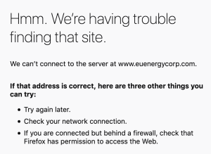
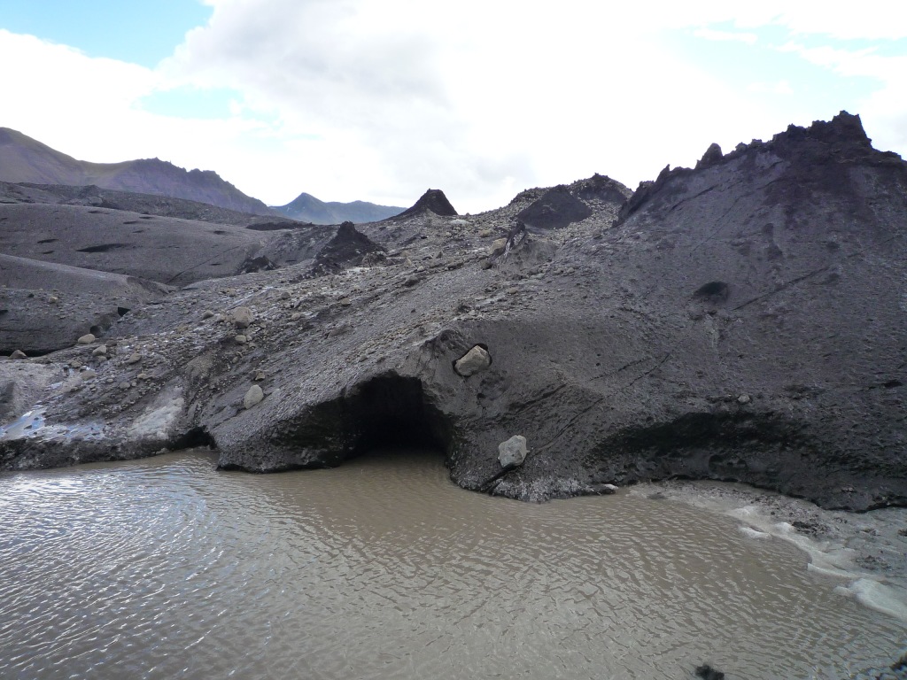
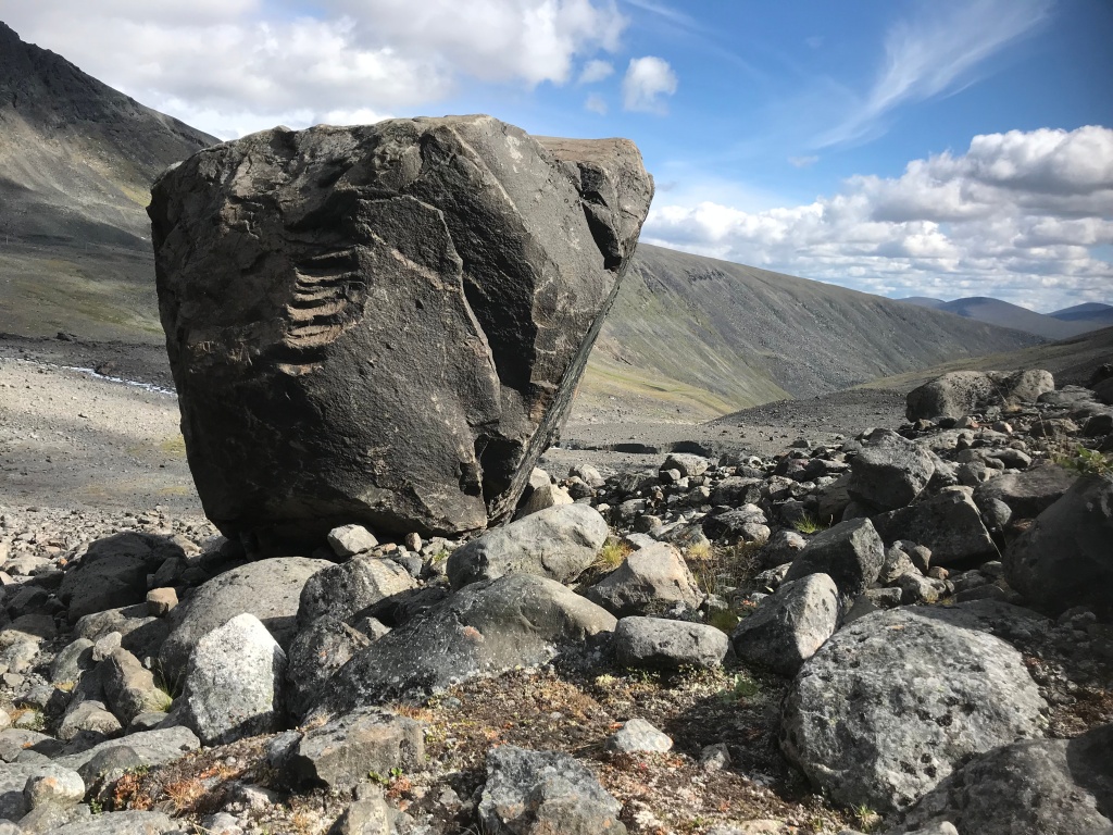
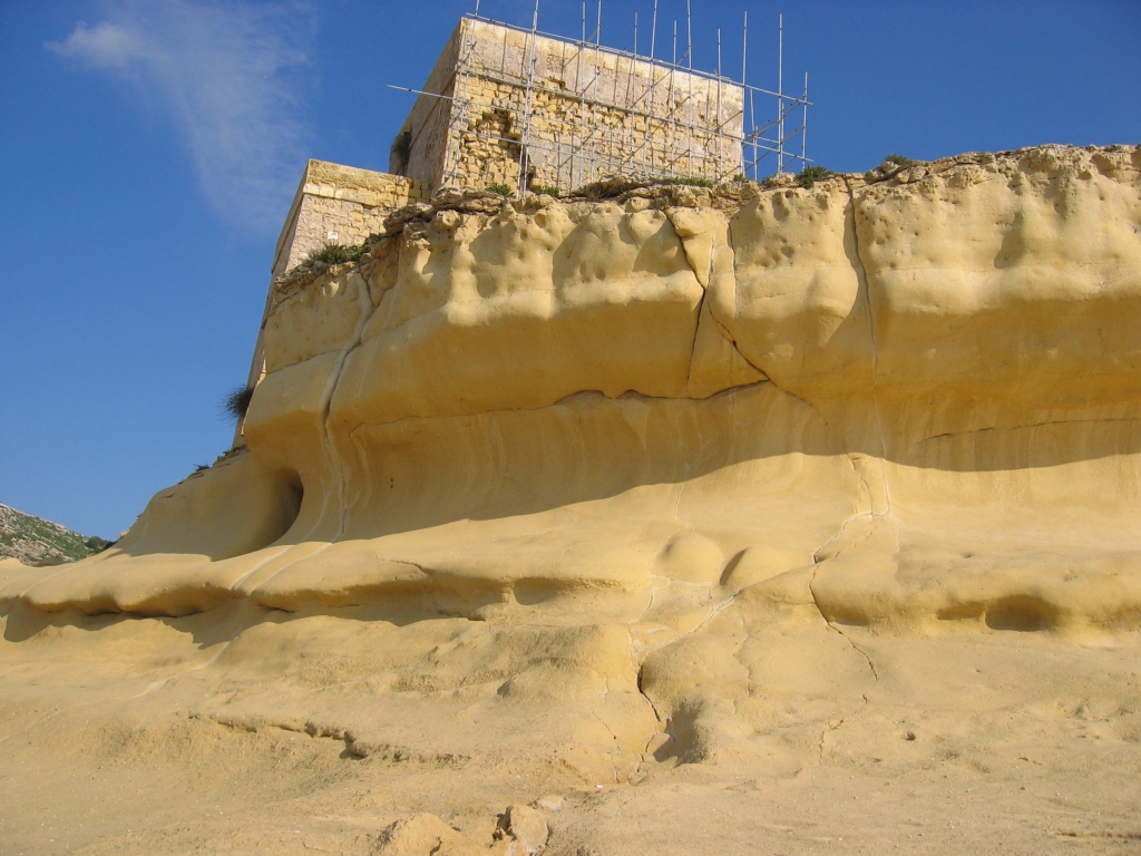
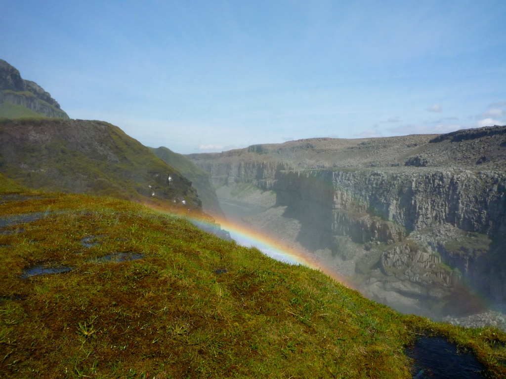
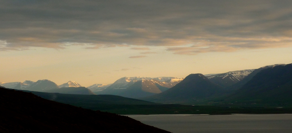
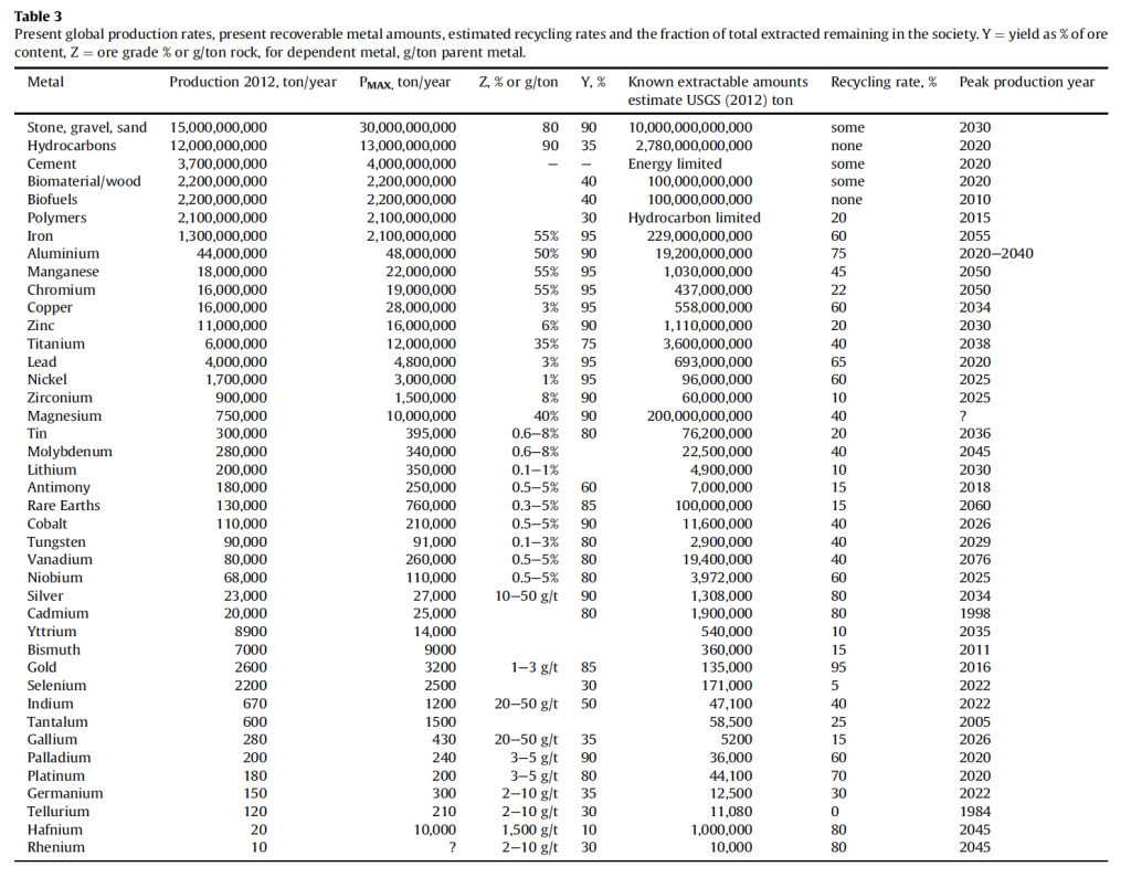
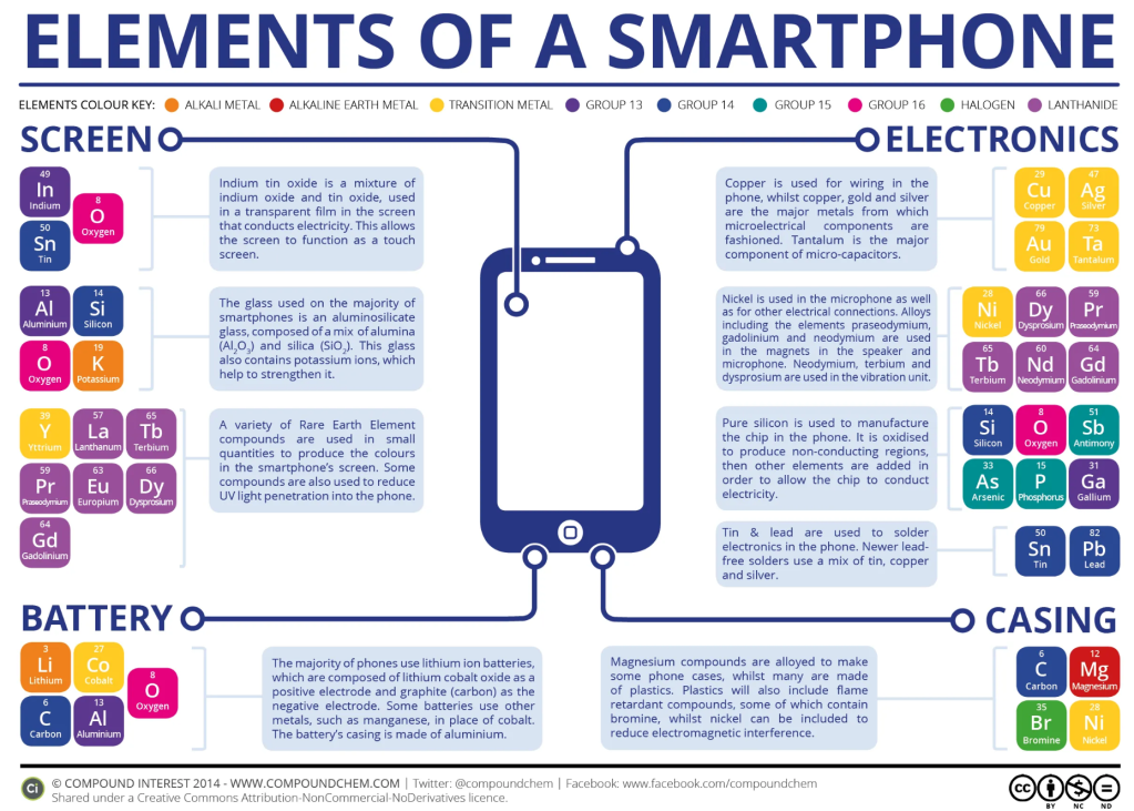
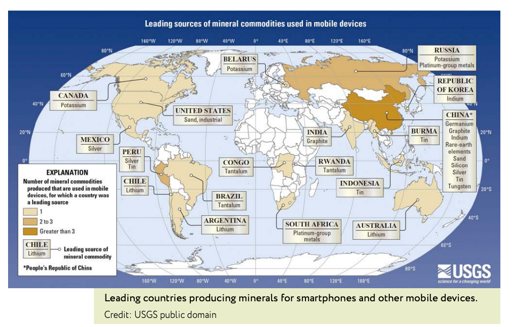
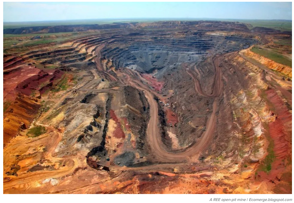
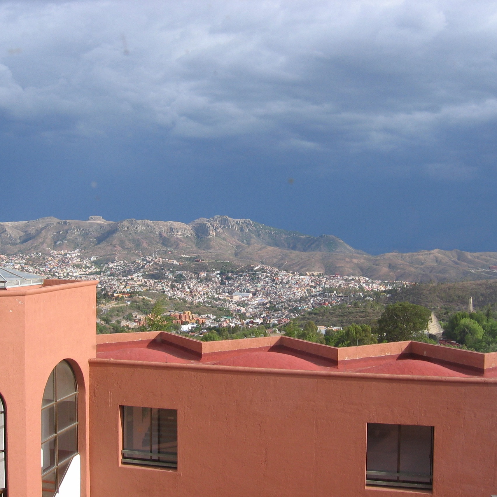
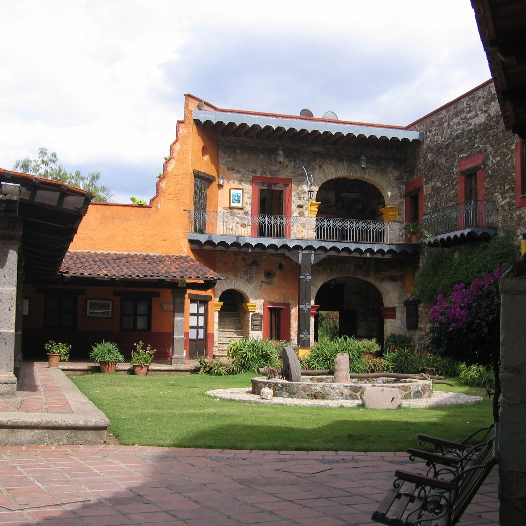
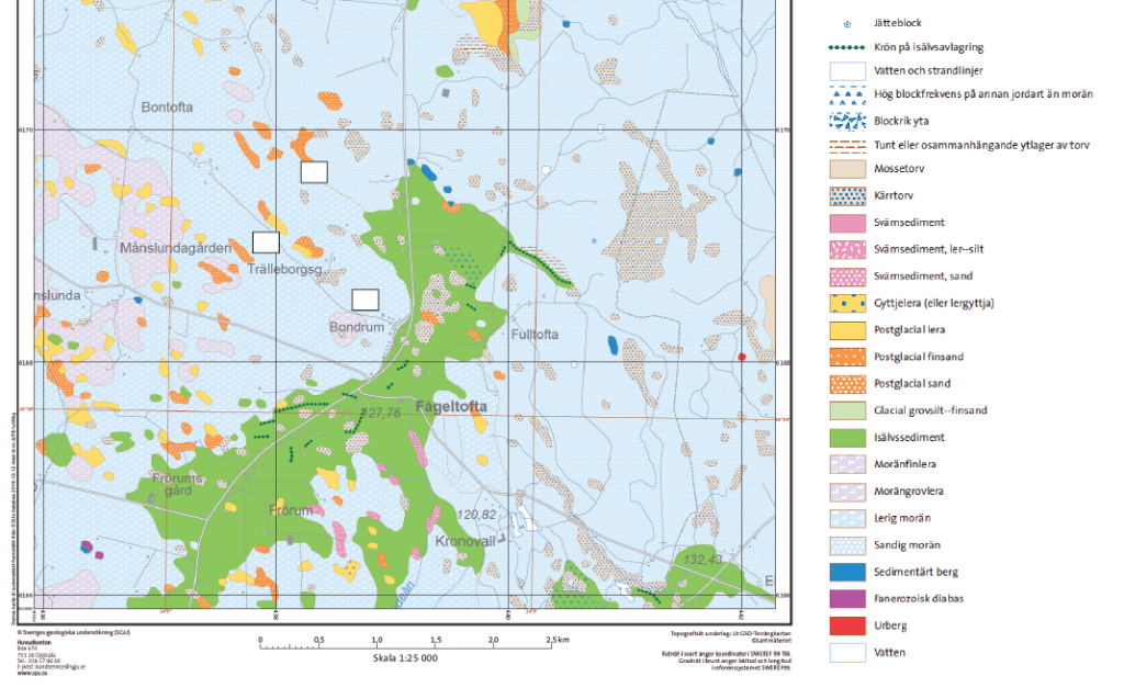
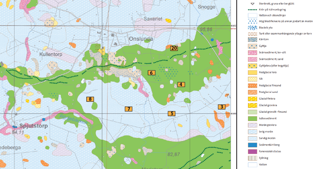
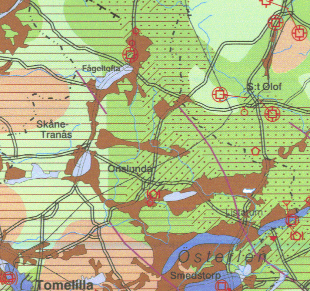

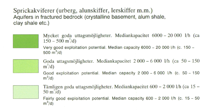
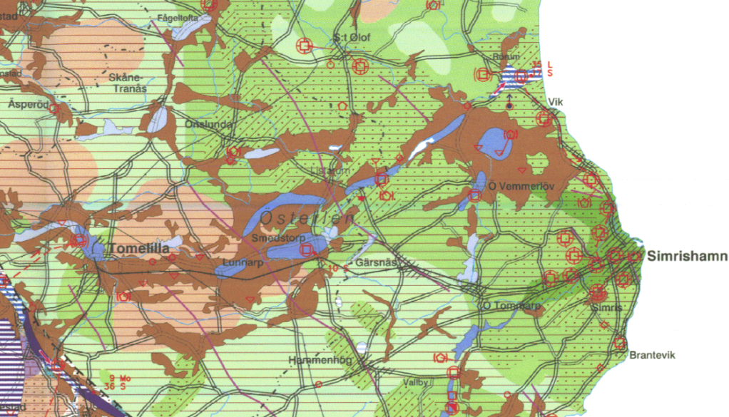
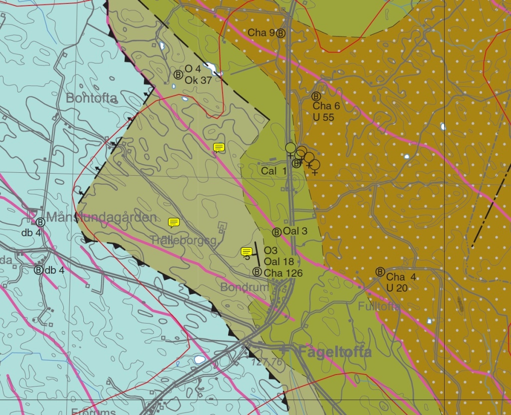
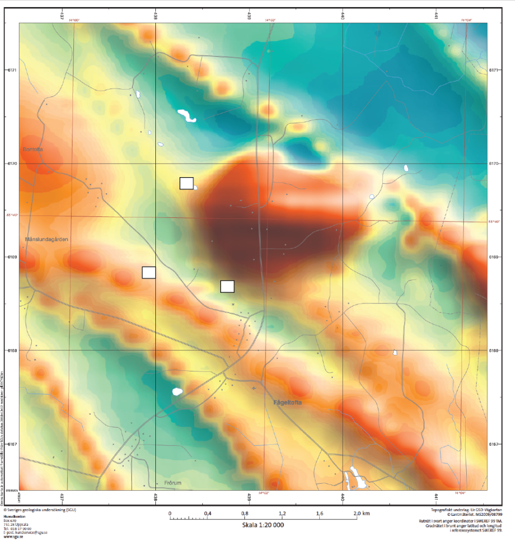
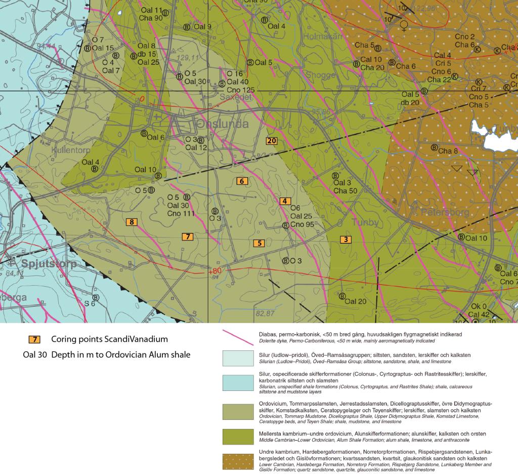
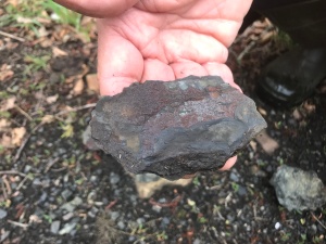
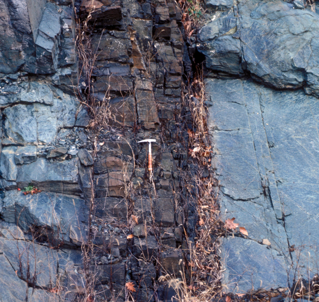
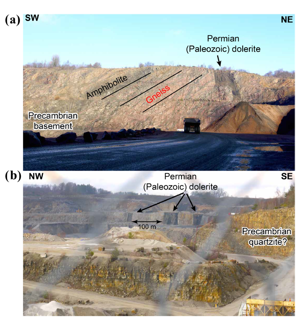

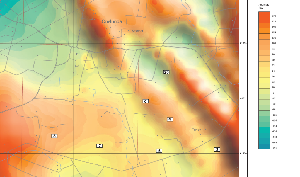
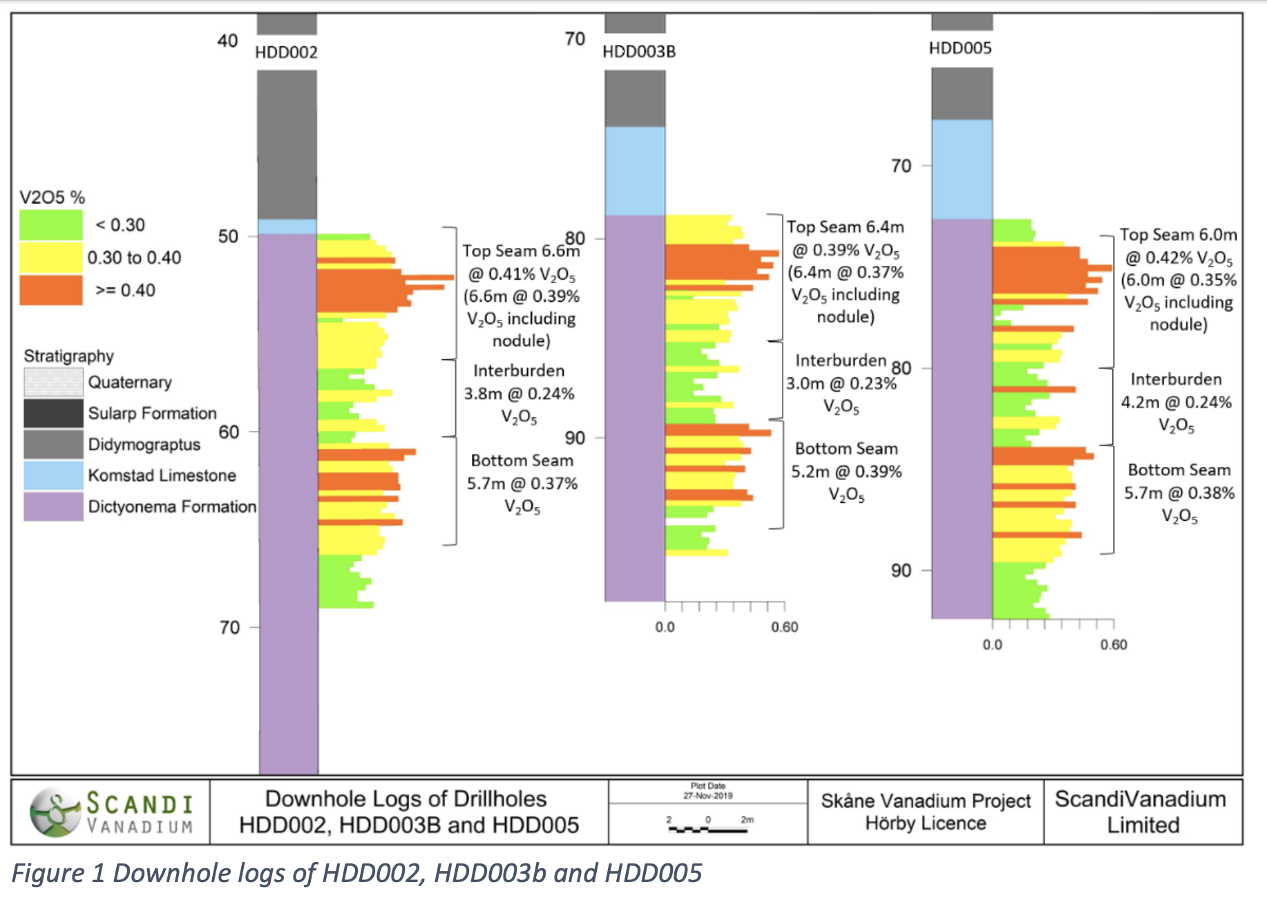
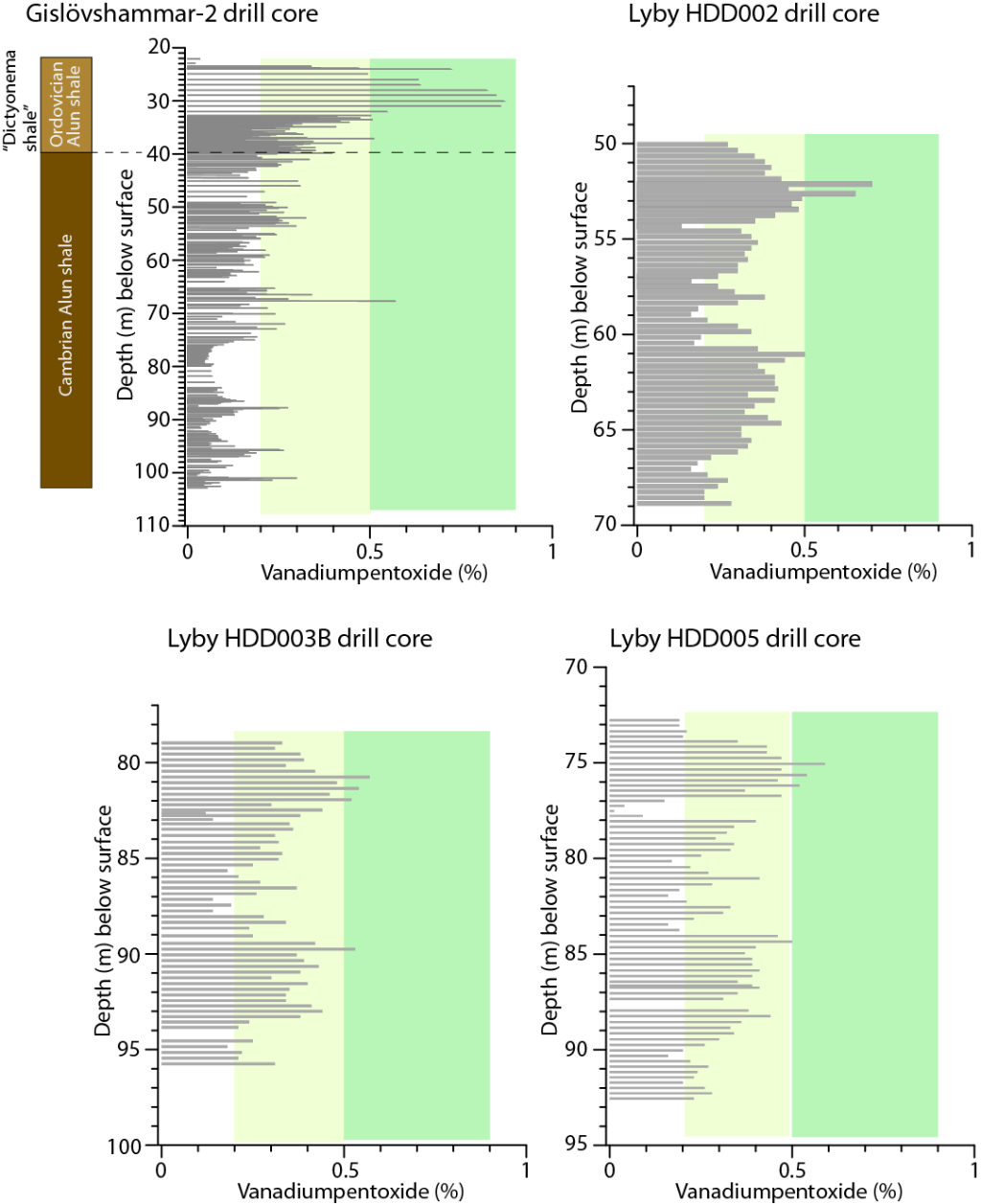


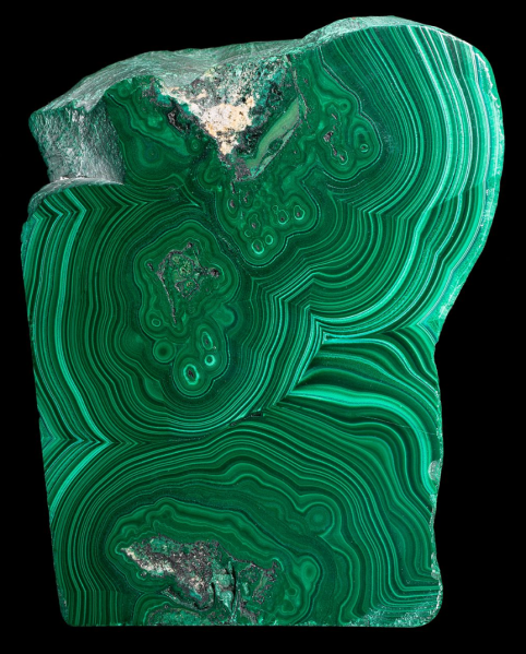
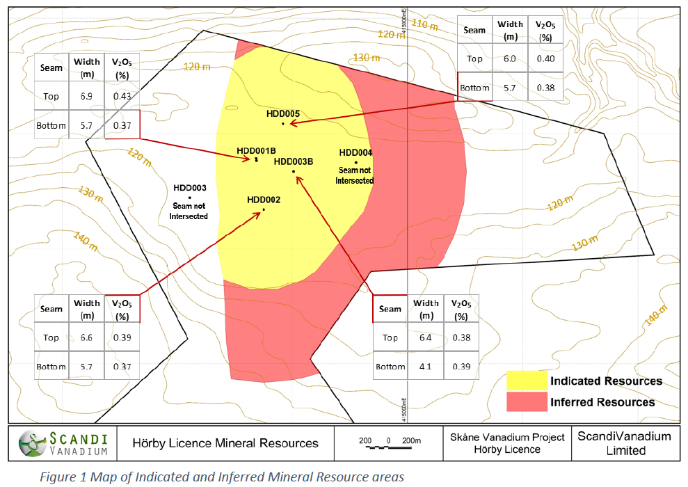
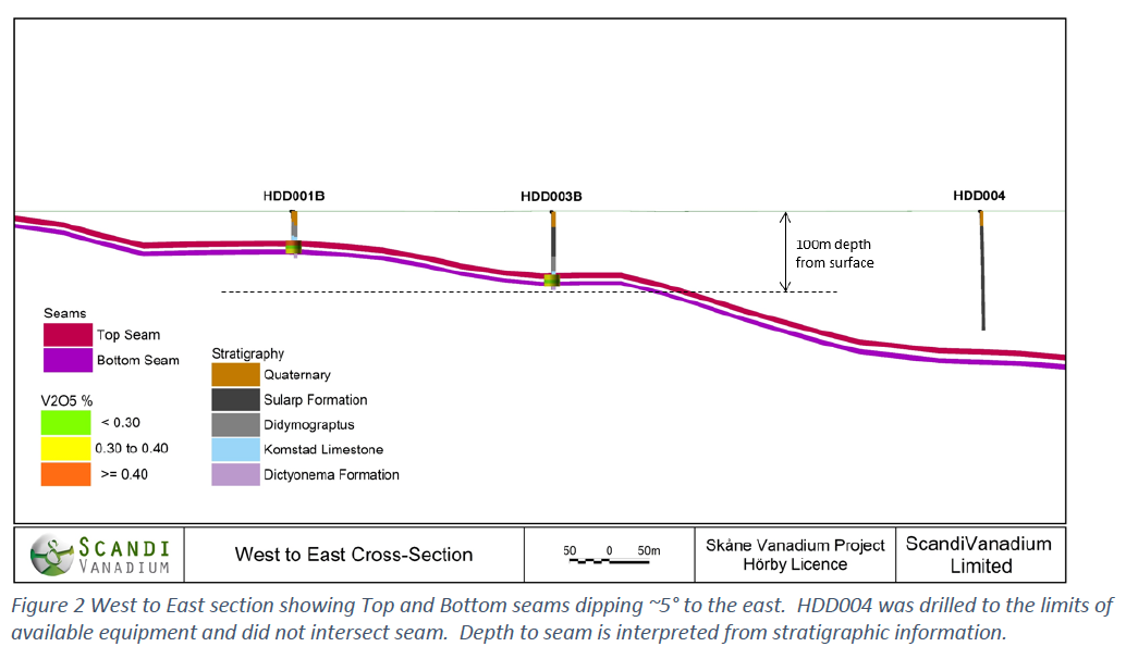

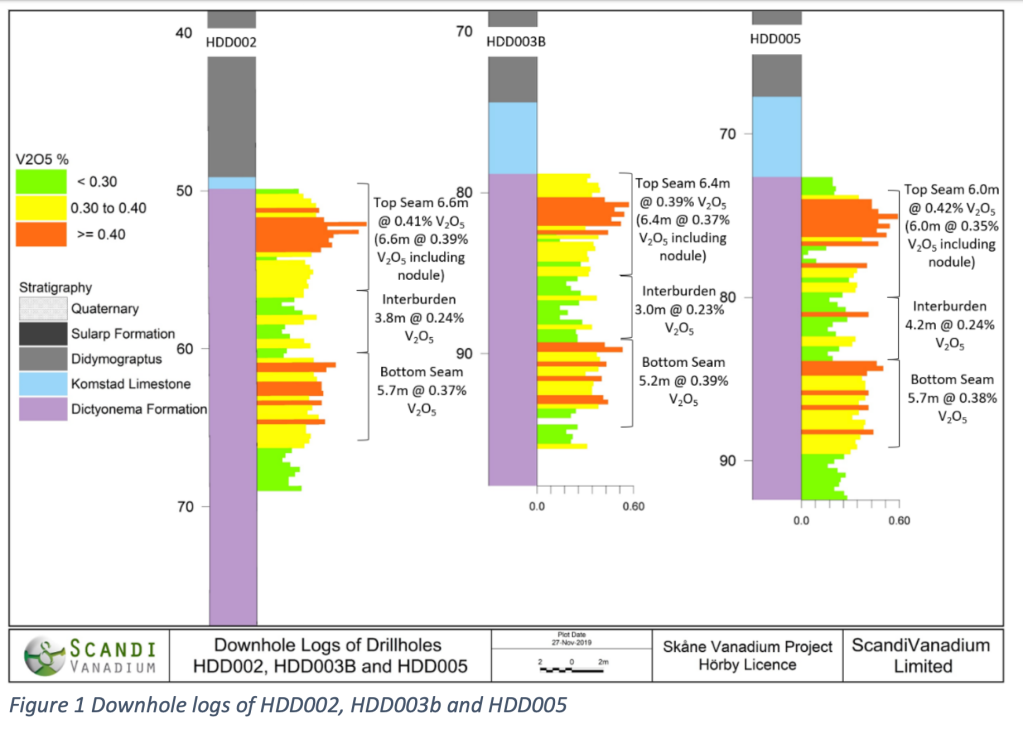
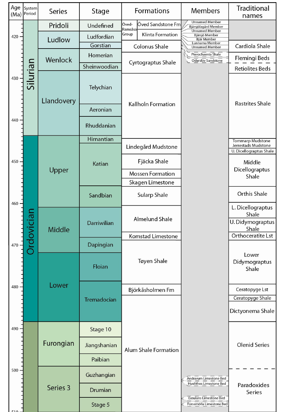
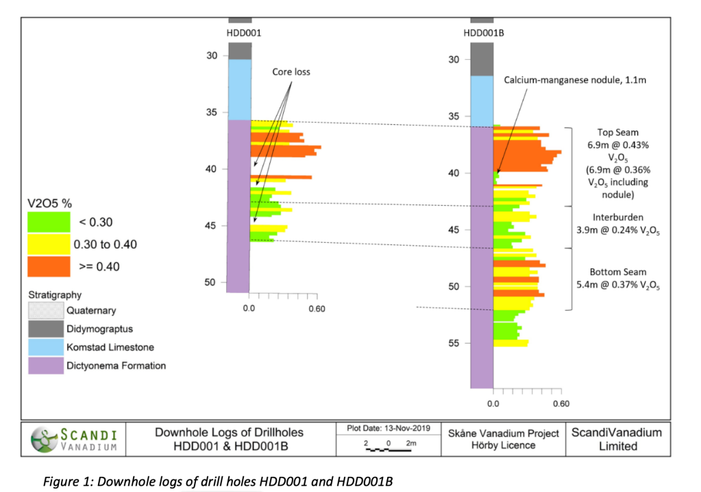

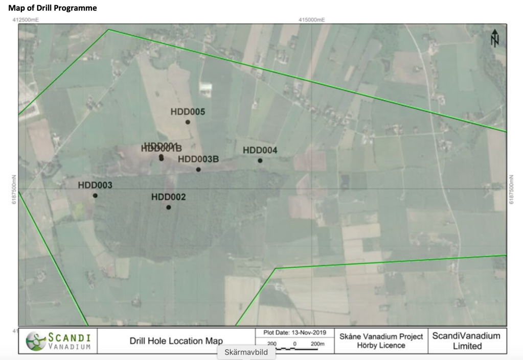


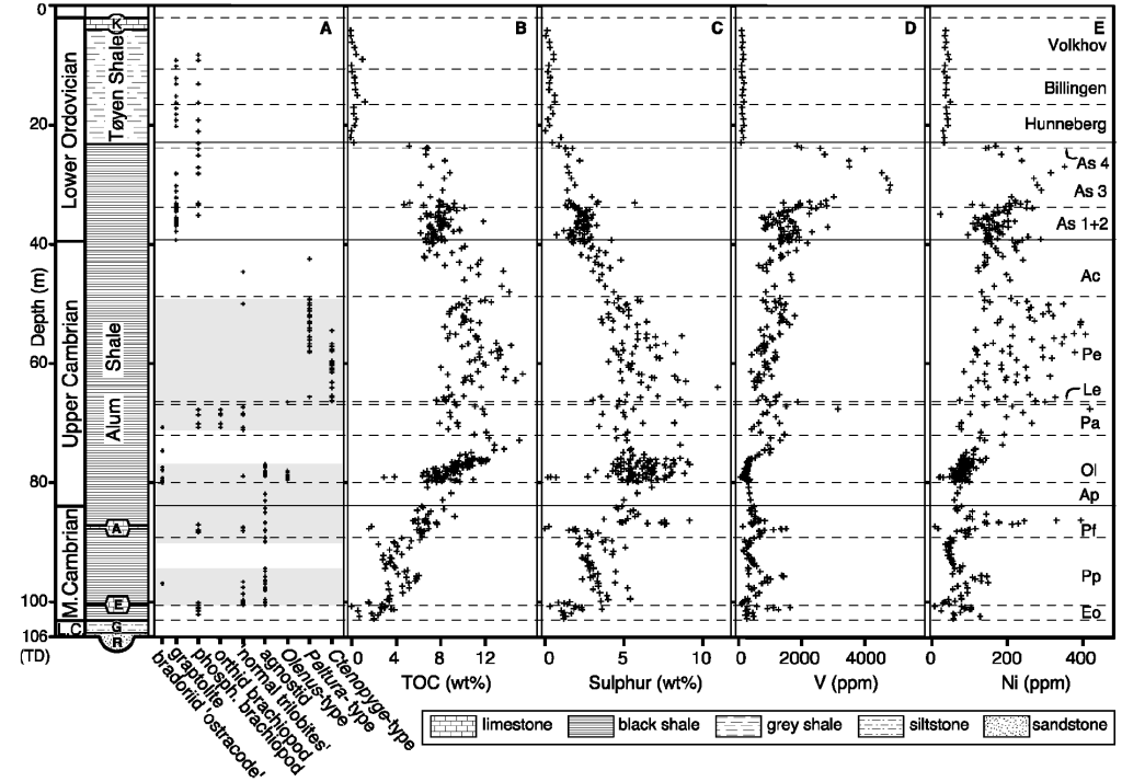
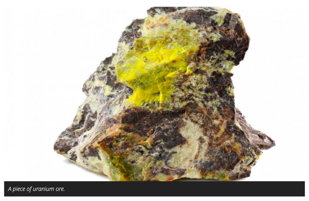
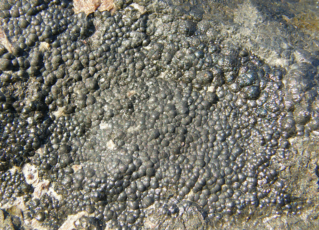

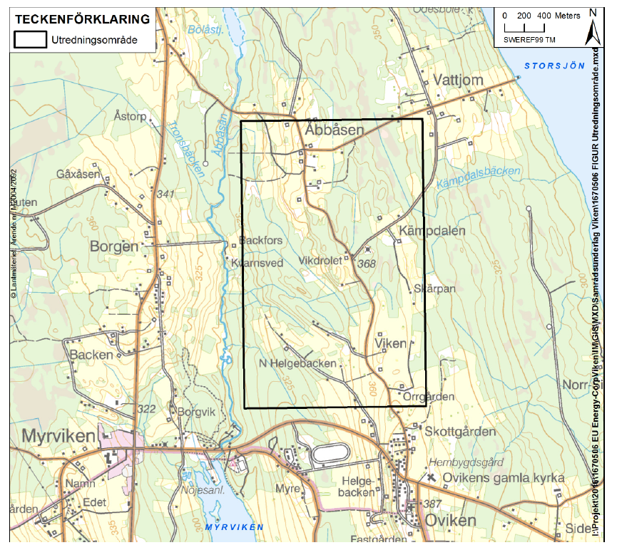
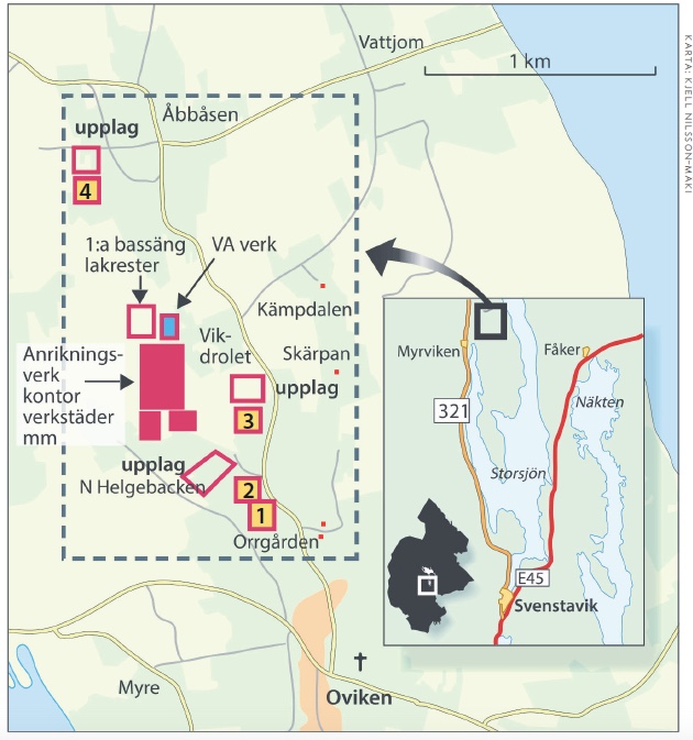

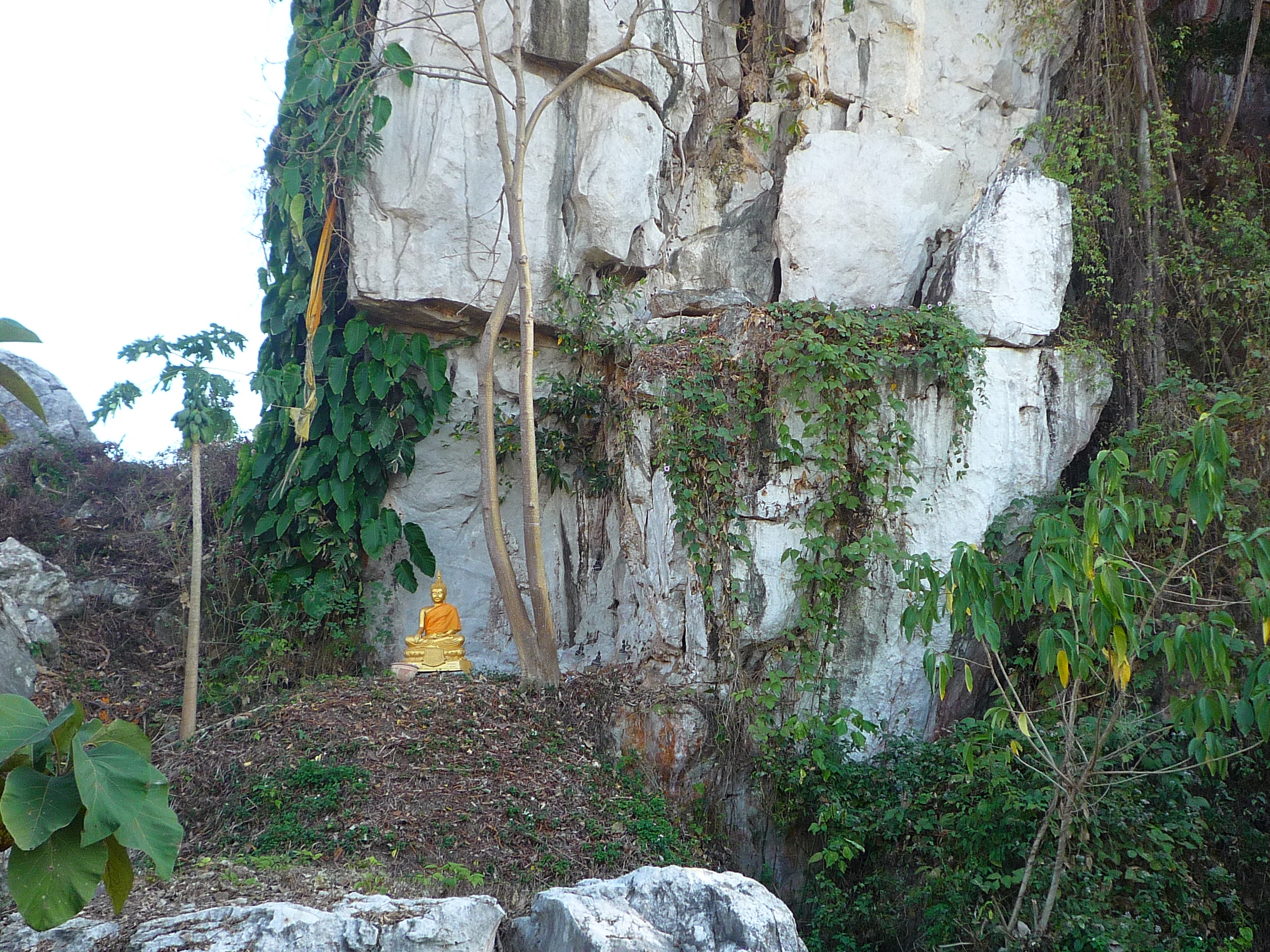
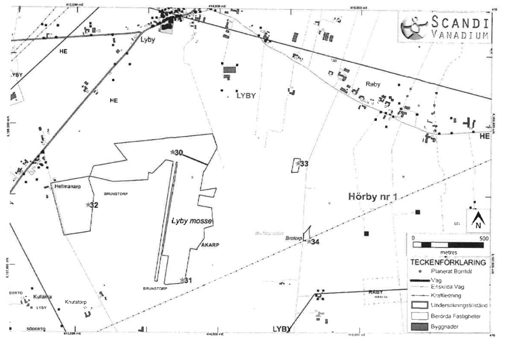
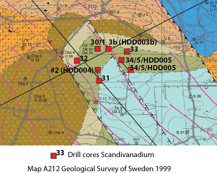
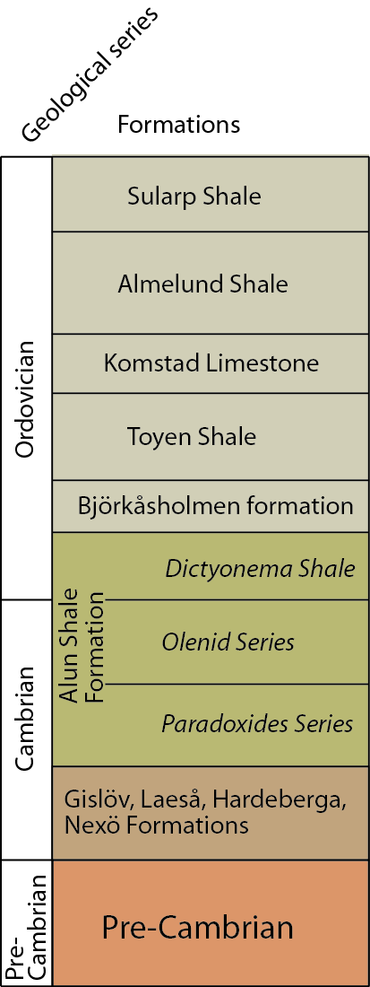
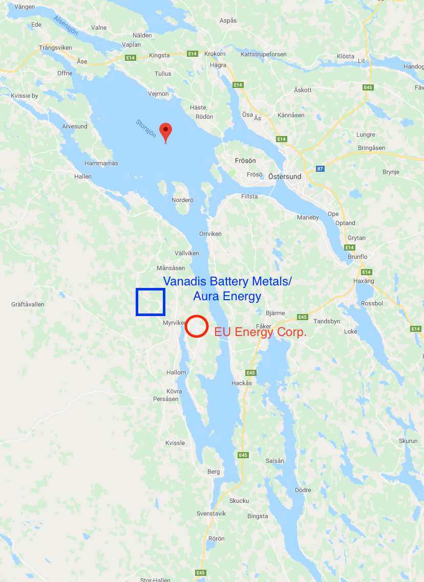
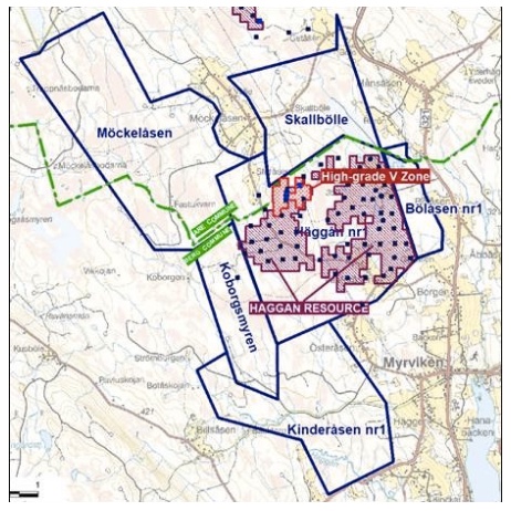
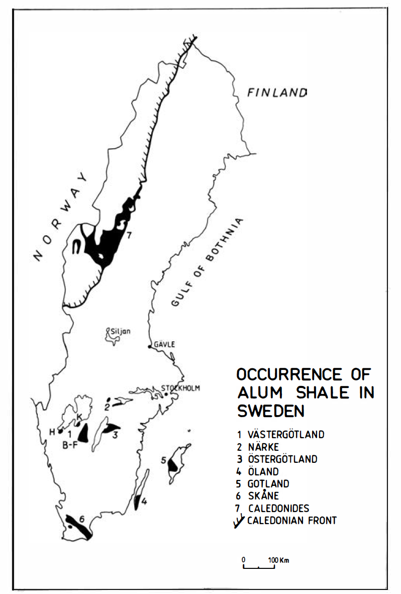
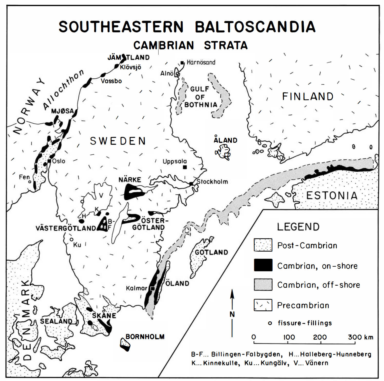
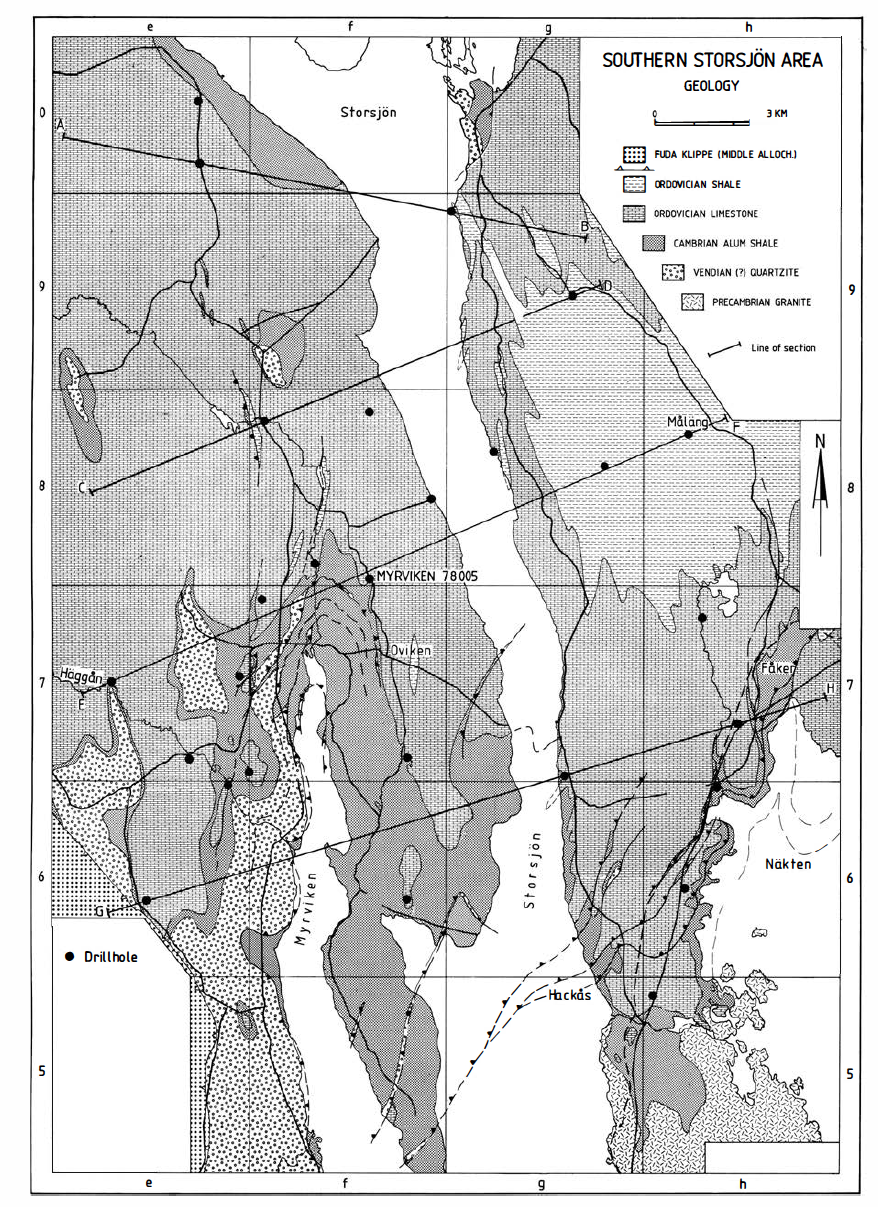
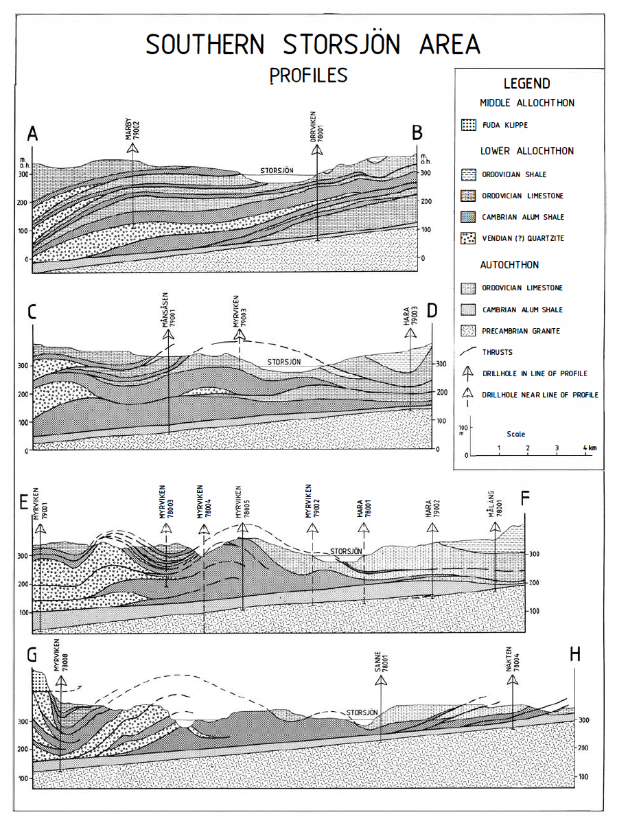
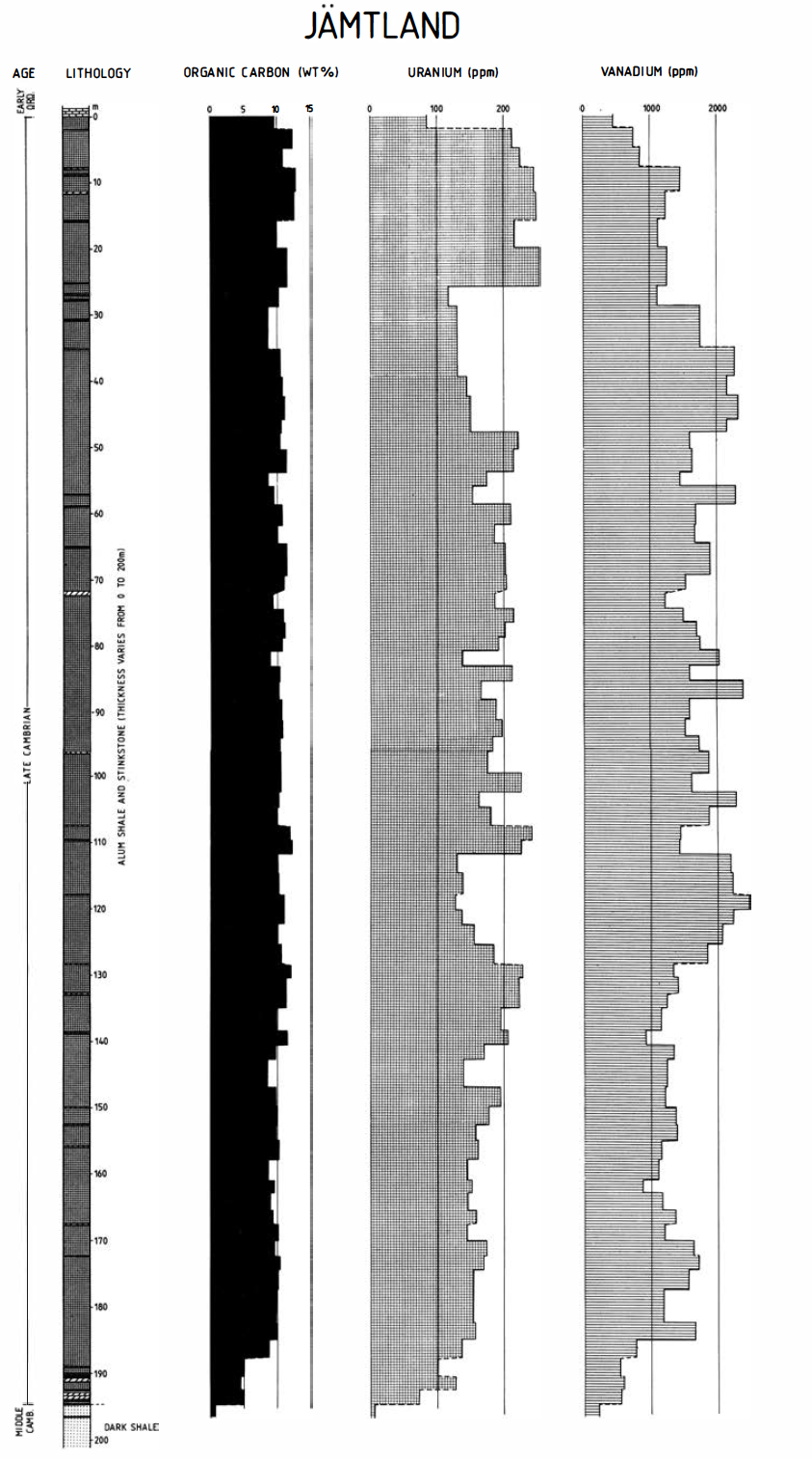
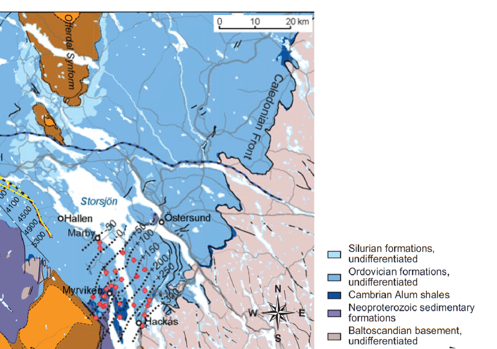
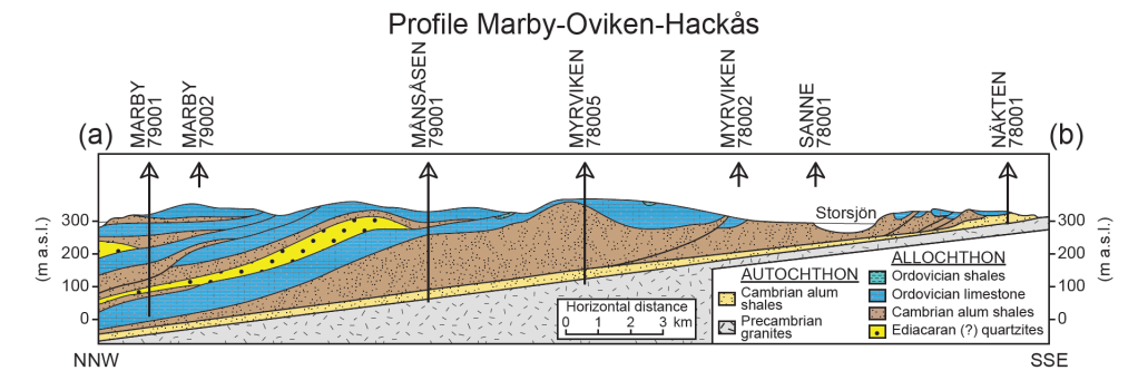
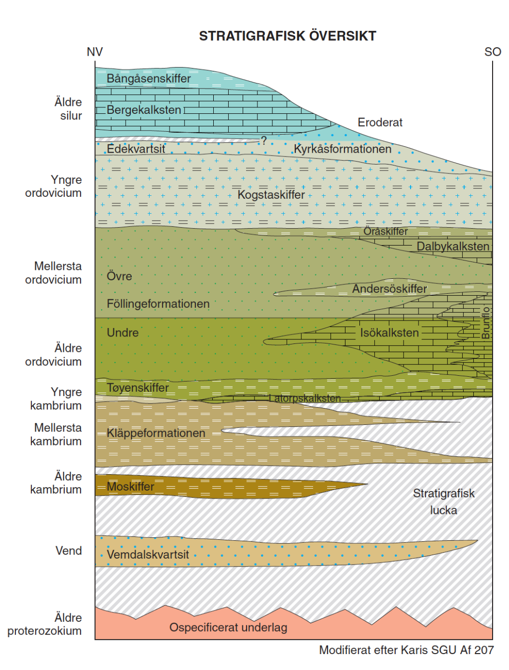
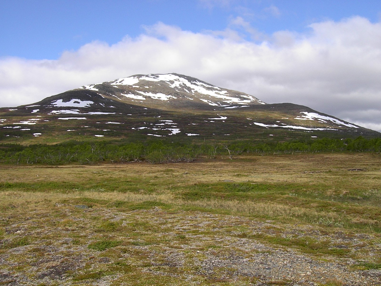

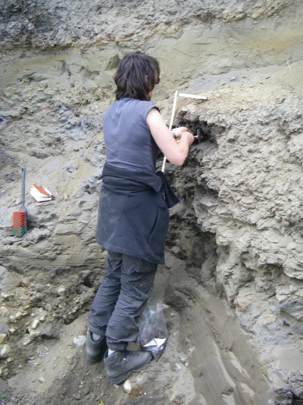
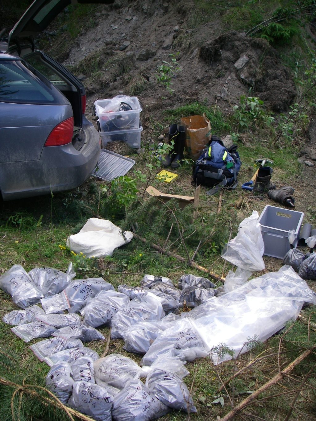

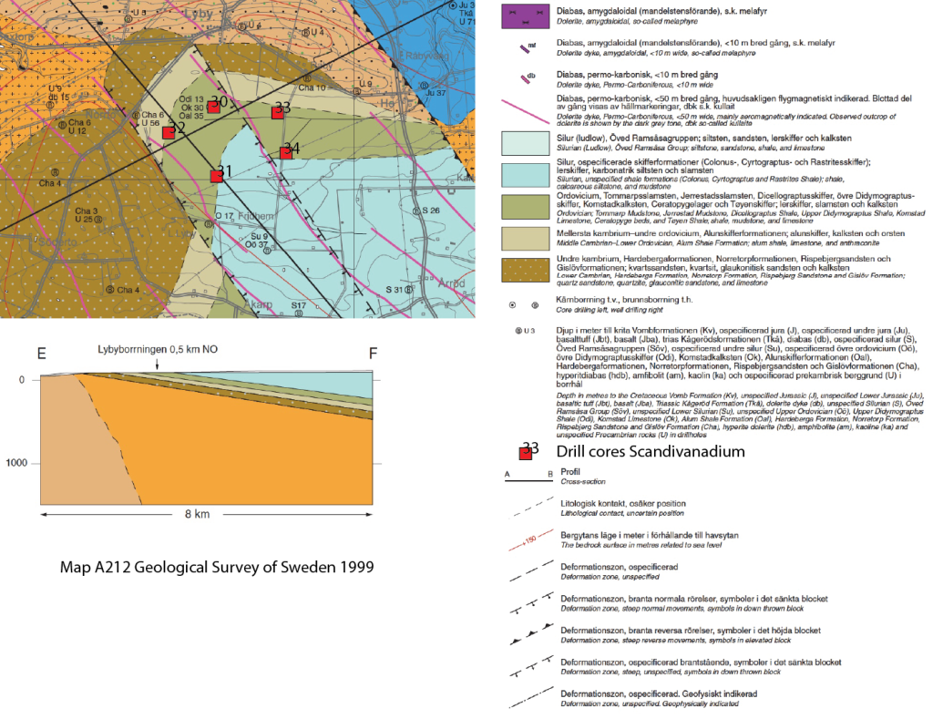
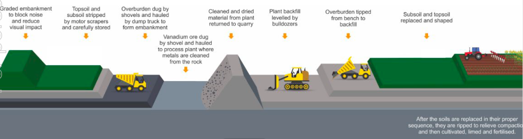
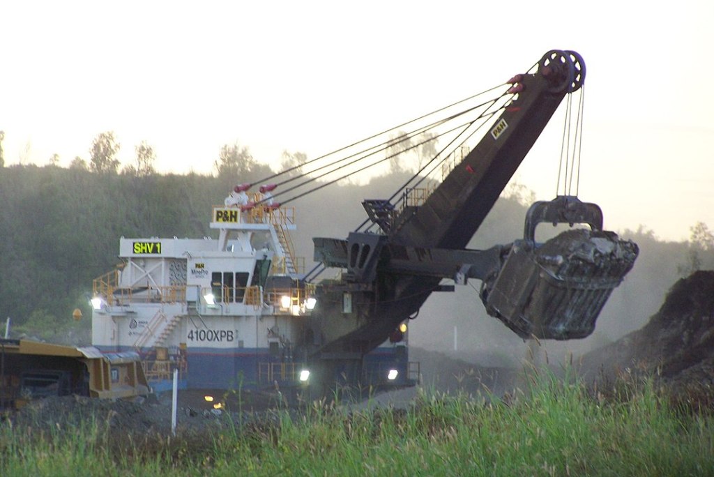
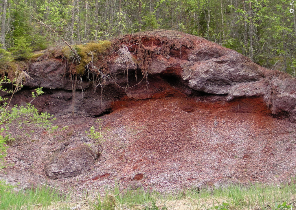
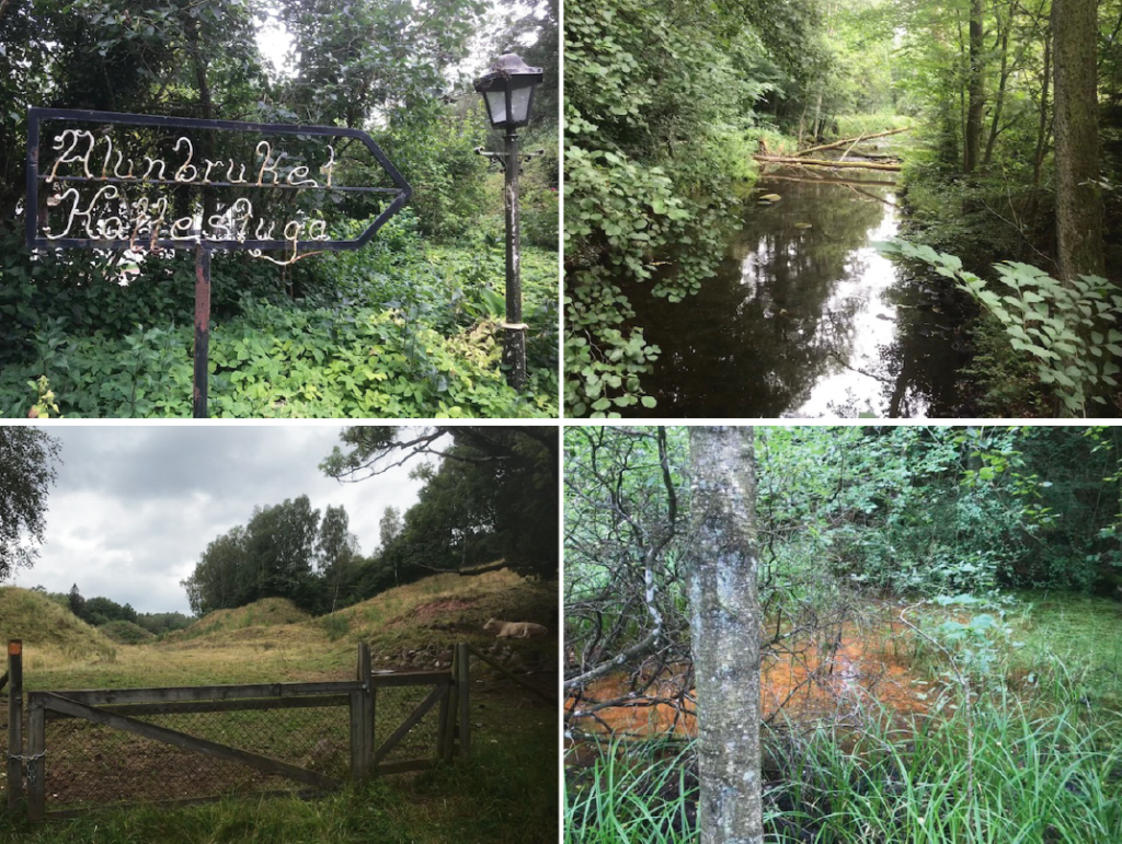
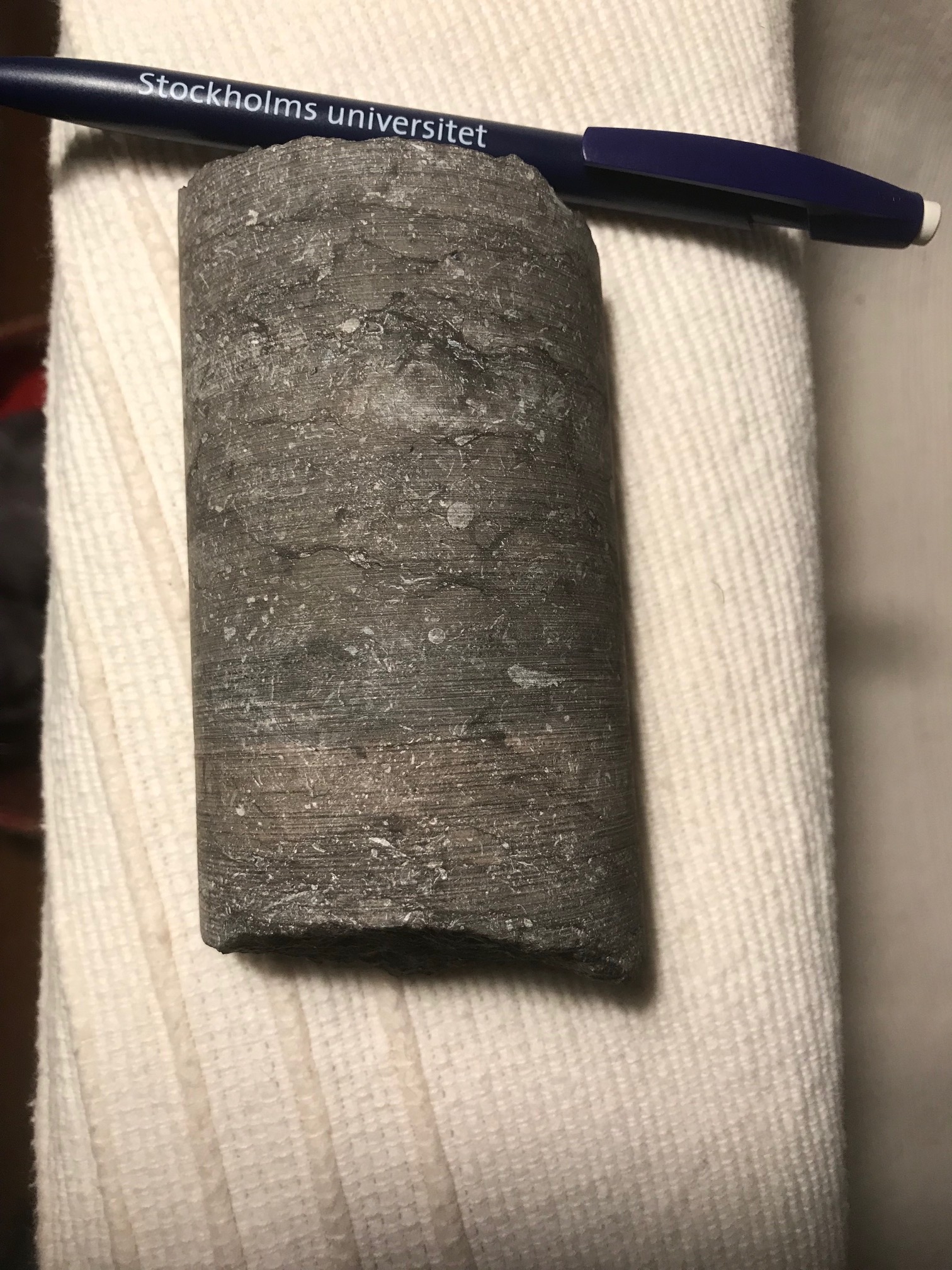
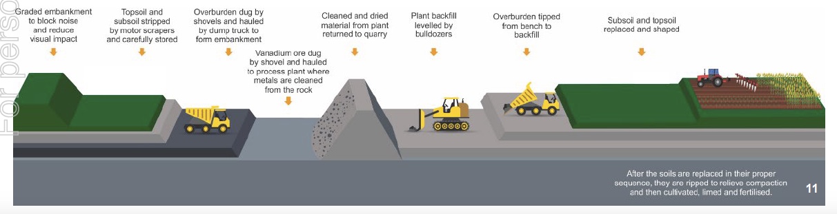
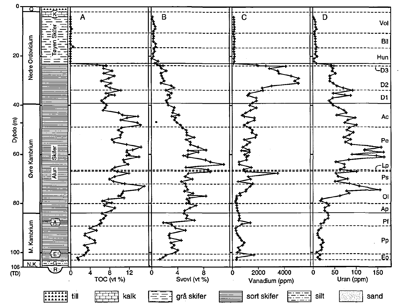


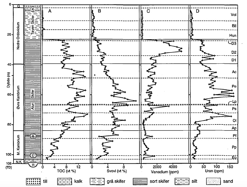
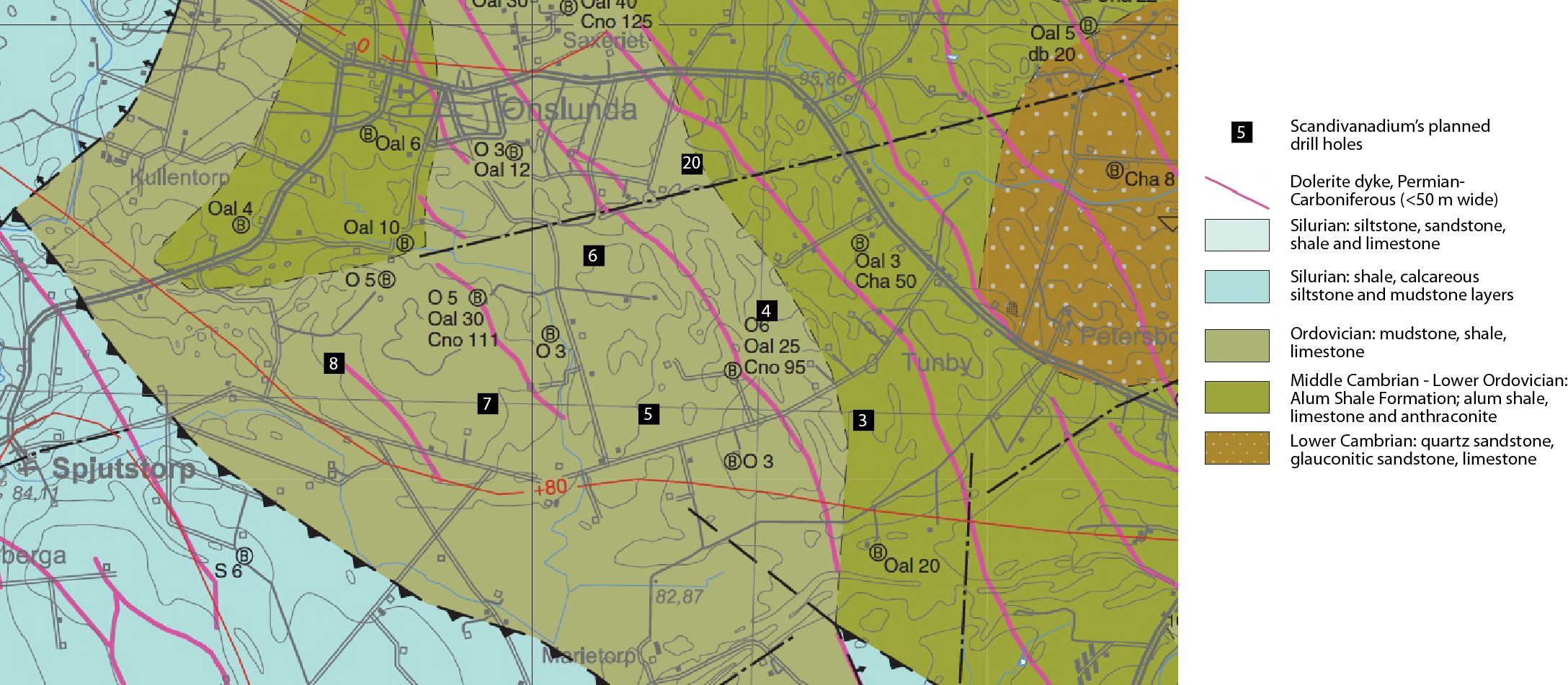

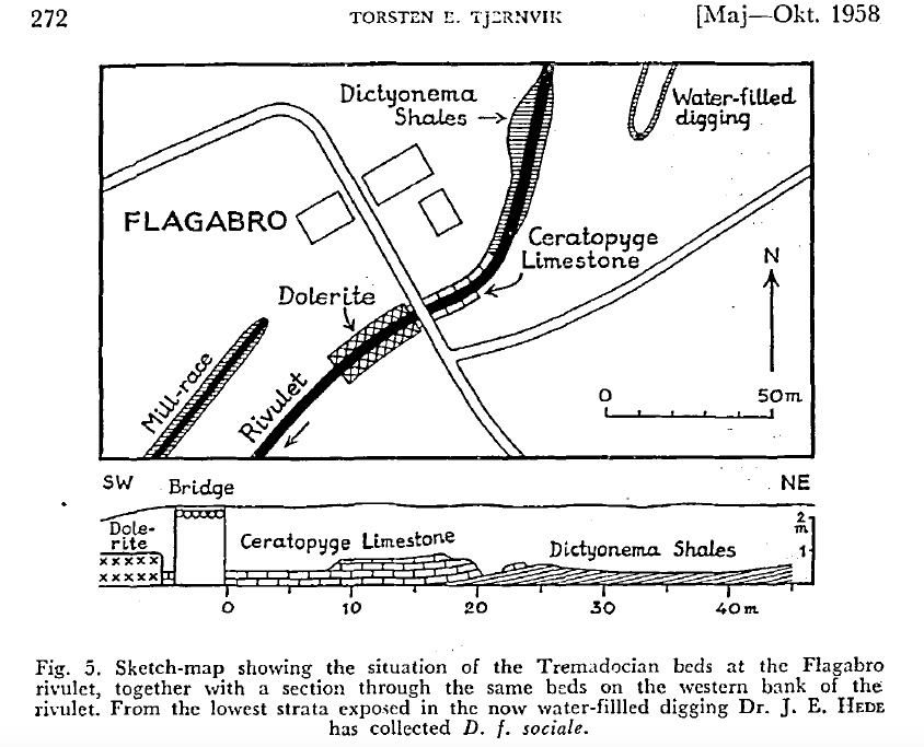
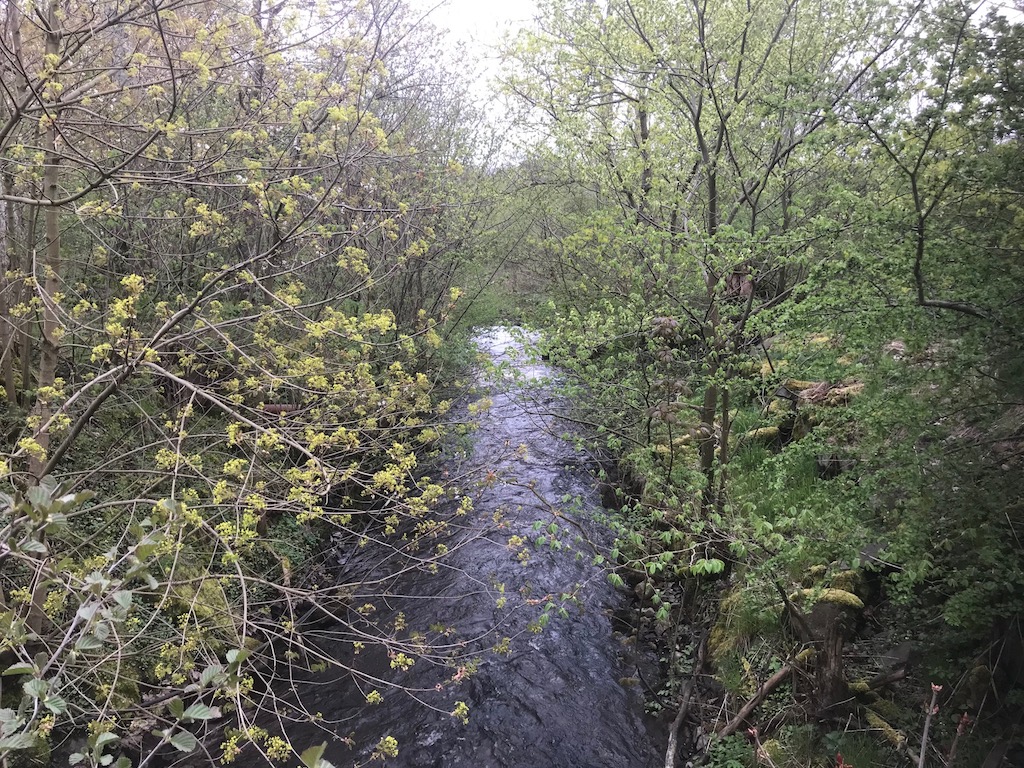
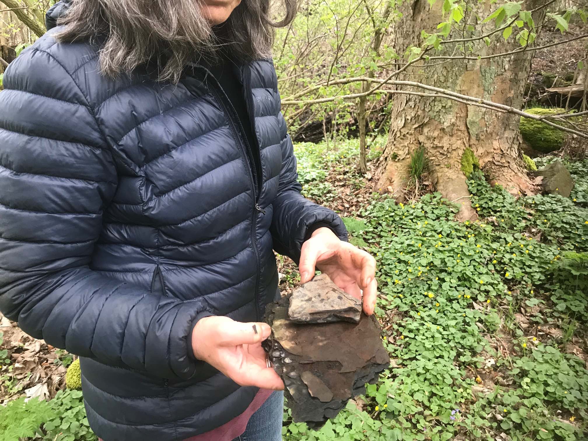
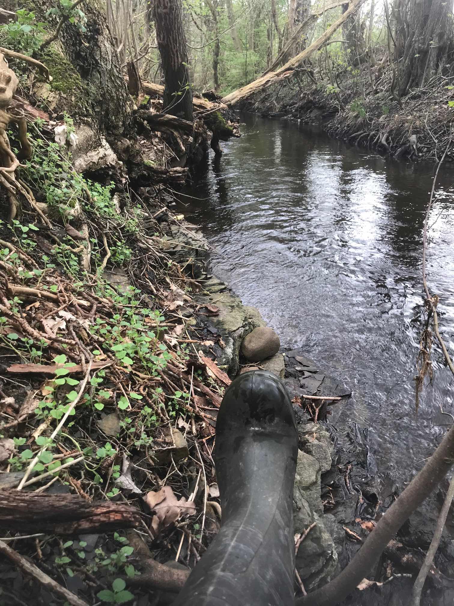

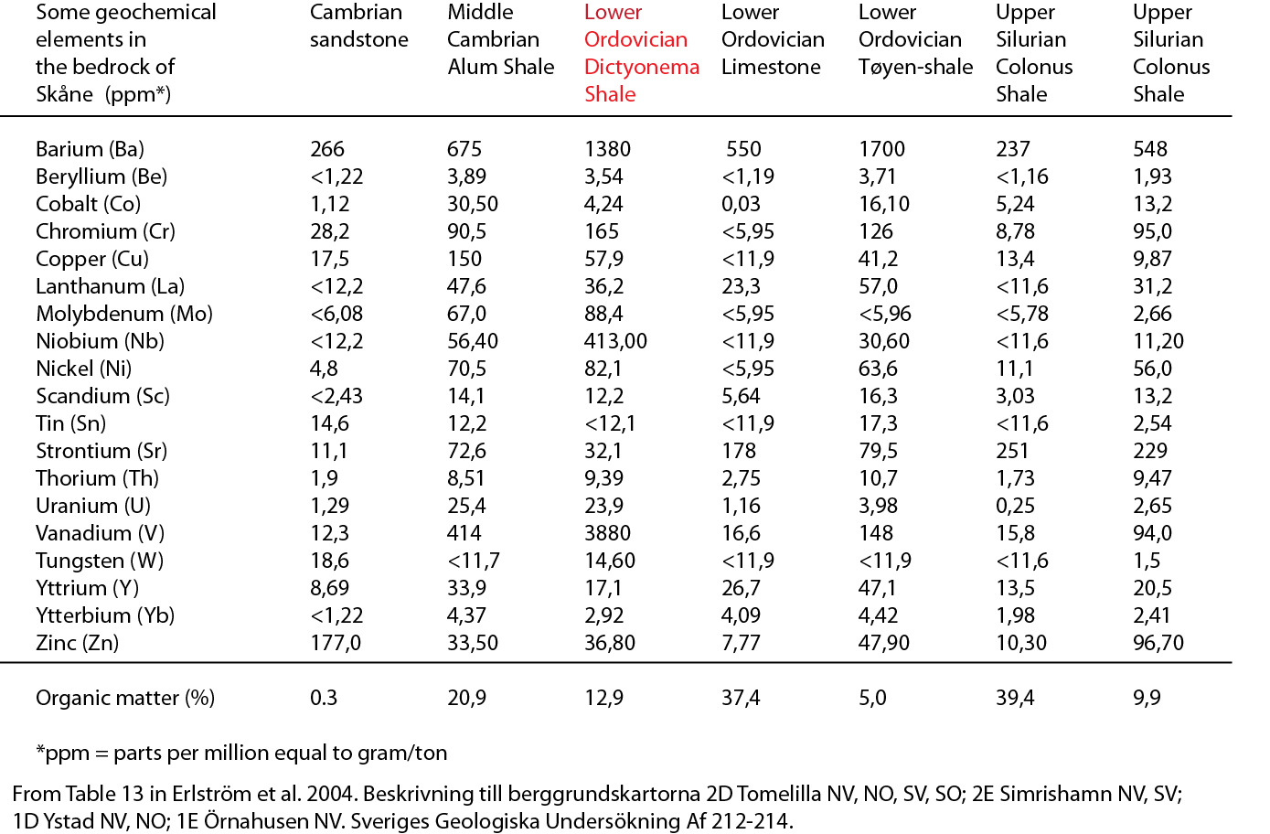
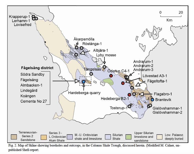


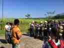


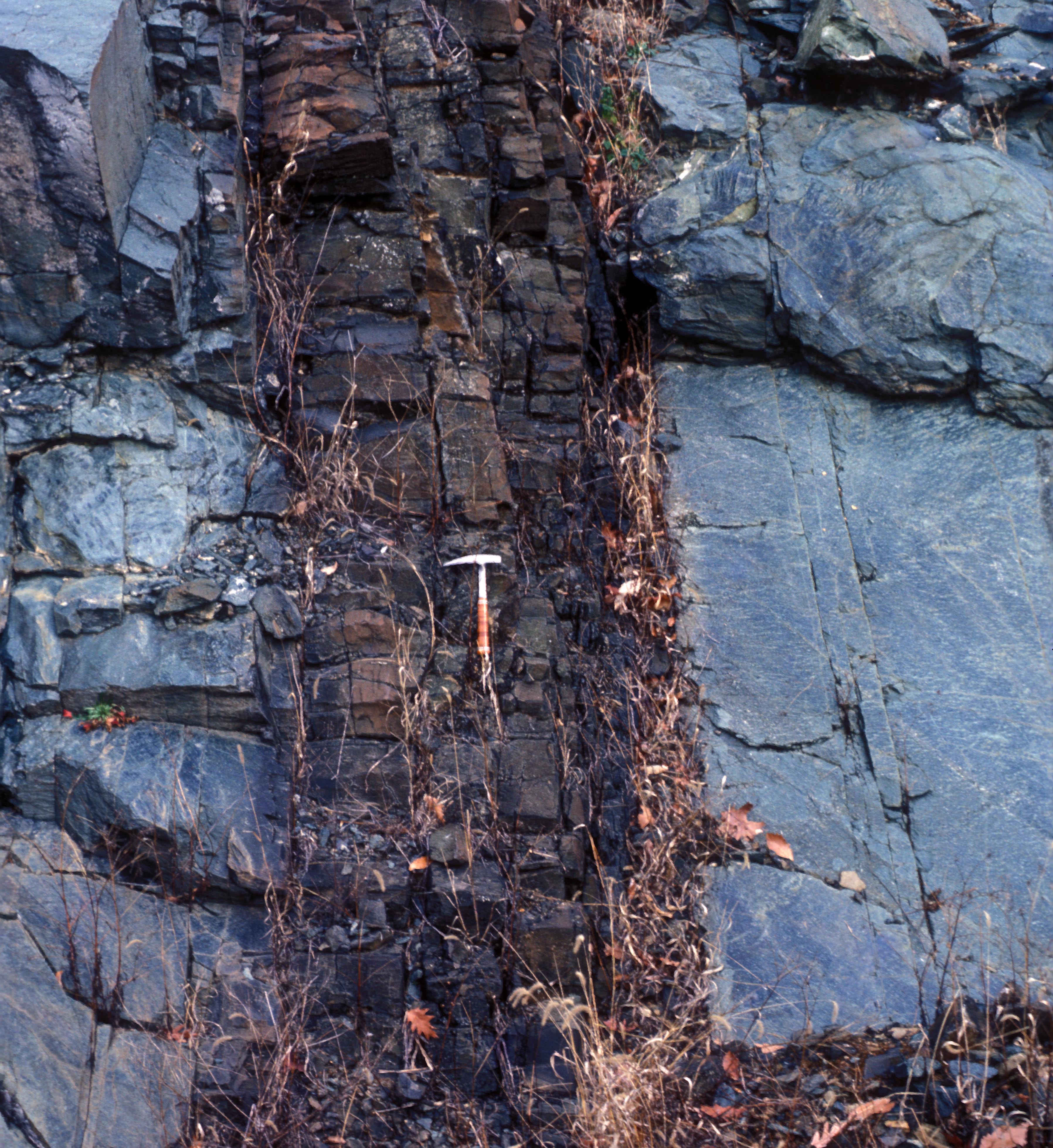