
Clean and healthy water is probably one of the most important things for our survival. We are really fortunate here in Sweden that we can drink tap water, that we can cook with clean water, water our plants with clean water and shower in clean water. This is not the case in many other places. I remember a travel to Guanajuato in Mexico, which still is an important silver and gold mining area.
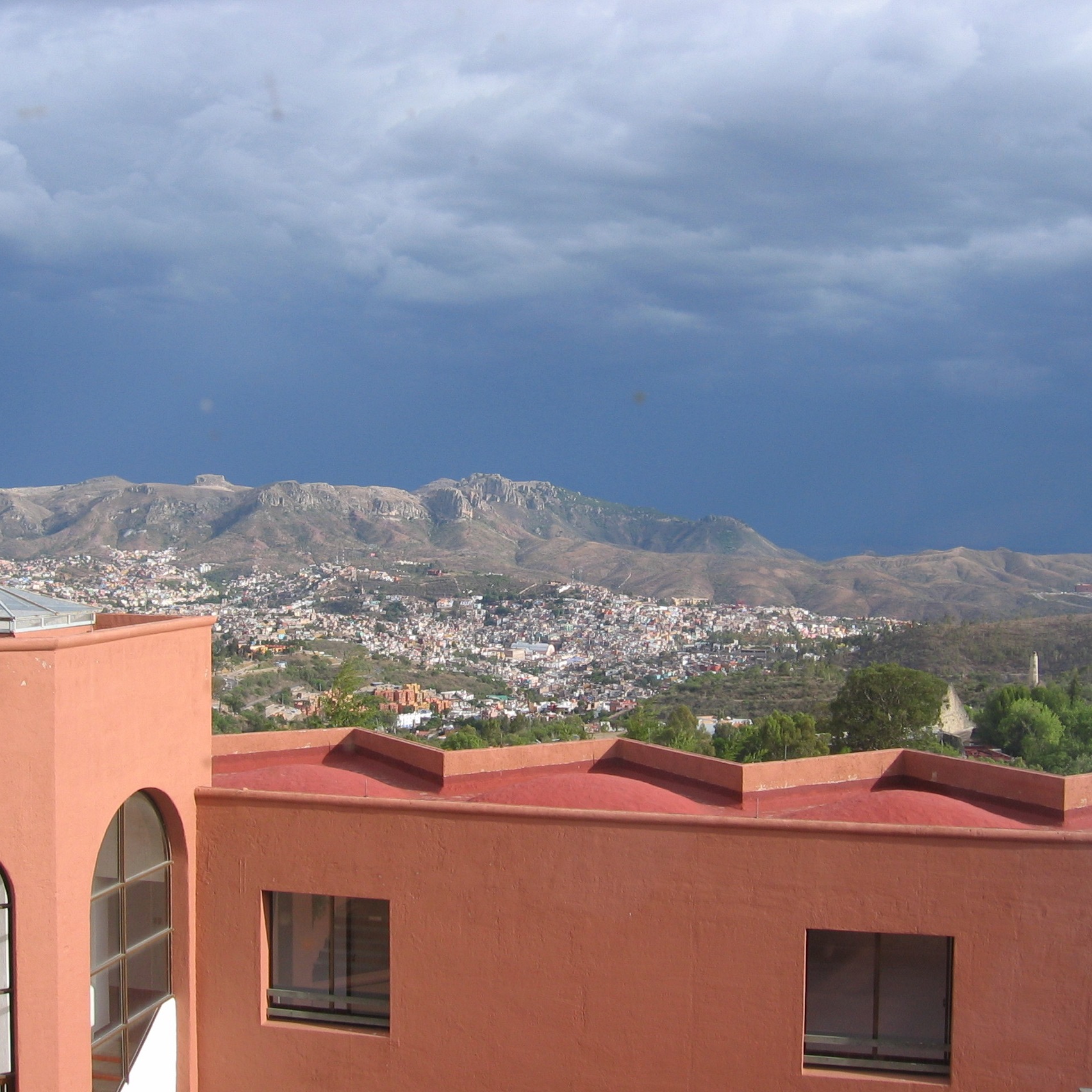
One of the old silver mines is actually a tourist attraction. What I remember most is that tap water could not be used to brush teeth, that the water coming out of the shower was extremely polluted and that the only water than could be used was bottled. At that time I had no idea how much pollution acid mine drainage can cause.
Later visits to Asia, where tap water also often is a no go, reinforced how precious clean drinking water is. We really should value what we have!
Therefore now a little note on the groundwater in the area, where ScandiVanadium wants to drill and eventually open a mine in the Alum shale to extract vanadium. The rationale for the company is that a greener future needs green technologies and one of these green technologies would be so-called Vanadium redox-flow batteries, which allow storing sun or wind energy for later use. Of course it is never mentioned in these future mining plans that mining consumes huge amounts of water, emits huge amounts of carbon dioxide and leaves huge amounts of toxic waste behind.
Where does the groundwater in the area around Onslunda, Spjutstorp and Fågeltofta, where the company plans for exploration drilling, come from?
Ground water aquifers can be found in the bedrock, but also fluvioglacial sediments (= isälvssediment) are good groundwater aquifers. Around Onslunda, Spjutstorp and Fågeltofta, the dominant glacial sediments are till (= morän; blue color) and fluvioglacial sediments (= isälvssediment; green color), as can be seen on the maps below. A marked esker (= ås) runs in an east-west direction south of Onslunda and Kullentorp and a smaller esker (= ås) can be spotted southwest of Fågeltofta (blue dotted line). Eskers (åsar) consist of coarse sediment, such as sand, gravel and rounded stones. Some eskers (åsar) can extend over long distances and were deposited by rivers draining the huge inland ice that melted 18 000-16 000 years ago. Other eskers (åsar) are much smaller, such as those close to Onslunda and Fågeltofta, which are probably related to melting of dead ice. Today these eskers (åsar) can function as an important groundwater aquifer. Would this be the case for the esker (åsar) deposits around Onslunda and Fågeltofta?
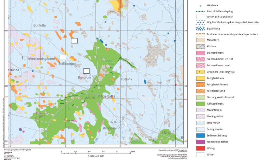
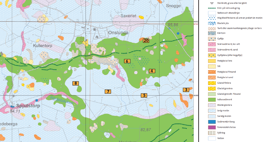
To check this up, I consulted the well archive (=Brunnsarkivet), which is available at the Geological Survey of Sweden, and several groundwater maps. I found information for more than 65 wells drilled around Onslunda and Spjutstorp and for 16 wells drilled in the area around Fågeltofta. The total depth for the different wells ranges between 11 and 150 m and it seems that most, if not all, of the wells reach the underlying bedrock.
Groundwater was however also found in much shallower depth, between 0 and 6 m, but this shallow aquifer does not seem to be used for wells. The reason is probably that groundwater availability is limited, or that the water does not qualify as drinking water. Indeed, by looking at the map below, it becomes obvious that the fluvioglacial sediments have a fairly low groundwater capacity. They deliver less than 1 l of groundwater per second and rarely exceed 5 l/second, except for in the very southern part of the map, where measurements indicate 5-25 l/second.
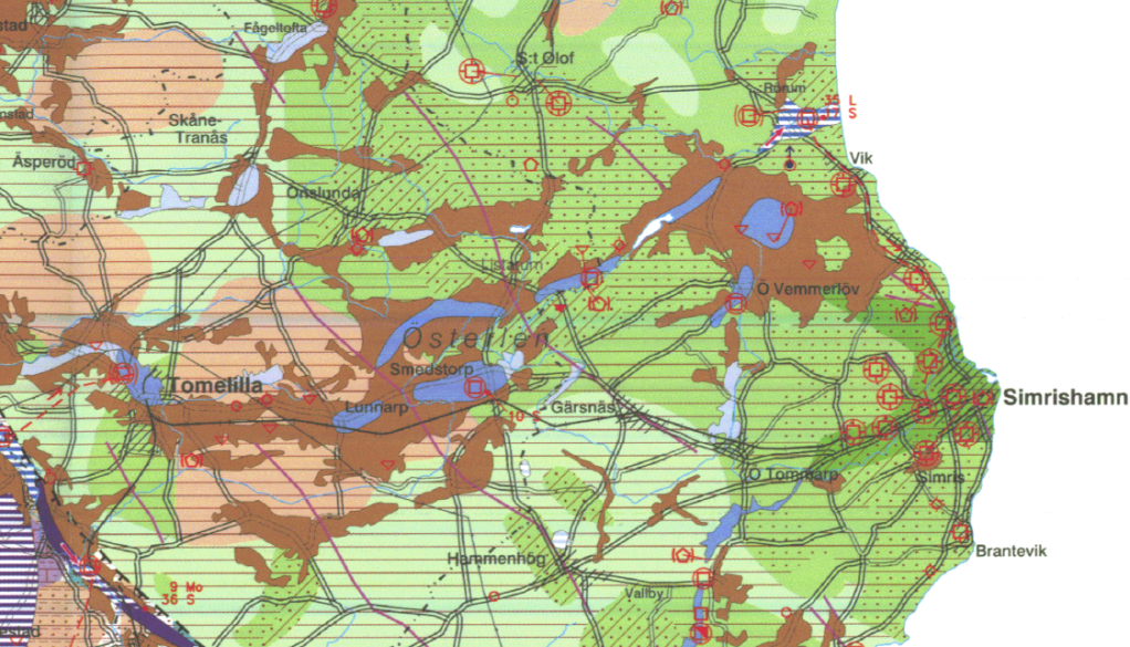
Looking at the Hydrogeological map for Skåne (Gustafsson, O. 1999; Sveriges geologiska undersökning, Ah 15. ISBN 91-7158-625-3) shown below, a similar picture appears. The brown colored areas on the map are a poor groundwater resource (<1l/s), whereas the light purple and blue areas are moderate (1-5 l/s) to good (5-25 l/s) groundwater resources, respectively. These areas correspond to where fluvioglacial sediments are found.
Downloaded from the Geological Survey of Sweden. Gustafsson, O. 1999. Hydrogeological map of Skåne County. Scale 1:250 000. Geological Survey of Sweden Ah 15.

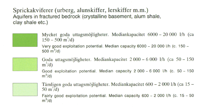
In contrast, aquifers in fractured bedrock (crystalline bedrock, sandstone, Alum shale, and so on) have fairly good (light green color on the map) (600-2000 l/s) and good (darker green color on the map) (2000-6000 l/s) exploitation potentials.
Wells drilled in bedrock thus seem to be the only alternative to obtain sufficient drinking water. However, there is a lot of Alum shale in the bedrock. Indeed, during drilling of deep wells in the Onslunda-Spjutstorp and Fågeltofta area, the well driller reported badly smelling water, which hints at sulfur-rich Alum shale. I cannot imagine that any of the wells that are in use derive their water from the shale, since it is not a good aquifer given its high content of uranium and other toxic elements.
Where do all the deep wells then get their water from? The really deep wells probably reach as far as into the Cambrian sandstone. Other, less deep wells might – depending on the bedrock – tap into aquifers in the Ordovician-Silurian shale.
The maps definitely tell us that the areas around Onslunda, Spjutstorp and Fågeltofta are really sensitive when it comes to groundwater. First of all, wells have to be deep enough to reach good aquifers; secondly, drilling deep wells costs a lot of money; and thirdly should these deep wells be polluted by mining and/or acid mining waste, then farming will no longer be possible.
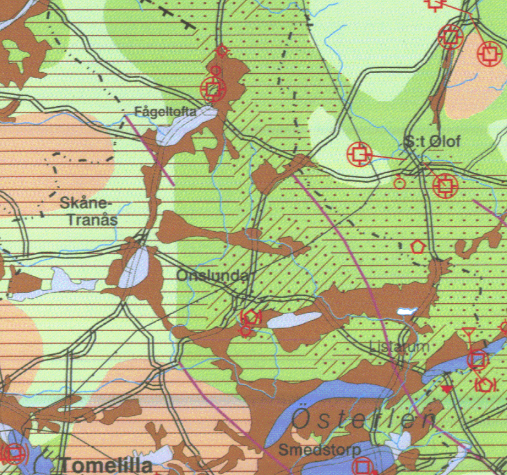
Any type of surface pollution will also easily spread to other areas via the fluvioglacial aquifers (brown color in the map below), which are connected and form a broad band stretching all the way to the Baltic Sea.
geologiska undersökning.


Du menar väl alunskiffer? Att aluminium skulle finnas i något slags skiffer har jag aldrig hört, har för mig att aluminium kallas bauxit när det bryts, men är inte helt säker på detta.
Hej Elisabeth eller Lisa,
jag förstår inte riktig din fråga. Jag skriver ingent om aluminium, bara om alunskiffer. Ja, aluminium utvinns av bauxit, men det finns även andra bergarter som innehåller aluminium i mindre mängder.
Vänliga hälsningar
Barbara